Table of Contents
- I. General
- II. Geography
- D. D - Natural Features
- E. E - Cultural Features
- F. F - Landmarks
- G. G - Ports, Waterways
- G.1. Bridges, Tunnels, Overhead Obstructions
- G.1.1. Bascule Bridge
- G.1.2. Bridges with Bridge Arches
- G.1.3. Fixed Bridge
- G.1.4. Lift Bridge
- G.1.5. Suspension Bridge
- G.1.6. Swing Bridge
- G.1.7. Tunnel
- G.1.8. Overhead Cable
- G.1.9. Overhead Pipe
- G.1.10. Pylons, Piers, and Bridge, Cable, Pipeline Support
- G.1.11. Foot Bridge / Catwalk
- G.1.12. Retractable (Draw) Bridge
- G.2. Hydraulic Structures in General
- G.3. Installations
- G.3.1. Boat Ramp
- G.3.2. Bunker / Fueling Station
- G.3.3. Conveyor
- G.3.4. Crane
- G.3.5. Dock / Wharf
- G.3.6. Dry Dock
- G.3.7. Floating Dock
- G.3.8. Fender
- G.3.9. Harbor Area
- G.3.10. Harbor Basin
- G.3.11. Landing Stage, Pontoon
- G.3.12. Mooring Facility
- G.3.13. Federal Mooring Facility
- G.3.14. Permanently Moored Vessel or Facility
- G.3.15. Port Area
- G.3.16. Free Port Area
- G.3.17. Refuse Dump
- G.3.18. Slipway
- G.3.19. Terminal
- G.3.20. Vehicle Transfer Location
- G.3.21. Landing Steps, Ladders
- G.3.22. Production / Storage Area
- G.3.23. Ice Breaker
- G.3.24. Pile or Post
- G.3.25. Water Intake Structure
- G.3.26. Power Supply Station
- G.4. Locks, Barrages, Exceptional Navigational Structures
- III. Hydrography
- H. H - Currents
- I. I - Depths
- J. J - Rocks, Wrecks, Obstructions and Nature of Riverbed
- K. K - Offshore Installations
- L. L - Tracks, Routes
- M. M - Areas, Limits
- IV. Aids and Services
- N. N - Lights
- O. O - Buoys, Beacons and Daymarks, Notice Marks
- P. P - Fog Signals
- Q. Q - Radar, Radio, Electronic Positioning
- R. R - Services
- S. S - Small Craft Facilities
- T. T - Time and Behaviour
- U. U - Legal ECDIS
- V. Alphabetical Indices
- VI. Annexes
- AA. AA - Notice Marks (CEVNI)
- AB. Annex AB - Notice Marks (Russian Inland Waterway Regulations)
- AC. Annex AC - Notice Marks (Brazilian Two Sides System)
- AD. Annex AD - Notice Marks (Brazilian Side Independent System)
- AE. Annex AE - Notice Marks (Brazilian Paraguay-Parana Waterway)
- AF. Annex AD - Notice Marks (Brazilian Side Independent System)
- AG. Annex AE - Notice Marks (Brazilian Paraguay-Parana Waterway)
- AH. Annex AF - XML Definition
Part I. General
Chapter A. A - Introduction
Background
Based on the findings of the European transport R&D project INDRIS (Inland Navigation Demonstrator for River Information Services) and the German project ARGO in 2001, both the Danube and the Rhine Commissions adopted an Inland Electronic Chart Display and Information Systems (ECDIS) standard for Electronic Navigational Chart (ENC) data and system requirements for the Rhine and the Danube Rivers. In 2001, the Economic Commission for Europe of the United Nations (UN ECE) adopted the Inland ECDIS Standard as a recommendation for the European inland waterway system (CCNR 2002).
In the USA, following a 1999 recommendation by the National Transportation Safety Board, the U.S. Army Corps of Engineers (USACE) initiated a program to facilitate the production and implementation of Inland ENCs on major river and inland waterway systems in the United States.
While there are some differences between the North American and European inland waterways, there are far more similarities. A North American - European Inland ENC Workshop was held in 2003 in conjunction with a Conference on River Information Services (RIS) organized by the European R&D-project COMPRIS (Consortium Operational Management Platform River Information Services). In addition to informing participants on the status of standards development and projects being conducted, a key objective was to discuss the benefits of harmonizing Inland ENC data standards between Europe and North America.
The North American - European Inland ENC Harmonization Group (IEHG) was formed in 2003 to facilitate the development of international standards for Inland ENC data. The IEHG is comprised of representatives from government, industry and academia. European participants take part on behalf of the European Inland ECDIS Expert Group. The North American participants are members of the North American Inland ENC Ad Hoc working group that was formed in 2002. The IEHG meets once per year. However, most of the work is accomplished via e-mail correspondence and the website http://ienc.openecdis.org.
The goal of the IEHG is to agree upon specifications for Inland ENCs that are suitable for all known inland ENC data requirements for safe and efficient navigation for European and North American inland waterways. However, it is intended that this standard meets the basic needs for Inland ENC applications, worldwide. As such, the Inland ENC standard is flexible enough to accommodate additional inland waterway requirements in other regions of the world.
In September 2005, the Ministry of Transport of the Russian Federation became a member of the IEHG. In 2007, Brazil through its national Hydrographic Service, the Directorate of Hydrography and Navigation (DHN), joined the IEHG as the first South American country. In October 2009, the Waterborne Transportation Institute of the Ministry of Transport, Peoples Republic of China became the first member of the IEHG from the Asian region.
IEHG also works closely with the International Hydrographic Organization (IHO). At the ECDIS stakeholders’ forum in 2007, IHO confirmed that compatibility with Inland ENC standards is allowed by the standards that are certified for maritime ECDIS applications. On 14 April 2009, IEHG became recognized as a Non-Governmental International Organization (NGIO) of IHO. In addition, at the 4th Extraordinary International Hydrographic Conference on 4 June 2009, IHO adopted a resolution to cooperate with the IEHG.
As an NGIO, IEHG supports, advises and provides input to IHO regarding Inland ENC matters. Specifically, IEHG attends:
Hydrographic Services and Standards Committee (HSSC)
Transfer Standard Maintenance and Application Development (TSMAD) WG
Inland Electronic Navigational Chart Defined
Inland Electronic Navigational Chart (IENC) means: the database, standardized as to content, structure and format, for use with inland electronic chart display and / or information systems operated onboard of vessels transiting inland waterways. An IENC is issued by or on the authority of a competent government agency, and conforms to standards [initially] developed by the International Hydrographic Organization (IHO) and [refined by] the Inland ENC Harmonization Group. An IENC contains all the chart information necessary for safe navigation on inland waterways and may contain supplementary information in addition to that contained in the paper chart (e.g. sailing directions, machine-readable operating schedules, etc.) which may be considered necessary for safe navigation and voyage planning.
IENC Standards
The framework for Inland ENC standards includes:
Use of IHO S-57 (Edition 3.1), including:
‘Maritime’ ENC Product Specification (Appendix B1)
Object Catalogue (Appendix A)
Use of Object Catalogue (Appendix B.1, Annex A)
A minimum Inland ENC Product Specification that includes mandatory requirements for safety-of-navigation on inland waterways, worldwide.
An Inland ENC Encoding Guide that provides guidance on recommended object classes, attributes, and attribute values for encoding IENC data.
Inland ENC Feature Catalogue.
Establishment of an Inland ENC Register for additional real-world, IENC features, attributes, and enumerations that are not already contained in IHO S-57 Edition 3.1 Object Catalogue.
Use of the ienc.openecdis.org as a means of communication, and as an interim means to register additional Inland ENC object classes, attributes, and attributes values.
Align with the IHO S-100 Universal Hydrographic Data Model. In particular, this includes the Inland ENC Register as part of the overall S-100 Geospatial Information Registry.
As of February 2011, the current versions of IENC-related standards are:
IENC Product Specification, Ed. 2.3 (February 2011)
Feature Catalogue, Ed. 2.3 (February 2011)
IENC Encoding Guide, Ed. 2.3.0 (February 2011)
Two other Inland IENC-related standards that are not maintained by IEHG, but are used in Europe include:
Inland ECDIS Standard, Ed. 2.2
IENC Presentation Library, Ed. 2.2
[Note: Both are under revision and will be posted on the IEHG website when available].
Copies of all IENC-related standards available at: http://ienc.openecdis.org.
IENC Encoding Guide
The IENC Encoding Guide provides detailed guidance on what is required to produce a consistent, uniform Inland ENC.
For all object classes, attributes, and attribute values that are used in conjunction with an IENC, the IENC Encoding Guide:
Provides a basis for its creation
Describes its relationship to the real-world entity
Provides criteria for its proper use
Gives specific encoding examples
Provides real-world and graphic examples of IENC information (portrayal)
Minimum Contents of an IENC
At a Minimum, the following objects shall be included in an IENC, if they exist:
Bank of waterway
Shoreline construction (e.g., groin, training wall)
Any facility that is considered a hazard to navigation
Contours of locks and dams (i.e., footprint area)
Boundaries of the navigation channel (if defined)
Isolated dangers in the navigation channel that are either:
under water (obstructions)
above water level (e.g., bridges, overhead cables)
Official Aids-to-Navigation (e.g. buoys, beacons, lights, notice marks)
Waterway axis with kilometres/hectometres
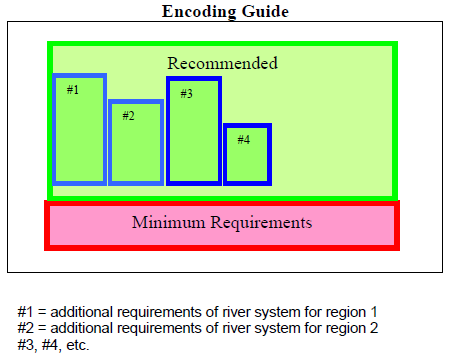
In addition to these minimum requirements, the Encoding Guide contains recommended objects, attributes and attribute values that are suitable for any Inland ENC application, worldwide. Each country or region can decide which of these recommended objects, attributes and attribute values are necessary to meet their requirements. For example, in Europe and the USA, there are different requirements for River Information Services (RIS). (See diagram below for reference.)
When the competent authorities in Europe define the “navigable water” for their individual waterways they should take into account water areas which can be used at mean water level by vessels with a hull length of 20m or more that are typically used on these waterways. Water areas on which navigation is prohibited are not “navigable water”. If an object which is minimum content when it is situated in navigable water is situated outside of the navigable water, it is recommended to encode it.
|
Changes to the IENC Encoding Guide
The IENC Encoding Guide is a living document that can be modified, as needed, to accommodate future Inland ENC requirements and development, worldwide. As such, two basic procedures have been established for making changes to the document.
Procedure A: Proposals for copied and new object classes, attributes and attribute values
Proposals for copied and new object classes, attributes and attribute values need a formal decision by IEHG according to the following steps:
Prior to submitting a proposal, it is necessary to check whether an existing S-57 object, attribute or attribute value can be used. If a new object, attribute or attribute value is needed, the proposed acronym should be registered on the IEHG/S-100 Register to ensure that there is no duplication of acronyms.
Publication of the proposal, including the necessary changes in the Encoding Guide, should be posted on the IEHG Discussion Forum. [http://operations.usace.army.mil/nav/IEHG/start.cfm?Option=Login].
Discussion and decision at a meeting of the IEHG.
Procedure B: Proposals for all the other changes and amendments
Proposals for other types of changes and amendments (e.g., additional pictures, coding instructions, or object coding using already existing object classes, attributes and attribute values) are decided upon using the following steps:
Posting of the proposal (using the proposal form) on the IEHG discussion forum on the OEF by a member of the IEHG.[http://operations.usace.army.mil/nav/IEHG/start.cfm?Option=Login].
If there are recommendations on how to improve the proposal, the amended proposal is regarded as a new one.
If there is no veto within six (6) weeks, the amendment is considered adopted. It then:
Is included in the working version of the Encoding Guide that is available on the OEF
Can be used by everyone
Will be included in the next official edition of the Encoding Guide
If there is a veto, the proposal will be further discussed and decided upon at the next meeting of the IEHG.
Decisions of the IEHG in accordance with Procedure A may result in issuing a new edition of the Encoding Guide and Product Specification for Inland ENCs (e.g., Edition 2.2.0 Edition 2.3.0). Decision in accordance with Procedure B do not require new edition of the IENC Production Specification, and will be considered version to an existing Edition (Edition 2.2.0 2.2.1). The current edition as well as the latest version will both be available at http://ienc.openecdis.org, together with a history of changes.
Chapter B. B - General Guidance
A. Features & Attributes: Mandatory, Conditional, Optional
Each feature class and attribute class in the harmonization guide has been classified for encoding purposes as mandatory, conditional or optional.
Mandatory (M) features or attributes must be encoded. For attributes, if the value is not known, it must be coded as UNKNOWN.
Conditional (C) features or attributes are mandatory (must be encoded) if defined conditions are met (e.g. if a feature has multiple colours, a colour pattern must be encoded). If the defined conditions are not met, the features or attributes are Optional (O).
Optional (O) features or attributes should be encoded if the value is known.
B. Attribute Classes Associated With All Geo Object Classes
The following attribute classes can be associated with all geo object classes in an IENC:
SORIND
US: The source indicator is a mandatory attribute and must be coded for all objects in the IENC. All objects in the Encoding Guide state that SORIND is Conditional (C); the condition that must be met is that it is a US produced chart.
The format is: 2 character country code, 2 character authority code, 5 character source code, identifier (no restriction on number of characters). Examples:
For navigation features reference an authority such as the USCG Mississippi River System Light List, Volume 5: (US,U3,MS_LL,2004_Edition_No.808)
For hydrographic features reference appropriate survey: (US,U3,SURVY,2001_Hydro_Survey)
For other features reference appropriate survey data: (US,U3,SURVY,1999_Aerial_Survey)
EU: The source indicator must only be coded for an object in an IENC when the source is different from the producer of the IENC and the producer wants to exclude liability.
The format is: 2 character country code, 2 character authority code, 5 character source code, identifier (no restriction on number of characters). Examples:
BR: SORIND is an optional attribute which may be used for an object in an IENC when the source is different from the producer of the IENC.
The format is: 2 character country code, description of the responsible authority (no restriction on number of characters).
SORDAT
The production date of the source of the data (e.g. the date of measurement). The source date should be coded for those objects in an IENC, which are changing regularly, for example depth information.
The format is yearmonthday (YYYYMMDD). Example:
SORDAT coding for a feature with of source date of September 30, 2004 is 20040930
US: SORDAT is a mandatory attribute and must be coded for all objects in the IENC. SORDAT should be set to the release date of the chart if the actual source dates of the data unavailable.
EU: SORDAT for other objects it might be set to "unknown".
BR: SORDAT is optional.
OBJNAM
Use to code feature's name (do not include information on characteristics of feature). Name must be in Title Case. Use abbreviations where possible. Use short names only to avoid clutter in the display. OBJNAM shall be entered in local language using Basic Latin Unicode characters, e.g. Baarlerbruecke, Volkeraksluis or Wien.
NOBJNM
Whenever OBJNAM is used, it is also possible to use NOBJNM. NOBJNM may be used for names in the National Language, for example, Cyrillic characters.
INFORM
Use to code navigationally significant information about the feature that cannot be coded by attributes. INFORM should always be in English.
NINFOM
Whenever INFORM is used, it is also possible to use NINFOM. INFORM should always be in English, whereas NINFOM may be used for the National Language, for example, Cyrillic characters.
TXTDSC
Use to link textual descriptions or feature information in an ASCII file. For object names within the TXTDSC file, the same rules as for the attribute OBJNAM are applicable. Free text within the TXTDSC file should be provided in English language. Note that filename must be in UPPER CASE.
US: Format is AARRMMMXNN.EXT where:
AA = 2-character Producer Code
RR = 2-character river code
MMM = 3-digit river mile or river km, 000-999
X = tenth of river mile/km; preceding decimal point implied; use zero if river mile/km known only to the nearest mile.
NN = 01-99; unique identifier for text file at the particular river mile/km.
For example, if three TXTDSC files exist at the same river mile/km, 01, 02, and 03 would be used.
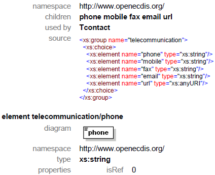
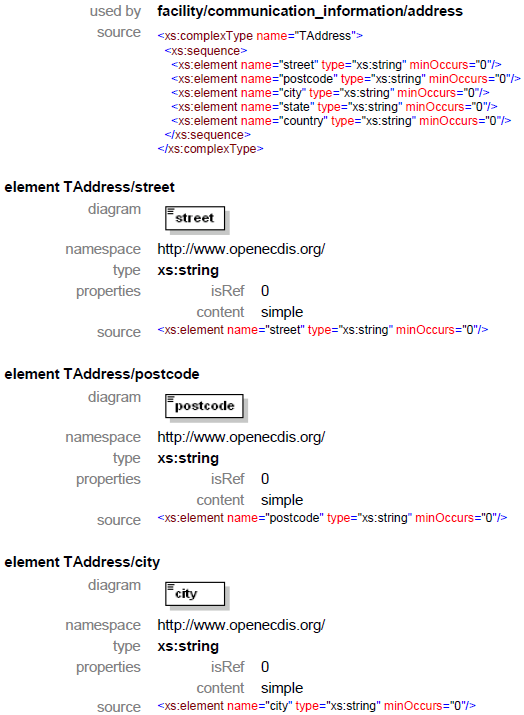
EXT = 3-character file extension for Hypertext Metafile (HTM), ASCII text (TXT), or Standardized External XML file with communication information.
EU: The ISRS code can be used for the file name, e.g. DEXXX039000000005023.XML.
NTXTDS
Use to link textual descriptions or feature information in the national language (if the national language is not English) in an ASCII file. For object names within the NTXTDS file, the same rules as for the attribute NOBJNM are applicable. Free text within the NTXTDS file should be provided in the national language.
Note that filename must be in UPPER CASE. EU: The two letter language code can be added to the file name, e.g. DEXXX039000000005023DE.XML
PICREP
Use to link imagery related to feature. Note that the filename must be in UPPER CASE. Image should be 640 x 480 pixels in resolution. Format is AARRMMMXNN.EXT, where:
AA = 2-character Producer Code
RR = 2-character river code
MMM = 3-digit river mile or river km, 000-999
X = tenth of river mile/km; preceding decimal point implied; use zero if river mile/km known only to the nearest mile.
NN = 01-99; unique identifier for image file at the particular river mile/km.
For example, if three PICREP files exist at the same river mile/km, 01, 02, and 03 would be used.
EXT = 3-character file extension for the image file format; most commonly TIFF (TIF) or JPEG (JPG) formats.
C. Scale Minimum
The values for the scale minimum mentioned in the encoding guide are recommendations for European and N. American waterways. The chart producer might deviate from these values in order to improve the chart display in special situations, for example on very small or very large waterways. The value of SCAMIN has to be set to a scale value smaller than or equal to the compilation scale of the data for the area.
D. Numeric Precision
Numeric attributes indicating meters (e.g., depth contours and structure heights) should reflect the accuracy of the number. For example, a bridge height of thirty-five meters, accurate to one meter, would be 35, not 35.0. No more than two decimal places should be used. Real values without safety margins should be used. The S-57 standard only supports depth contour resolutions to 0.1 meter.
E. Feature Naming and Text Display
US: Any important navigation notes that should always be shown on the IENC should be encoded as LNDRGN (P) on land or SEAARE (P) objects in the water.
EU: Use the appropriate object to display information (e.g. comare).
F. Assigning Approximate Positions
To assign an approximate position (‘PA’) for charted features, the attribute Quality of Position [QUAPOS = 4 (approximate)] is assigned to the appropriate spatial object (point or line). It is not assigned to the feature object (e.g. WRECKS object), but to the spatial reference for the feature object. When correctly coded, the electronic chart system will display ‘PA’ adjacent to the feature object.
G. Navigational Purpose
The following types of Navigational Purpose (“usage”) are available:
|
Subfield |
Navigational purpose |
Definition for intended use |
|---|---|---|
|
1 |
Overview: |
For route planning and oceanic crossing. |
|
2 |
General: |
For navigating oceans, approaching coasts and route planning. |
|
3 |
Coastal: |
For navigating along the coastline, either inshore or offshore. |
|
4 |
Approach: |
Navigating the approaches to ports or mayor channels or through intricate or congested waters. |
|
5 |
Harbour: |
Navigating within ports, harbours, bays, rivers and canals, for anchorages. |
|
6 |
Berthing: |
Detailed data to aid berthing. |
|
7 |
River: |
Navigating the inland waterways (skin cell). |
|
8 |
River harbour: |
Navigating within ports and harbours on inland waterways (skin cell). |
|
9 |
River berthing: |
Detailed data to aid berthing maneuvering in inland navigation (skin cell). |
|
A |
Overlay: |
Overlay cell to be displayed in conjunction with skin cells |
The Navigational Purposes 1 to 8 may be used by authorities as well as private bodies. Navigational Purpose 9 may only be used by private bodies. Overlay cells may be used by authorities as well as private bodies.
Within overlapping cells with the same navigational purpose skin-of-the-earth objects of the same object class must not overlap.
The letter “A” at the third position of the file name indicates that the cell is displayed as overlay over other cells within a range of usages. Overlay cells may not contain skin-of-the-earth objects. The range of usages of overlay cells is indicated in the Data Set Identification Field of the header of the overlay cell (see S57, Part 3, Data Structure, ch. 7.3.1.1). The 8th bit of the intended usage subfield (INTU) has to be set, if a range is used and the other seven bits describe the range (e.g. 25 means a range from usage 2 to usage 5).
H. UN Location Code
The attribute ‘unlocd’ should be used to encode the UN Location Code (http://www.unece.org/cefact/locode/service/main.htm) or, in Europe, the Inland Ship Reporting Standard (ISRS) Code; which is used to establish a standardized relation to other River Information Services.
UN country code (2 digits),
UN Location code (3 digits, “XXX” if not available),
Fairway section number (5 alphanumerical digits, to be determined by the national authority; a side branch should have its own section number, when there are special restrictions, e.g. bridges),
Terminal code or passage point code (5 alphanumerical digits, “00000” if not available),
Fairway section hectometre (5 numerical digits, hectometre at the center of the area or “00000” if not available).
If the ISRS code is not available, the code of the Noordersoft RIS-Index may be used.
I. Legal ECDIS (refers to Section U)
Category attributes for ship types, ship formations and cargo type are available. These categories are used to describe for which type of ship, convoy, or cargo the particular regulation is valid. There are two ways of describing which categories are affected by the rule:
explicit selection
implicit selection
The attributes for explicit type selection are used to explicitly select the types from the given list. The attributes for implicit type selection are is used to select those types that are not affected.
It is up to the encoder if the explicit attribute or its implicit version is used. However, it is not allowed to use both attributes when defining the category of a law content object.
One would make use of implicit type selection if for example the respective regulation states which types are excluded from the regulation rather than explicitly listing those types that are affected. Example: “recreational crafts are excluded from a speed limit.”
J. DATSTA, DATEND, PERSTA and PEREND
For objects, which are installed for a specific time, the date start and date end should be encoded using the DATSTA and DATEND attributes. In case of periodic installation (for example in the summer time each year) the attributes periodic start PERSTA and periodic end PEREND should be used.
The attributes should be encoded using 4 digits for the calendar year (CCYY), 2 digits for the month (MM) (e.g. April = 04) and 2 digits for the day (DD), according to ISO 8601: 1988.
Format is: CCYYMMDD (mandatory), for example: 19960822 for 22 August 1996.
These attributes may not be used for Group I feature classes.
Chapter C. C - IENC Meta Information
Table of Contents
C.1. Meta Features
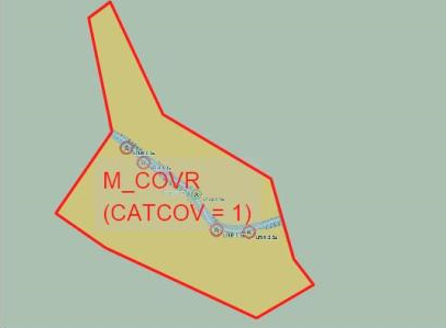
C.1.1. Data Coverage (M)
A geographical area that describes the coverage and extent of the spatial objects. (S-57 Standard)
|
Graphics |
Encoding Intructions |
Object Encoding | |
|---|---|---|---|
|
IENC Symbolization
|
|
Object Encoding Object Class =M_COVR(A) (M) CATCOV = [1 (coverage available), 2 (no coverage available)] (C) SORDAT = [YYYYMMDD] (C) SORIND = (Refer to Section B, General Guidance) |
C.1.2. Data Quality (C)
An area within which a uniform assessment of the quality of the data exists. (S-57 Standard)
Graphics | Encoding Intructions | Object Encoding | |
|---|---|---|---|
|
IENC Symbolization (for CATZOC=6)
|
|
Object Encoding Object Class =M_QUAL(A) (O) CATZOC = [1 (zone of confidence A1), 2 (zone of confidence A2), 3 (zone of confidence B), 4 (zone of confidence C), 5 (zone of confidence D), 6 (zone of confidence U (data not assessed))] (C) SORDAT = [YYYYMMDD] (C) SORIND = (Refer to Section B, General Guidance) |
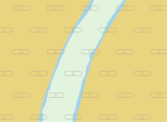
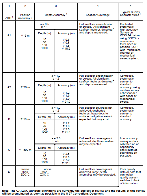
Zone of Confidence (ZOC) Table
 |
Remarks:
To decide on a ZOC Category, all conditions outlined in columns 2 to 4 of the tables must be met.
Footnote numbers quoted in the table have the following meanings:
The allocation of a ZOC indicates that particular data meets minimum criteria for position and depth accuracy and seafloor coverage defined in this Table. Data may be further qualified by Object Class Quality of Data (M_QUAL) sub-attributes as follows:
Positional Accuracy (POSACC) and Sounding Accuracy (SOUACC) may be used to indicate that a higher position or depth accuracy has been achieved than defined in this Table (e.g. a survey where full seafloor coverage was not achieved could not be classified higher than ZOC B; however, if the positional accuracy was, for instance, 15 metres, the sub-attribute POSACC could be used to indicate this).
Swept areas where the clearance depth is accurately known but the actual seabed depth is not accurately known may be accorded a higher ZOC (i.e. A1 or A2) providing positional and depth accuracies of the swept depth meets the criteria in this Table. In this instance, Depth Range Value 1 (DRVAL1) may be used to specify the swept depth. The position accuracy criteria apply to the boundaries of swept areas.
SURSTA, SUREND and TECOU may be used to indicate the start and end dates of the survey and the technique of sounding measurement.
Position Accuracy of depicted soundings at 95% CI (2.45 sigma) with respect to the given datum. It is the cumulative error and includes survey, transformation and digitizing errors, etc. Position accuracy need not be rigorously computed for ZOCs B, C, and D but may be estimated based on type of equipment, calibration regime, historical accuracy, etc.
Depth accuracy of depicted soundings = a + (B%d) / 100 at 95% CI (2.00 sigma), where d = depth in metres at the critical depth. Depth accuracy need not be rigorously computed for ZOCs B, C and D but may be estimated based on type of equipment, calibration regime, historical accuracy, etc.
Significant seafloor features are defined as those rising above depicted depths by more than:
Depth
Significant Feature
a.
< 10 metres
> 0.1% depth,
b.
10 to 30 metres
> 1.0 metre,
c.
> 30 metres
> (0.1% depth) minus 2.0 metres
Controlled, systematic (high accuracy) survey (ZOC A1, A2, and B) – a survey comprising planned survey lines on a geodetic datum that can be transformed to WGS 84.
Position fixing (ZOC A1) must be strong with at least three high quality Lines of Position (LOP) or Differential GPS.
Modern survey echosounder – a high precision surveying depth measuring equipment, generally including all survey echosounders designed post 1970.
C.1.3. Navigation System of Marks (M)
An area within which a specific system of navigational marks applies and/or a common direction of buoyage. (S-57 Standard)
Graphics | Encoding Intructions | Object Encoding |
|---|---|---|
|
|
Object Encoding Object Class =m_nsys(A) (M) marsys = [1 (IALA A), 2 (IALA B), 9 (no system), 10 (other system), 11 (CEVNI), 12 (Russian inland waterway regulations), 13 (Brazilian national inland waterway regulations - two sides), 14 (Brazilian national inland waterway regulations - side independent), 15 (Paraguay-Parana waterway - Brazilian complementary aids)] (C) SORDAT = [YYYYMMDD] (C) SORIND = (Refer to Section B, General Guidance) |
C.1.4. Sounding Datum (O)
A geographical area of uniform sounding datum. (S-57 Standard)
Graphics | Encoding Intructions | Object Encoding |
|---|---|---|
|
|
Object Encoding Object Class =m_sdat(A) (M) verdat = [12 (Mean lower low water), 31 (Local low water reference level), 32 (Local high water reference level), 33 (Local mean water reference level), 34 (Equivalent height of water (German GlW)), 35 (Highest Shipping Height of Water (German HSW)), 36 (Reference low water level according to Danube Commission), 37 (Highest shipping height of water according to Danube Commission), 38 (Dutch river low water reference level (OLR)), 39 (Russian project water level), 40 (Russian normal backwater level), 41 (Ohio River Datum), 42 (Approximate LAT), 43 (Dutch High Water Reference Level (MHW)), 44 (Tweede Algemene Waterpassing)] (C) SORDAT = [YYYYMMDD] (C) SORIND = (Refer to Section B, General Guidance) |
C.1.5. Vertical Datum (O)
A geographical area of uniform vertical datum. (S-57 Standard)
Graphics | Encoding Intructions | Object Encoding |
|---|---|---|
|
|
Object Encoding Object Class =m_vdat(A) (M) verdat = [12 (Mean lower low water), 31 (Local low water reference level), 32 (Local high water reference level), 33 (Local mean water reference level), 34 (Equivalent height of water (German GlW)), 35 (Highest Shipping Height of Water (German HSW)), 36 (Reference low water level according to Danube Commission), 37 (Highest shipping height of water according to Danube Commission), 38 (Dutch river low water reference level (OLR)), 39 (Russian project water level), 40 (Russian normal backwater level), 41 (Ohio River Datum), 42 (Approximate LAT), 43 (Dutch High Water Reference Level (MHW)), 44 (Tweede Algemene Waterpassing)] (C) SORDAT = [YYYYMMDD] (C) SORIND = (Refer to Section B, General Guidance) |
C.1.6. Quality of Data for Detailed Depth Information (O)
An area within which a uniform assessment of the quality of the data exists. Distinction: accuracy of data; Survey reliability (S-57 Standard)
Graphics | Encoding Intructions | Object Encoding |
|---|---|---|
|
|
Object Encoding Object Class =M_QUAL(A) (M) TECSOU = [1 (found by echo-sounder), 2 (found by side-scan-sonar), 3 (found by multi-beam), 4 (found by diver), 5 (found by lead-line), 6 (swept by wire-drag), 7 (found by laser), 8 (swept by vertical acoustic system), 9 (found by electromagnetic sensor), 10 (photogrammetry), 11 (satellite imagery), 12 (found by levelling), 13 (swept by side-scan-sonar), 14 (computer generated)] (O) SOUACC = [x.xx] The best estimate of the accuracy of the sounding data. Minimum value: 0; Resolution: 0.1 m (O) POSACC = [xxx.x] (metres), The best estimate of the accuracy of a position. Minimum value: 0; Resolution: 0.1 m (C) SORDAT = [YYYYMMDD] (C) SORIND = (Refer to Section B, General Guidance) |
C.1.7. Survey Reliability for Detailed Depth Information (O)
An area within which a uniform assessment of the reliability of source survey information exists. Distinction: accuracy of data; quality of data (S-57 Standard)
Graphics | Encoding Intructions | Object Encoding |
|---|---|---|
|
|
Object Encoding Object Class =M_SREL(L,A) (M) QUASOU = [1 (depth known), 2 (depth unknown), 8 (value reported (not surveyed)), 10 (maintained depth), 11 (not regularly maintained)] (C) QUAPOS = [10 (precisely known)] (M) SURATH = (Name of the surveying authority: e.g., “Wasser- und Schifffahrtsamt Bingen”) (M) SUREND = [CCYYMMDD (full date), CCYYMM (no specific day required)] (M) SURSTA = [CCYYMMDD (full date), CCYYMM (no specific day required)] (C) SURTYP = [2 (controlled survey)] (C) SORDAT = [YYYYMMDD] (C) SORIND = (Refer to Section B, General Guidance) |
C.1.8. Nautical Publication Information (O)
Used to relate additional nautical information or publications to the data
Graphics | Encoding Intructions | Object Encoding |
|---|---|---|
|
|
Object Encoding Object Class =M_NPUB(A) (M) TXTDSC = (Refer to letter B) (C) SORDAT = [YYYYMMDD] (C) SORIND = (Refer to Section B, General Guidance) |
Part II. Geography
Table of Contents
- D. D - Natural Features
- E. E - Cultural Features
- F. F - Landmarks
- G. G - Ports, Waterways
- G.1. Bridges, Tunnels, Overhead Obstructions
- G.1.1. Bascule Bridge
- G.1.2. Bridges with Bridge Arches
- G.1.3. Fixed Bridge
- G.1.4. Lift Bridge
- G.1.5. Suspension Bridge
- G.1.6. Swing Bridge
- G.1.7. Tunnel
- G.1.8. Overhead Cable
- G.1.9. Overhead Pipe
- G.1.10. Pylons, Piers, and Bridge, Cable, Pipeline Support
- G.1.11. Foot Bridge / Catwalk
- G.1.12. Retractable (Draw) Bridge
- G.2. Hydraulic Structures in General
- G.3. Installations
- G.3.1. Boat Ramp
- G.3.2. Bunker / Fueling Station
- G.3.3. Conveyor
- G.3.4. Crane
- G.3.5. Dock / Wharf
- G.3.6. Dry Dock
- G.3.7. Floating Dock
- G.3.8. Fender
- G.3.9. Harbor Area
- G.3.10. Harbor Basin
- G.3.11. Landing Stage, Pontoon
- G.3.12. Mooring Facility
- G.3.13. Federal Mooring Facility
- G.3.14. Permanently Moored Vessel or Facility
- G.3.15. Port Area
- G.3.16. Free Port Area
- G.3.17. Refuse Dump
- G.3.18. Slipway
- G.3.19. Terminal
- G.3.20. Vehicle Transfer Location
- G.3.21. Landing Steps, Ladders
- G.3.22. Production / Storage Area
- G.3.23. Ice Breaker
- G.3.24. Pile or Post
- G.3.25. Water Intake Structure
- G.3.26. Power Supply Station
- G.4. Locks, Barrages, Exceptional Navigational Structures
Chapter D. D - Natural Features
Table of Contents
D.1. Hydrology
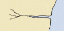
D.1.1. Canal (non-navigable) (O)
These are artificial tributaries of the main waterway.
Graphics | Encoding Intructions | Object Encoding |
|---|---|---|
|
|
Object Encoding Object Class =CANALS(L,A) (O) OBJNAM = [Canal name] (O) NOBJNM = (Refer to Section B, General Guidance) (M) SCAMIN = [45000] (C) SORDAT = [YYYYMMDD] (C) SORIND = (Refer to Section B, General Guidance) |
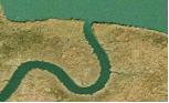
D.1.2. Rivers (non-navigable) (O)
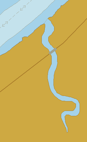
Mainly free flowing water courses that are typically tributaries of the main waterway.
Graphics | Encoding Intructions | Object Encoding | |||
|---|---|---|---|---|---|
|
Real World
Chart Symbol
IENC Symbolization
|
|
Object Encoding Object Class =RIVERS(L,A) (O) OBJNAM = [River Name] (O) NOBJNM = (Refer to Section B, General Guidance) (M) SCAMIN = [EU: 45000; US: 60000] (C) SORDAT = [YYYYMMDD] (C) SORIND = (Refer to Section B, General Guidance) |
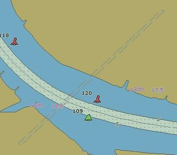
D.1.3. Named Water Area (O)
A geographically defined part of navigable waters. It may be specified within its limits by its proper name.
Graphics | Encoding Intructions | Object Encoding | ||
|---|---|---|---|---|
|
Chart Symbol
IENC Symbolization
|
|
Object Encoding Object Class =SEAARE(P,A) (M) OBJNAM = [Water Area Name] (O) NOBJNM = (Refer to Section B, General Guidance) (O) CATSEA = [5 (bay), 12 (narrows), 13 (shoal), 51 (canal), 52 (lake), 53 (river), 54 (reach), 57 (chute), 58 (backwater/slough), 59 (bend)] (M) SCAMIN = [EU: 45000; US: 60000] (C) SORDAT = [YYYYMMDD] (C) SORIND = (Refer to Section B, General Guidance) |
D.1.4. Dredging Lake (O)
A body of water mostly surrounded by land, from which sand or gravel is dredged.
Graphics | Encoding Intructions | Object Encoding | ||
|---|---|---|---|---|
|
Real World
IENC Symbolization
|
|
Object Encoding Object Class =DEPARE(A) (M) DRVAL1 = [x.x] (metres), e.g., 2.7 or UNKNOWN (M) DRVAL2 = Maximum known depth of depth area: [xx.x] (metres) or UNKNOWN (C) QUASOU = [2 (depth unknown), 8 (value reported (not surveyed))] (C) SORDAT = [YYYYMMDD] (C) SORIND = (Refer to Section B, General Guidance) Object Encoding Object Class =depare(A) (M) DRVAL1 = [x.x] (metres), e.g., 2.7 or UNKNOWN (M) DRVAL2 = Maximum known depth of depth area: [xx.x] (metres) or UNKNOWN (C) eleva1 = Maximum elevation 1 of a depth area: [xx.x] (metres) or UNKNOWN (C) eleva2 = Minimum elevation 2 of a depth area: [xx.x] (metres) or UNKNOWN (M) wtwdis = [xxxx.xxx] (units defined in hunits), e.g., 2451.732 (M) hunits = [3 (kilometres), 4 (hectometres), 5 (statute miles), 6 (nautical miles)] (C) SORDAT = [YYYYMMDD] (C) SORIND = (Refer to Section B, General Guidance) |
D.1.5. Lake (O)
A large body of water entirely surrounded by land. (IHO Dictionary, S-32, 5th Edition, 2629)
Graphics | Encoding Intructions | Object Encoding | ||
|---|---|---|---|---|
|
Chart Symbol
IENC Symbolization
|
|
Object Encoding Object Class =LAKARE(A) (O) OBJNAM = [Lake Name] (O) NOBJNM = (Refer to Section B, General Guidance) (M) SCAMIN = [EU: 90000; US: 300000] (C) SORDAT = [YYYYMMDD] (C) SORIND = (Refer to Section B, General Guidance) |
D.2. Topography
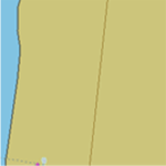
D.2.1. Land Area (M)
The solid portion of the Earth's surface, as opposed to navigable river and water. (IHO Dictionary, S-32, 5th Edition, 2635)
Graphics | Encoding Intructions | Object Encoding | |
|---|---|---|---|
|
IENC Symbolization
|
|
Object Encoding Object Class =LNDARE(P,L,A) (O) OBJNAM = "Land Area Name" (O) NOBJNM = (Refer to Section B, General Guidance) (C) SORDAT = [YYYYMMDD] (C) SORIND = (Refer to Section B, General Guidance) |

D.2.2. Land Region (O)
Land Areas adjacent to the waterway that are significant for navigation reference.
Graphics | Encoding Intructions | Object Encoding | ||
|---|---|---|---|---|
|
Chart Symbol
IENC Symbolization
|
|
Object Encoding Object Class =LNDRGN(P,A) (M) OBJNAM = [location name] (O) NOBJNM = (Refer to Section B, General Guidance) (M) SCAMIN = [EU: 45000; US: 60000] (C) SORDAT = [YYYYMMDD] (C) SORIND = (Refer to Section B, General Guidance) |
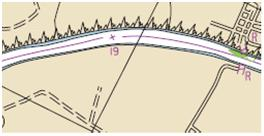
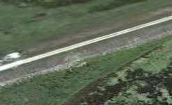
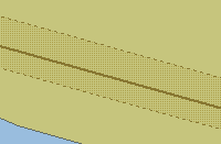
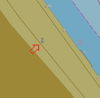
D.2.3. Natural Dunes or Ridges (O)
Natural dunes or ridges, roughly paralleling the waterway, to keep flood waters within the river course.
Graphics | Encoding Intructions | Object Encoding | |||
|---|---|---|---|---|---|
|
Real World
Chart Symbol
IENC Symbolization
|
|
Object Encoding Object Class =SLOGRD(L,A) (M) CATSLO = [3 (dune)] (O) NATSUR = [1 (mud), 2 (clay), 3 (silt), 4 (sand), 5 (stone), 6 (gravel), 7 (pebbles), 8 (cobbles), 9 (rock), 11 (lava), 14 (coral), 17 (shells), 18 (boulder)] (M) SCAMIN = [22000] (C) SORDAT = [YYYYMMDD] (C) SORIND = (Refer to Section B, General Guidance) Object Encoding Object Class =SLOTOP(L) (M) CATSLO = [2 (embankment)] (O) NATSUR = [1 (mud), 2 (clay), 3 (silt), 4 (sand), 5 (stone), 6 (gravel), 7 (pebbles), 8 (cobbles), 9 (rock), 11 (lava), 14 (coral), 17 (shells), 18 (boulder)] (M) SCAMIN = [22000] (C) SORDAT = [YYYYMMDD] (C) SORIND = (Refer to Section B, General Guidance) |

D.2.4. Rock Wall (O)
The delineation of a natural rock wall that could be a hazard to navigation.
Graphics | Encoding Intructions | Object Encoding | |||
|---|---|---|---|---|---|
|
Real World
Chart Symbol
IENC Symbolization
|
|
Object Encoding Object Class =SLOTOP(L) (M) CATSLO = [6 (cliff)] (O) NATSUR = [1 (mud), 2 (clay), 3 (silt), 4 (sand), 5 (stone), 6 (gravel), 7 (pebbles), 8 (cobbles), 9 (rock), 11 (lava), 14 (coral), 17 (shells), 18 (boulder)] (M) SCAMIN = [EU: 22000; US: 60000] (C) SORDAT = [YYYYMMDD] (C) SORIND = (Refer to Section B, General Guidance) Object Encoding Object Class =CTNARE(A) (M) INFORM = "Natural Rock Wall" (O) NINFOM = (Refer to Section B, General Guidance) (M) SCAMIN = [EU: 22000; US: 60000] (C) SORDAT = [YYYYMMDD] (C) SORIND = (Refer to Section B, General Guidance) |
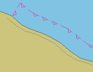
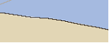
D.2.5. Shoreline (M)
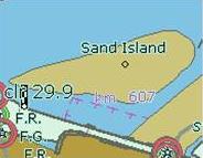
The line where shore and water meet. Although the terminology of coasts and shores is rather confused, shoreline and coastline are generally used as synonyms. (IHO Dictionary, S-32, 5th Edition, 858,4695)
Graphics | Encoding Intructions | Object Encoding | ||
|---|---|---|---|---|
|
Chart Symbol
IENC Symbolization
|
|
Object Encoding Object Class =COALNE(L) (O) CATCOA = [1 (steep coast), 2 (flat coast), 3 (sandy shore), 4 (stony shore), 5 (shingly shore), 6 (glacier (seaward end)), 7 (mangrove), 8 (marshy shore), 9 (coral reef), 10 (ice coast), 11 (shelly shore)] (M) SCAMIN = [EU: 45000; US: 300000] (C) SORDAT = [YYYYMMDD] (C) SORIND = (Refer to Section B, General Guidance) |

D.3. Vegetation
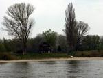
D.3.1. Vegetation (C)
Collections of, or individual plants. (S-57 standard)
Graphics | Encoding Intructions | Object Encoding | ||
|---|---|---|---|---|
|
Real World
IENC Symbolization
|
|
Object Encoding Object Class =VEGATN(P,A) (O) CONVIS = [1 (visually conspicuous), 2 (not visually conspicuous)] (M) SCAMIN = [EU: 12000; US: 18750] (C) SORDAT = [YYYYMMDD] (C) SORIND = (Refer to Section B, General Guidance) |
Chapter E. E - Cultural Features
Table of Contents
E.1. Settlements, Buildings, Political Boundaries
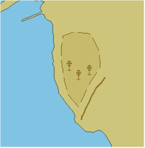
E.1.1. Built-up Areas (O)
An area containing a concentration of buildings and the supporting road or rail infrastructure (S-57 Standard)
Graphics | Encoding Intructions | Object Encoding | ||||
|---|---|---|---|---|---|---|
|
Real World
Chart Symbol
IENC Symbolization (area)
IENC Symbolization (point)
|
|
Object Encoding Object Class =BUAARE(P,A) (O) OBJNAM = [urban or settlement name] (O) NOBJNM = (Refer to Section B, General Guidance) (O) CATBUA = [1 (urban area), 2 (settlement), 3 (village), 4 (town), 5 (city)] (O) CONDTN = [1 (under construction), 2 (ruined), 3 (under reclamation), 5 (planned construction)] (M) SCAMIN = [EU: 90000 (except: 700000 for CATBUA1 and 180000 for CATBUA5); US: 75000] (C) SORDAT = [YYYYMMDD] (C) SORIND = (Refer to Section B, General Guidance) |
E.1.2. Buildings of Navigational Significance (O)
Buildings with a special function, which may be of interest for the skipper.
Graphics | Encoding Intructions | Object Encoding | |||
|---|---|---|---|---|---|
|
Real World
Chart Symbol
IENC Symbolization
|
|
Object Encoding Object Class =BUISGL(P,A) (O) OBJNAM = [name and/or operator/owner] (O) NOBJNM = (Refer to Section B, General Guidance) (C) FUNCTN = [2 (harbour-master's office), 3 (custom office), 4 (health office), 5 (hospital), 6 (post office), 7 (hotel), 8 (railway station), 9 (police station), 10 (water-police station), 11 (pilot office), 12 (pilot lookout), 13 (bank office), 14 (headquarters for district control), 15 (transit shed/warehouse), 16 (factory), 17 (power station), 18 (administrative), 19 (educational facility), 20 (church), 21 (chapel), 22 (temple), 23 (pagoda), 24 (shinto shrine), 25 (buddhist temple), 26 (mosque), 27 (marabout), 28 (lookout), 29 (communication), 30 (television), 31 (radio), 32 (radar), 33 (light support), 34 (microwave), 35 (cooling), 36 (observation), 37 (time ball), 38 (clock), 39 (control), 40 (airship mooring), 41 (stadium), 42 (bus station)] (C) CONVIS = [1 (visually conspicuous), 2 (not visually conspicuous)] (O) CONDTN = [1 (under construction), 2 (ruined), 3 (under reclamation), 4 (wingless), 5 (planned construction)] (M) SCAMIN = [US: 18750; EU: 22000 (except: 45000 for FUNCT20-CONVIS2, 45000 for FUNCT33-CONVIS2, 90000 for FUNCTN20-CONVIS1, 90000 for FUNCTN33-CONVIS1)] (C) SORDAT = [YYYYMMDD] (C) SORIND = (Refer to Section B, General Guidance) |

E.1.3. International Boundaries and National Limits (Administration Area) (O)
A defined and named administrative area (e.g. country, state, district)
Graphics | Encoding Intructions | Object Encoding | |
|---|---|---|---|
|
IENC Symbolization (only visible in display mode “other”)
|
|
Object Encoding Object Class =ADMARE(A) (M) JRSDTN = [1 (international), 2 (national), 3 (national sub-division)] (M) NATION = [xx] (Refer to letter B) (M) OBJNAM = [name of the administrative area] (O) NOBJNM = (Refer to Section B, General Guidance) (O) CONDTN = [3 (under reclamation)] (M) SCAMIN = [90000] (C) SORDAT = [YYYYMMDD] (C) SORIND = (Refer to Section B, General Guidance) |
E.2. Airfields, Railways, Roads
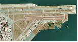
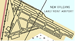
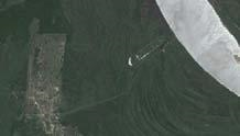
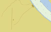
E.2.1. Airport (C)
An area containing at least one runway, used for landing, take-off, and movement of aircraft. (S-57 Standard)
Graphics | Encoding Intructions | Object Encoding | |||
|---|---|---|---|---|---|
|
Real World
Chart Symbol
IENC Symbolization
|
|
Object Encoding Object Class =AIRARE(P,A) (O) CATAIR = [1 (military aeroplane airport), 2 (civil aeroplane airport), 4 (civil heliport), 6 (small planes airfield)] (O) OBJNAM = [(Name) + “Airport” or (Name) + “Airfield”] (O) NOBJNM = (Refer to Section B, General Guidance) (O) CONDTN = [1 (under construction), 2 (ruined), 3 (under reclamation), 5 (planned construction)] (M) SCAMIN = [45000] (C) SORDAT = [YYYYMMDD] (C) SORIND = (Refer to Section B, General Guidance) |

E.2.2. Railway (C)
A rail or set of parallel rails on which a train or tram runs. (Digital Geographic Information Working Group, Oct.87)
Graphics | Encoding Intructions | Object Encoding | ||
|---|---|---|---|---|
|
Chart Symbol
IENC Symbolization
|
|
Object Encoding Object Class =RAILWY(L) (O) OBJNAM = [Railroad Name] (O) NOBJNM = (Refer to Section B, General Guidance) (C) INFORM = (Refer to letter A) (C) NINFOM = (Refer to Section B, General Guidance) (O) CONDTN = [1 (under construction), 2 (ruined), 3 (under reclamation), 5 (planned construction)] (M) SCAMIN = [EU: 45000; US: 15000] (C) SORDAT = [YYYYMMDD] (C) SORIND = (Refer to Section B, General Guidance) |

E.2.3. Road (C)
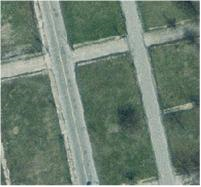
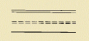
A road is an open way for the passage of vehicles. (United States Geological Survey, Jan.89)
Graphics | Encoding Intructions | Object Encoding | |||
|---|---|---|---|---|---|
|
Real World
Chart Symbol
IENC Symbolization
|
|
Object Encoding Object Class =ROADWY(L,A) (M) CATROD = [1 (motorway), 2 (major road), 3 (minor road), 4 (track/path)] (O) OBJNAM = [highway, interstate, road name] (O) NOBJNM = (Refer to Section B, General Guidance) (O) NATCON = [4 (hard surfaced), 5 (unsurfaced)] (O) CONDTN = [1 (under construction), 2 (ruined), 3 (under reclamation), 5 (planned construction)] (M) SCAMIN = [EU: 45000; US: 15000] (C) SORDAT = [YYYYMMDD] (C) SORIND = (Refer to Section B, General Guidance) |

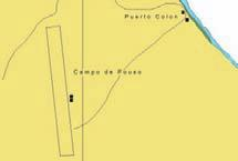
E.2.4. Runway (O)
A defined rectangular area, on a land aerodrome, prepared for the landing and take-off run of aircraft along its length. A site on which helicopters may land and take off. (S-57 Standard)
Graphics | Encoding Intructions | Object Encoding | |||
|---|---|---|---|---|---|
|
Real World
Chart Symbol
IENC Symbolization
|
|
Object Encoding Object Class =RUNWAY(P,L,A) (O) CATRUN = [1 (aeroplane runway), 2 (helicopter landing pad)] (O) CONVIS = [1 (visually conspicuous), 2 (not visually conspicuous)] (O) NATCON = [4 (hard surface), 5 (unsurfaced)] (O) OBJNAM = [Runway name] (O) NOBJNM = (Refer to Section B, General Guidance) (M) SCAMIN = 45000 (C) SORDAT = [YYYYMMDD] (C) SORIND = (Refer to Section B, General Guidance) |
E.3. Other Cultural Features
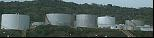
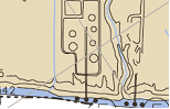
E.3.1. Silo / Storage Tank (O)
An enclosed container, used for storage (Digital Geographic Information Working Group, Oct.87)
Graphics | Encoding Intructions | Object Encoding | |||
|---|---|---|---|---|---|
|
Real World
Chart Symbol
IENC Symbolization
|
|
Object Encoding Object Class =SILTNK(P,A) (O) PRODCT = [1 (oil), 2 (gas), 3 (water), 7 (chemicals), 22 (grain)] (O) CATSIL = [1 (silo in general), 2 (tank in general), 3 (grain elevator), 4 (water tower)] (O) OBJNAM = [Facility Owner] (O) NOBJNM = (Refer to Section B, General Guidance) (C) INFORM = [“Tank Farm/Multiple Structures”] (O) NINFOM = (Refer to Section B, General Guidance) (O) CONDTN = [1 (under construction), 2 (ruined), 3 (under reclamation), 5 (planned construction)] (M) SCAMIN = [EU: 22000; US: 30000] (C) SORDAT = [YYYYMMDD] (C) SORIND = (Refer to Section B, General Guidance) |

E.3.2. Embankment (O)
An artificial elevation constructed from earth, stone, etc. carrying a road, railway or similar or serving to dam water.
Graphics | Encoding Intructions | Object Encoding | ||
|---|---|---|---|---|
|
Real World
IENC Symbolization
|
|
Object Encoding Object Class =SLOGRD(L,A) (M) CATSLO = [2 (embankment)] (O) NATSUR = [1 (mud), 2 (clay), 3 (silt), 4 (sand), 5 (stone), 6 (gravel), 7 (pebbles), 8 (cobbles), 9 (rock), 11 (lava), 14 (coral), 17 (shells), 18 (boulder)] (O) CONDTN = [1 (under construction), 2 (ruined), 3 (under reclamation), 5 (planned construction)] (M) SCAMIN = 22000 (C) SORDAT = [YYYYMMDD] (C) SORIND = (Refer to Section B, General Guidance) |
Chapter F. F - Landmarks
Table of Contents
F.1. Landmarks
F.1.1. Conspicuous Landmark (O)
A prominent object at a fixed location which can be used in determining a location or a direction (adapted from IHO Dictionary, S-32, 5th Edition, 2643).
Graphics | Encoding Intructions | Object Encoding | |||
|---|---|---|---|---|---|
|
Real World
IENC Symbolization (point)
IENC Symbolization (area)
|
|
Object Encoding Object Class =LNDMRK(P,A) (M) CONVIS = [1 (visually conspicuous)] (M) CATLMK = [1 (cairn), 2 (cemetery), 3 (chimney), 4 (dish aerial), 5 (flagstaff (flagpole)), 6 (flare stack), 7 (mast), 8 (wind sock), 9 (monument), 10 (column (pillar)), 11 (memorial plaque), 12 (obelisk), 13 (statue), 14 (cross), 15 (dome), 16 (radar scanner), 17 (tower), 18 (windmill), 19 (windmotor), 20 (spire/minaret), 21 (large rock or boulder on land)] (O) OBJNAM = [name and/or operator/owner] (O) NOBJNM = (Refer to Section B, General Guidance) (C) FUNCTN = [33 (light support)] (O) CONDTN = [1 (under construction), 2 (ruined), 3 (under reclamation), 4 (wingless), 5 (planned construction)] (M) SCAMIN = [EU: use 22000 for a point object (except 45000 for CONVIS1) and 45000 for line objects; US: 60000] (C) SORDAT = [YYYYMMDD] (C) SORIND = (Refer to Section B, General Guidance) |

Chapter G. G - Ports, Waterways
Table of Contents
- G.1. Bridges, Tunnels, Overhead Obstructions
- G.1.1. Bascule Bridge
- G.1.2. Bridges with Bridge Arches
- G.1.3. Fixed Bridge
- G.1.4. Lift Bridge
- G.1.5. Suspension Bridge
- G.1.6. Swing Bridge
- G.1.7. Tunnel
- G.1.8. Overhead Cable
- G.1.9. Overhead Pipe
- G.1.10. Pylons, Piers, and Bridge, Cable, Pipeline Support
- G.1.11. Foot Bridge / Catwalk
- G.1.12. Retractable (Draw) Bridge
- G.2. Hydraulic Structures in General
- G.3. Installations
- G.3.1. Boat Ramp
- G.3.2. Bunker / Fueling Station
- G.3.3. Conveyor
- G.3.4. Crane
- G.3.5. Dock / Wharf
- G.3.6. Dry Dock
- G.3.7. Floating Dock
- G.3.8. Fender
- G.3.9. Harbor Area
- G.3.10. Harbor Basin
- G.3.11. Landing Stage, Pontoon
- G.3.12. Mooring Facility
- G.3.13. Federal Mooring Facility
- G.3.14. Permanently Moored Vessel or Facility
- G.3.15. Port Area
- G.3.16. Free Port Area
- G.3.17. Refuse Dump
- G.3.18. Slipway
- G.3.19. Terminal
- G.3.20. Vehicle Transfer Location
- G.3.21. Landing Steps, Ladders
- G.3.22. Production / Storage Area
- G.3.23. Ice Breaker
- G.3.24. Pile or Post
- G.3.25. Water Intake Structure
- G.3.26. Power Supply Station
- G.4. Locks, Barrages, Exceptional Navigational Structures
G.1. Bridges, Tunnels, Overhead Obstructions
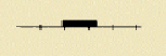
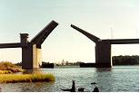
G.1.1. Bascule Bridge (M)
A counterpoise bridge rotated in a vertical plane about an axis at one or both ends. Also called a balance. (IHO Dictionary, S-32, 5th Edition, 545)
Graphics | Encoding Intructions | Object Encoding | |||
|---|---|---|---|---|---|
|
Real World
Chart Symbol
IENC Symbolization
|
|
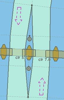
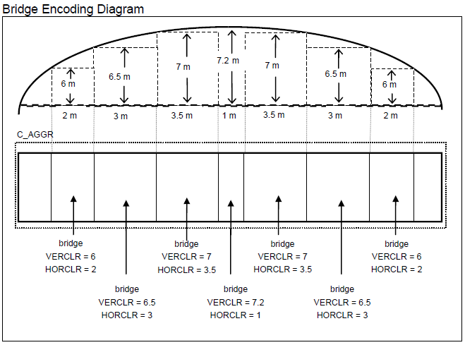
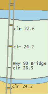
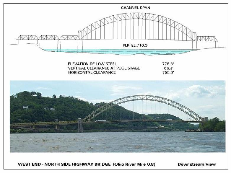
Object Encoding Object Class =bridge(A) (M) CATBRG = [5 (bascule bridge)] (C) HORCLR = [xx.x] (metres), e.g., 34.2 (C) VERCOP = [xx.x] (metres), e.g., 23.4 (C) VERCCL = [xx.x] (metres), e.g., 13.2 - over navigable waters (C) verdat = [12 (Mean lower low water), 31 (Local low water reference level), 32 (Local high water reference level), 33 (Local mean water reference level), 34 (Equivalent height of water (German GlW)), 35 (Highest Shipping Height of Water (German HSW)), 36 (Reference low water level according to Danube Commission), 37 (Highest shipping height of water according to Danube Commission), 38 (Dutch river low water reference level (OLR)), 39 (Russian project water level), 40 (Russian normal backwater level), 41 (Ohio River Datum), 42 (Approximate LAT), 43 (Dutch High Water Reference Level (MHW)), 44 (Tweede Algemene Waterpassing)] (C) unlocd = [ISRS code] (M) wtwdis = [xxxx.xxx] (units defined in hunits), e.g., 2451.732 (M) hunits = [3 (kilometres), 4 (hectometres), 5 (statute miles), 6 (nautical miles)] (C) OBJNAM = (Refer to letter J) (C) NOBJNM = (Refer to Section B, General Guidance) (C) INFORM = (Refer to letter D) (O) NINFOM = (Refer to Section B, General Guidance) (C) PICREP = (Refer to Section B, General Guidance) (O) CONDTN = [1 (under construction), 2 (ruined), 3 (under reclamation), 5 (planned construction)] (C) refgag = (Refer to letter R) (M) SCAMIN = [EU: 90000; US: 300000] (C) SORDAT = [YYYYMMDD] (C) SORIND = (Refer to Section B, General Guidance) Object Encoding Object Class =C_AGGR() (M) OBJNAM = [name and/or operator/owner] (O) NOBJNM = (Refer to Section B, General Guidance) (O) TXTDSC = (Refer to letter M) (C) unlocd = [ISRS code] (C) SORIND = (Refer to Section B, General Guidance) (C) SORDAT = [YYYYMMDD] |
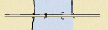
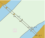
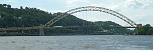
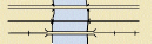
G.1.2. Bridges with Bridge Arches (M)
A Bridge which has bridge arches rather than straight construction.
Graphics | Encoding Intructions | Object Encoding | ||
|---|---|---|---|---|
|
Real World
IENC Symbolization
|
|
Object Encoding Object Class =bridge(A) (M) CATBRG = [1 (fixed bridge), 13 (bridge arch)] (C) HORCLR = [xx.x] (metres), e.g., 34.2 (C) VERCLR = [xx.xx] (metres), e.g., 13.27 (C) verdat = [12 (Mean lower low water), 31 (Local low water reference level), 32 (Local high water reference level), 33 (Local mean water reference level), 34 (Equivalent height of water (German GlW)), 35 (Highest Shipping Height of Water (German HSW)), 36 (Reference low water level according to Danube Commission), 37 (Highest shipping height of water according to Danube Commission), 38 (Dutch river low water reference level (OLR)), 39 (Russian project water level), 40 (Russian normal backwater level), 41 (Ohio River Datum), 42 (Approximate LAT), 43 (Dutch High Water Reference Level (MHW)), 44 (Tweede Algemene Waterpassing)] (C) PICREP = (Refer to Section B, General Guidance) (C) unlocd = [ISRS code] (M) wtwdis = [xxxx.xxx] (units defined in hunits), e.g., 2451.732 (M) hunits = [3 (kilometres), 4 (hectometres), 5 (statute miles), 6 (nautical miles)] (C) OBJNAM = (Refer to letter I) (C) NOBJNM = (Refer to Section B, General Guidance) (O) CONDTN = [1 (under construction), 2 (ruined), 3 (under reclamation), 5 (planned construction)] (C) refgag = (Refer to letter P) (M) SCAMIN = [EU: 90000; US: 300000] (C) SORDAT = [YYYYMMDD] (C) SORIND = (Refer to Section B, General Guidance) Object Encoding Object Class =C_AGGR() (M) OBJNAM = [name and/or operator/owner] (O) NOBJNM = (Refer to Section B, General Guidance) (O) TXTDSC = (Refer to letter L) (C) unlocd = [ISRS code] (C) SORDAT = [YYYYMMDD] (C) SORIND = (Refer to Section B, General Guidance) Object Encoding Object Class =c_brga() (O) OBJNAM = [name and/or operator/owner] (O) NOBJNM = (Refer to Section B, General Guidance) (O) PICREP = (Refer to Section B, General Guidance) |
|
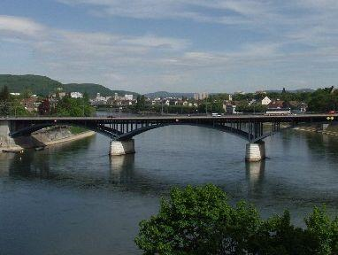
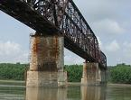
G.1.3. Fixed Bridge (M)
A bridge having permanent horizontal and vertical alignment. (McGraw-Hill Dictionary of Scientific and Technical Terms, 3rd Edition, 1984)
Graphics | Encoding Intructions | Object Encoding | |||
|---|---|---|---|---|---|
|
Real World
Chart Symbol
IENC Symbolization
|
|
Object Encoding Object Class =bridge(A) (M) CATBRG = [1 (fixed bridge)] (C) HORCLR = [xx.x] (metres), e.g., 34.2 (C) VERCLR = [xx.xx] (metres), e.g., 13.27 (C) verdat = [12 (Mean lower low water), 31 (Local low water reference level), 32 (Local high water reference level), 33 (Local mean water reference level), 34 (Equivalent height of water (German GlW)), 35 (Highest Shipping Height of Water (German HSW)), 36 (Reference low water level according to Danube Commission), 37 (Highest shipping height of water according to Danube Commission), 38 (Dutch river low water reference level (OLR)), 39 (Russian project water level), 40 (Russian normal backwater level), 41 (Ohio River Datum), 42 (Approximate LAT), 43 (Dutch High Water Reference Level (MHW)), 44 (Tweede Algemene Waterpassing)] (C) PICREP = (Refer to Section B, General Guidance) (C) unlocd = [ISRS code] (M) wtwdis = [xxxx.xxx] (units defined in hunits), e.g., 2451.732 (M) hunits = [3 (kilometres), 4 (hectometres), 5 (statute miles), 6 (nautical miles)] (C) INFORM = (Refer to letter C) (O) NINFOM = (Refer to Section B, General Guidance) (C) OBJNAM = (Refer to letter I) (C) NOBJNM = (Refer to Section B, General Guidance) (O) CONDTN = [1 (under construction), 2 (ruined), 3 (under reclamation), 5 (planned construction)] (C) refgag = (Refer to letter P) (M) SCAMIN = [EU: 90000; US: 300000] (C) SORIND = (Refer to Section B, General Guidance) (C) SORDAT = [YYYYMMDD] Object Encoding Object Class =C_AGGR() (M) OBJNAM = [name and/or operator/owner] (O) NOBJNM = (Refer to Section B, General Guidance) (O) TXTDSC = (Refer to letter L) (C) unlocd = [ISRS code] (C) SORDAT = [YYYYMMDD] (C) SORIND = (Refer to Section B, General Guidance) |
|
|
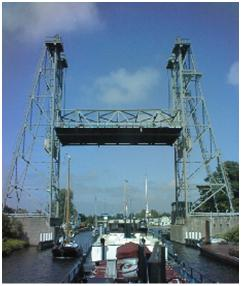
G.1.4. Lift Bridge (M)
A movable bridge (or span thereof) which is capable of being lifted vertically to allow vessels to pass beneath. (adapted from IHO Dictionary, S-32, 5th Edition, 547)
|
Real World
Chart Symbol
IENC Symbolization
|
|
Object Encoding Object Class =bridge(A) (M) CATBRG = [4 (lifting bridge)] (C) HORCLR = [xx.x] (metres), e.g., 34.2 (C) VERCOP = [xx.x] (metres), e.g., 23.4 (C) VERCCL = [xx.x] (metres), e.g., 13.2 - over navigable waters (C) verdat = [12 (Mean lower low water), 31 (Local low water reference level), 32 (Local high water reference level), 33 (Local mean water reference level), 34 (Equivalent height of water (German GlW)), 35 (Highest Shipping Height of Water (German HSW)), 36 (Reference low water level according to Danube Commission), 37 (Highest shipping height of water according to Danube Commission), 38 (Dutch river low water reference level (OLR)), 39 (Russian project water level), 40 (Russian normal backwater level), 41 (Ohio River Datum), 42 (Approximate LAT), 43 (Dutch High Water Reference Level (MHW)), 44 (Tweede Algemene Waterpassing)] (C) unlocd = [ISRS code] (M) wtwdis = [xxxx.xxx] (units defined in hunits), e.g., 2451.732 (M) hunits = [3 (kilometres), 4 (hectometres), 5 (statute miles), 6 (nautical miles)] (C) INFORM = (Refer to letter C) (O) NINFOM = (Refer to Section B, General Guidance) (C) PICREP = (Refer to Section B, General Guidance) (C) OBJNAM = (Refer to letter I) (C) NOBJNM = (Refer to Section B, General Guidance) (O) CONDTN = [1 (under construction), 2 (ruined), 3 (under reclamation), 5 (planned construction)] (C) refgag = (Refer to letter Q) (M) SCAMIN = [EU: 90000; US: 300000] (C) SORDAT = [YYYYMMDD] (C) SORIND = (Refer to Section B, General Guidance) Object Encoding Object Class =C_AGGR() (M) OBJNAM = [name and/or operator/owner] (O) NOBJNM = (Refer to Section B, General Guidance) (O) TXTDSC = (Refer to letter L) (C) unlocd = [ISRS code] (C) SORDAT = [YYYYMMDD] (C) SORIND = (Refer to Section B, General Guidance) |
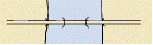
G.1.5. Suspension Bridge (M)
A fixed bridge consisting of either a roadway or a truss suspended from two or more cables which pass over towers and are anchored by backstays to a firm foundation. (McGraw-Hill Encyclopaedia of Science and Technology, 7th Edition, 1992)
Graphics | Encoding Intructions | Object Encoding | |||
|---|---|---|---|---|---|
|
Real World
Chart Symbol
IENC Symbolization
|
|
Object Encoding Object Class =bridge(A) (M) CATBRG = [12 (suspension bridge)] (C) HORCLR = [xx.x] (metres), e.g., 34.2 (C) VERCLR = [xx.xx] (metres), e.g., 13.27 (C) verdat = [12 (Mean lower low water), 31 (Local low water reference level), 32 (Local high water reference level), 33 (Local mean water reference level), 34 (Equivalent height of water (German GlW)), 35 (Highest Shipping Height of Water (German HSW)), 36 (Reference low water level according to Danube Commission), 37 (Highest shipping height of water according to Danube Commission), 38 (Dutch river low water reference level (OLR)), 39 (Russian project water level), 40 (Russian normal backwater level), 41 (Ohio River Datum), 42 (Approximate LAT), 43 (Dutch High Water Reference Level (MHW)), 44 (Tweede Algemene Waterpassing)] (C) unlocd = [ISRS code] (M) wtwdis = [xxxx.xxx] (units defined in hunits), e.g., 2451.732 (M) hunits = [3 (kilometres), 4 (hectometres), 5 (statute miles), 6 (nautical miles)] (C) INFORM = (Refer to letter C) (O) NINFOM = (Refer to Section B, General Guidance) (C) PICREP = (Refer to Section B, General Guidance) (C) refgag = (Refer to letter P) (M) SCAMIN = [EU: 90000; US: 300000] (C) SORDAT = [YYYYMMDD] (C) SORIND = (Refer to Section B, General Guidance) Object Encoding Object Class =C_AGGR() (M) OBJNAM = [name and/or operator/owner] (O) NOBJNM = (Refer to Section B, General Guidance) (O) TXTDSC = (Refer to letter L) (C) unlocd = [ISRS code] (C) SORDAT = [YYYYMMDD] (C) SORIND = (Refer to Section B, General Guidance) |
G.1.6. Swing Bridge (M)
A movable bridge (or span thereof) that rotates in a horizontal plane about a vertical pivot to allow the passage of vessels. (adapted from McGraw-Hill Encyclopedia of Science and Technology, 7th Edition, 1992)
Graphics | Encoding Intructions | Object Encoding | |||
|---|---|---|---|---|---|
|
Real World
Chart Symbol
IENC Symbolization
|
|
Object Encoding Object Class =bridge(A) (M) CATBRG = [3 (swing bridge)] (C) HORCLR = [xx.x] (metres), e.g., 34.2 (C) VERCLR = [xx.xx] (metres), e.g., 13.27 (C) verdat = [12 (Mean lower low water), 31 (Local low water reference level), 32 (Local high water reference level), 33 (Local mean water reference level), 34 (Equivalent height of water (German GlW)), 35 (Highest Shipping Height of Water (German HSW)), 36 (Reference low water level according to Danube Commission), 37 (Highest shipping height of water according to Danube Commission), 38 (Dutch river low water reference level (OLR)), 39 (Russian project water level), 40 (Russian normal backwater level), 41 (Ohio River Datum), 42 (Approximate LAT), 43 (Dutch High Water Reference Level (MHW)), 44 (Tweede Algemene Waterpassing)] (C) unlocd = [ISRS code] (M) wtwdis = [xxxx.xxx] (units defined in hunits), e.g., 2451.732 (M) hunits = [3 (kilometres), 4 (hectometres), 5 (statute miles), 6 (nautical miles)] (C) INFORM = (Refer to letter D) (O) NINFOM = (Refer to Section B, General Guidance) (C) PICREP = (Refer to Section B, General Guidance) (C) OBJNAM = (Refer to letter I) (C) NOBJNM = (Refer to Section B, General Guidance) (O) CONDTN = [1 (under construction), 2 (ruined), 3 (under reclamation), 5 (planned construction)] (C) refgag = (Refer to letter S) (M) SCAMIN = [EU: 90000; US: 300000] (C) SORDAT = [YYYYMMDD] (C) SORIND = (Refer to Section B, General Guidance) Object Encoding Object Class =C_AGGR() (M) OBJNAM = [name and/or operator/owner] (O) NOBJNM = (Refer to Section B, General Guidance) (O) TXTDSC = (Refer to letter N) (C) unlocd = [ISRS code] (C) SORDAT = [YYYYMMDD] (C) SORIND = (Refer to Section B, General Guidance) Object Encoding Object Class =CTNARE(A) (M) INFORM = ["Swing Area"] (O) NINFOM = (Refer to Section B, General Guidance) (M) SCAMIN = [60000] (C) SORDAT = [YYYYMMDD] (C) SORIND = (Refer to Section B, General Guidance) |

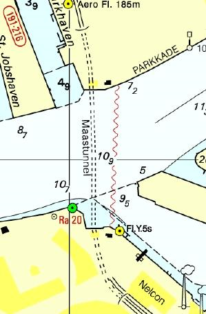
G.1.7. Tunnel (C)
A passage that is open to the atmosphere at both ends, buried under the sea bed or laid over the sea floor or bored under the ground or through mountains. (S-57 Standard)
Graphics | Encoding Intructions | Object Encoding | |||
|---|---|---|---|---|---|
|
Real World
Chart Symbol
IENC Symbolization
|
|
Object Encoding Object Class =TUNNEL(L,A) (O) BURDEP = [xx.x ] (metres), e.g., 2.5 (C) HORCLR = [xx.x] (metres), e.g., 34.2 (C) VERCLR = [xx.xx] (metres), e.g., 13.27 (O) OBJNAM = [name and/or operator/owner] (O) NOBJNM = (Refer to Section B, General Guidance) (O) unlocd = [ISRS code] (O) TXTDSC = (Refer to letter D) (O) CONDTN = [1 (under construction), 2 (ruined), 3 (under reclamation), 5 (planned construction)] (M) SCAMIN = [EU: 22000; US: 45000] (C) SORDAT = [YYYYMMDD] (C) SORIND = (Refer to Section B, General Guidance) Object Encoding Object Class =C_AGGR() (M) OBJNAM = [name and/or operator/owner] (O) NOBJNM = (Refer to Section B, General Guidance) (O) TXTDSC = (Refer to letter D) (C) unlocd = [ISRS code] (C) SORDAT = [YYYYMMDD] (C) SORIND = (Refer to Section B, General Guidance) |
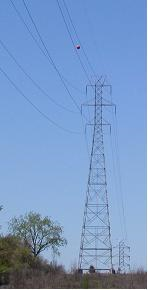
G.1.8. Overhead Cable (M)
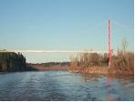
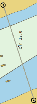
An overhead cable is an assembly of wires or fibres, or a wire rope or chain, which is supported by structures such as poles or pylons and passing over or nearby navigable waters. (Hydrographic Service, Royal Australian Navy).
Graphics | Encoding Intructions | Object Encoding | |||
|---|---|---|---|---|---|
|
Real World
Chart Symbol
IENC Symbolization
|
|
Object Encoding Object Class =cblohd(L) (M) VERCLR = [xx.xx] (metres), e.g., 13.27 (M) catcbl = [1 (power line), 3 (transmission line), 4 (telephone), 5 (telegraph), 6 (mooring cable/chain), 7 (ferry cable)] (O) verdat = [12 (Mean lower low water), 31 (Local low water reference level), 32 (Local high water reference level), 33 (Local mean water reference level), 34 (Equivalent height of water (German GlW)), 35 (Highest Shipping Height of Water (German HSW)), 36 (Reference low water level according to Danube Commission), 37 (Highest shipping height of water according to Danube Commission), 38 (Dutch river low water reference level (OLR)), 39 (Russian project water level), 40 (Russian normal backwater level), 41 (Ohio River Datum), 42 (Approximate LAT), 43 (Dutch High Water Reference Level (MHW)), 44 (Tweede Algemene Waterpassing)] (O) wtwdis = [xxxx.xxx] (units defined in hunits), e.g., 2451.732 (M) hunits = [3 (kilometres), 4 (hectometres), 5 (statute miles), 6 (nautical miles)] (O) OBJNAM = [name and/or operator/owner] (if relevant for navigation) (O) NOBJNM = (Refer to Section B, General Guidance) (O) INFORM = [name and/or operator/owner] (if relevant in case of accidents) (O) NINFOM = (Refer to Section B, General Guidance) (C) unlocd = [ISRS code] (O) CONDTN = [1 (under construction), 2 (ruined), 3 (under reclamation), 5 (planned construction)] (C) refgag = (Refer to letter H) (M) SCAMIN = [EU: 45000; US: 900000] (C) SORDAT = [YYYYMMDD] (C) SORIND = (Refer to Section B, General Guidance) |

G.1.9. Overhead Pipe (C)
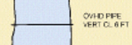
A pipeline is a string of interconnected pipes used for the transport of matter, nowadays mainly oil or gas. (IHO Dictionary, S-32, 5th Edition, 3857) An overhead pipeline is a pipeline supported by pylons and passing over or nearby navigable waters. (S-57 Standard)
Graphics | Encoding Intructions | Object Encoding | |||
|---|---|---|---|---|---|
|
Real World
Chart Symbol
IENC Symbolization
|
|
Object Encoding Object Class =pipohd(L) (M) CATPIP = [2 (outfall pipe), 3 (intake pipe), 4 (sewer), 6 (supply pipe)] (M) PRODCT = [1 (oil), 2 (gas), 3 (water), 7 (chemicals), 8 (drinking water)] (M) VERCLR = [xx.xx] (metres), e.g., 13.27 (O) verdat = [12 (Mean lower low water), 31 (Local low water reference level), 32 (Local high water reference level), 33 (Local mean water reference level), 34 (Equivalent height of water (German GlW)), 35 (Highest Shipping Height of Water (German HSW)), 36 (Reference low water level according to Danube Commission), 37 (Highest shipping height of water according to Danube Commission), 38 (Dutch river low water reference level (OLR)), 39 (Russian project water level), 40 (Russian normal backwater level), 41 (Ohio River Datum), 42 (Approximate LAT), 43 (Dutch High Water Reference Level (MHW)), 44 (Tweede Algemene Waterpassing)] (O) wtwdis = [xxxx.xxx] (units defined in hunits), e.g., 2451.732 (O) hunits = [3 (kilometres), 4 (hectometres), 5 (statute miles), 6 (nautical miles)] (O) OBJNAM = [name and/or operator/owner] (if relevant for navigation) (O) NOBJNM = (Refer to Section B, General Guidance) (O) INFORM = [name and/or operator/owner] (if relevant in case of accidents) (O) NINFOM = (Refer to Section B, General Guidance) (C) unlocd = [ISRS code] (O) CONDTN = [1 (under construction), 2 (ruined), 3 (under reclamation), 5 (planned construction)] (C) refgag = (Refer to letter K) (M) SCAMIN = [EU: 22000; US: 900000] (C) SORDAT = [YYYYMMDD] (C) SORIND = (Refer to Section B, General Guidance) |
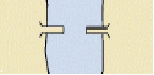
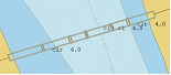
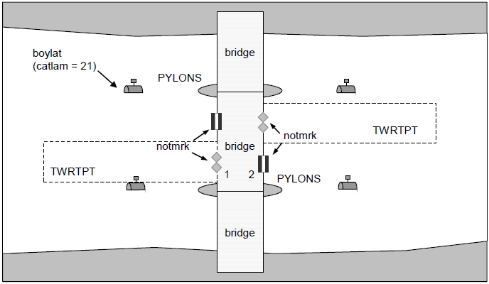
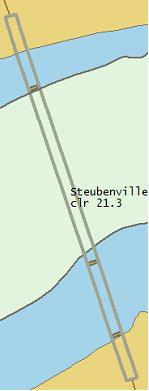
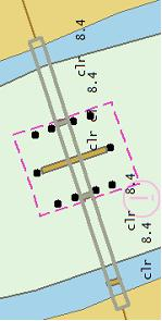
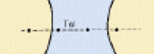
G.1.10. Pylons, Piers, and Bridge, Cable, Pipeline Support (C)
A vertical construction consisting, for example, of a steel framework or pre-stressed concrete to carry cables, pipelines or bridges. (S-57 Standard)
Graphics | Encoding Intructions | Object Encoding | ||||
|---|---|---|---|---|---|---|
|
Real World
Chart Symbol (bridge with piers)
IENC Symbolization (point)
IENC Symbolization (area)
|
|
Object Encoding Object Class =PYLONS(P,A) (M) CATPYL = [1 (power transmission pylon/pole), 2 (telephone/telegraph pylon/pole), 3 (aerial cableway/sky pylon), 4 (bridge pylon/tower), 5 (bridge pier)] (M) WATLEV = [2 (always dry)] (O) CONDTN = [1 (under construction), 2 (ruined), 3 (under reclamation), 5 (planned construction)] (M) SCAMIN = [EU: 22000; US: 300000] (C) SORDAT = [YYYYMMDD] (C) SORIND = (Refer to Section B, General Guidance) |

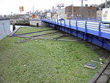
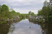
G.1.11. Foot Bridge / Catwalk (M)
A bridge structure used only for pedestrian traffic, commonly found crossing navigable waterways, but also found along waterways over non-navigable water.
Graphics | Encoding Intructions | Object Encoding | ||
|---|---|---|---|---|
|
Real World (Foot Bridge over navigable water)
Real World (Catwalk over non-navigable water)
|
|
Object Encoding Object Class =bridge(A) (M) CATBRG = [9 (footbridge)] (C) HORCLR = [xx.x] (metres), e.g., 34.2 (C) VERCLR = [xx.xx] (metres), e.g., 13.27 (C) VERCCL = [xx.x] (metres), e.g., 13.2 (C) VERCOP = [xx.x] (metres), e.g., 23.4 (C) verdat = [12 (Mean lower low water), 31 (Local low water reference level), 32 (Local high water reference level), 33 (Local mean water reference level), 34 (Equivalent height of water (German GlW)), 35 (Highest Shipping Height of Water (German HSW)), 36 (Reference low water level according to Danube Commission), 37 (Highest shipping height of water according to Danube Commission), 38 (Dutch river low water reference level (OLR)), 39 (Russian project water level), 40 (Russian normal backwater level), 41 (Ohio River Datum), 42 (Approximate LAT), 43 (Dutch High Water Reference Level (MHW)), 44 (Tweede Algemene Waterpassing)] (C) unlocd = [ISRS code] (C) wtwdis = [xxxx.xxx] (units defined in hunits), e.g., 2451.732 (C) hunits = [3 (kilometres), 4 (hectometres), 5 (statute miles), 6 (nautical miles)] (C) PICREP = (Refer to Section B, General Guidance) (O) CONDTN = [1 (under construction), 2 (ruined), 3 (under reclamation), 5 (planned construction)] (C) refgag = (Refer to letter N) (M) SCAMIN = [90000] (C) SORDAT = [YYYYMMDD] (C) SORIND = (Refer to Section B, General Guidance) Object Encoding Object Class =C_AGGR() (M) OBJNAM = [name and/or operator/owner] (O) NOBJNM = (Refer to Section B, General Guidance) (O) TXTDSC = (Refer to letter K) (C) unlocd = [ISRS code] (C) SORDAT = [YYYYMMDD] (C) SORIND = (Refer to Section B, General Guidance) |
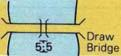
G.1.12. Retractable (Draw) Bridge (O)
A retractable bridge is a type of movable bridge in which the deck can be rolled or slid backwards to open a gap for crossing traffic, usually a ship on a waterway. This type is sometimes referred to as a thrust bridge. The bridge deck of a thrust bridge is retracted to one side and is related to the type S57 CATBRG 7 : Drawbridge
Graphics | Encoding Intructions | Object Encoding | |||
|---|---|---|---|---|---|
|
Real World
Real World
Chart Symbol
|
|
Object Encoding Object Class =bridge(A) (M) CATBRG = [7 (draw bridge)] (C) HORCLR = [xx.x] (metres), e.g., 34.2 (C) VERCOP = [xx.x] (metres), e.g., 23.4 (C) VERCCL = [xx.x] (metres), e.g., 13.2 (C) verdat = [12 (Mean lower low water), 31 (Local low water reference level), 32 (Local high water reference level), 33 (Local mean water reference level), 34 (Equivalent height of water (German GlW)), 35 (Highest Shipping Height of Water (German HSW)), 36 (Reference low water level according to Danube Commission), 37 (Highest shipping height of water according to Danube Commission), 38 (Dutch river low water reference level (OLR)), 39 (Russian project water level), 40 (Russian normal backwater level), 41 (Ohio River Datum), 42 (Approximate LAT), 43 (Dutch High Water Reference Level (MHW)), 44 (Tweede Algemene Waterpassing)] (C) unlocd = [ISRS code] (M) wtwdis = [xxxx.xxx] (units defined in hunits), e.g., 2451.732 (M) hunits = [3 (kilometres), 4 (hectometres), 5 (statute miles), 6 (nautical miles)] (C) OBJNAM = (Refer to letter J) (O) NOBJNM = (Refer to Section B, General Guidance) (C) INFORM = (Refer to letter D) (O) NINFOM = (Refer to Section B, General Guidance) (O) PICREP = (Refer to Section B, General Guidance) (O) CONDTN = [1 (under construction), 2 (ruined), 3 (under reclamation), 5 (planned construction)] (M) SCAMIN = [EU: 90000; US: 30000] (C) SORDAT = [YYYYMMDD] (C) SORIND = (Refer to Section B, General Guidance) Object Encoding Object Class =C_AGGR() (M) OBJNAM = [name and/or operator/owner] (O) NOBJNM = (Refer to Section B, General Guidance) (O) TXTDSC = (Refer to letter M) (C) unlocd = [ISRS code] (C) SORDAT = [YYYYMMDD] (C) SORIND = (Refer to Section B, General Guidance) |
G.2. Hydraulic Structures in General
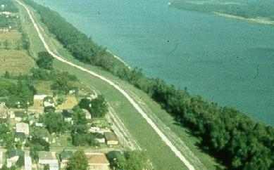
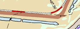
G.2.1. Dyke / Levee (O)
Artificial earthen embankment, roughly paralleling the waterway, to keep flood waters within the river course.
Graphics | Encoding Intructions | Object Encoding | |||
|---|---|---|---|---|---|
|
Real World
Chart Symbol
IENC Symbolization
|
|
Object Encoding Object Class =DYKCON(L,A) (O) HEIGHT = [xxx.x] metres, e.g., 27.4 (C) OBJNAM = (Refer to letter E) (O) NOBJNM = (Refer to Section B, General Guidance) (O) INFORM = [“Levee or European dyke”] (O) NINFOM = (Refer to Section B, General Guidance) (O) CONDTN = [1 (under construction), 2 (ruined), 3 (under reclamation), 5 (planned construction)] (M) SCAMIN = [22000] (C) SORDAT = [YYYYMMDD] (C) SORIND = (Refer to Section B, General Guidance) Object Encoding Object Class =SLOTOP(L) (M) CATSLO = [2 (embankment)] (O) NATSUR = [1 (mud), 2 (clay), 3 (silt), 4 (sand), 5 (stone), 6 (gravel), 7 (pebbles), 8 (cobbles), 9 (rock), 11 (lava), 14 (coral), 17 (shells), 18 (boulder)] (O) CONDTN = [1 (under construction), 2 (ruined), 3 (under reclamation), 5 (planned construction)] (M) SCAMIN = [22000] (C) SORDAT = [YYYYMMDD] (C) SORIND = (Refer to Section B, General Guidance) |

G.2.2. Fence / Floodwall (O)
A natural or man-made barrier used as an enclosure or boundary or for protection, including floodwalls.
Graphics | Encoding Intructions | Object Encoding | ||||
|---|---|---|---|---|---|---|
|
Real World
Real World
Chart Symbol
IENC Symbolization
|
|
Object Encoding Object Class =FNCLNE(L) (M) CATFNC = [1 (fence), 4 (wall)] (O) TXTDSC = (Refer to letter C) (O) OBJNAM = (Refer to letter E) (O) NOBJNM = (Refer to Section B, General Guidance) (O) INFORM = (Refer to letter B) (O) NINFOM = (Refer to Section B, General Guidance) (O) CONDTN = [1 (under construction), 2 (ruined), 3 (under reclamation), 5 (planned construction)] (M) SCAMIN = [EU: 12000; US: 18750] (C) SORDAT = [YYYYMMDD] (C) SORIND = (Refer to Section B, General Guidance) |
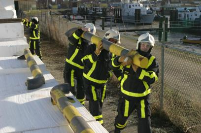

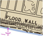
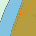
G.2.3. Groin (C)
A low artificial wall-like structure of durable material extending from the land to seaward for a particular purpose, such as to prevent coast erosion (adapted from IHO Dictionary, S-32, 5th Edition, 2525 and IHO Chart Specifications, M-4)
Graphics | Encoding Intructions | Object Encoding | ||
|---|---|---|---|---|
|
Chart Symbol
IENC Symbolization
|
|
Object Encoding Object Class =slcons(L,A) (M) catslc = [2 (groyne (groin))] (O) NATCON = [1 (masonry), 2 (concreted), 3 (loose boulders), 4 (hard surfaced), 5 (unsurfaced), 6 (wooden), 7 (metal), 8 (glass reinforced plastic (GRP))] (C) watlev = [1 (partly submerged at high water), 2 (always dry), 3 (always under water/submerged), 4 (covers and uncovers), 8 (above mean water level), 9 (below mean water level)] (C) OBJNAM = [EU: name and/or operator/owner; US refer to letter E] (O) NOBJNM = (Refer to Section B, General Guidance) (O) CONDTN = [1 (under construction), 2 (ruined), 3 (under reclamation), 5 (planned construction)] (M) SCAMIN = [EU: 45000 for line objects or 22000 for area objects; US: 45000] (C) SORDAT = [YYYYMMDD] (C) SORIND = (Refer to Section B, General Guidance) |
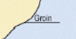
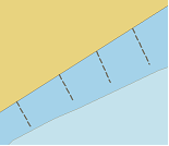
G.2.4. Ground Sill (C)
A natural or artificial small elevation in the river bed, which is due to sedimentation of till. DIN 4054: regulation structure built on the ground of a waterway that is higher than the ground itself.
Graphics | Encoding Intructions | Object Encoding |
|---|---|---|
|
|
Object Encoding Object Class =SLCONS(L,A) (M) CATSLC = [2 (groyne (groin))] (O) NATCON = [1 (masonry), 2 (concreted), 3 (loose boulders), 4 (hard surfaced), 5 (unsurfaced), 6 (wooden), 7 (metal), 8 (glass reinforced plastic (GRP))] (M) WATLEV = [3 (always under water/submerged)] (O) OBJNAM = [name and/or operator/owner] (O) NOBJNM = (Refer to Section B, General Guidance) (O) INFORM = "ground sill" (O) NINFOM = (Refer to Section B, General Guidance) (O) CONDTN = [1 (under construction), 2 (ruined), 3 (under reclamation), 5 (planned construction)] (M) SCAMIN = [45000 for line objects or 22000 for area objects] (C) SORDAT = [YYYYMMDD] (C) SORIND = (Refer to Section B, General Guidance) |
G.2.5. Revetment (O)
Facing of concrete blocks linked together, stone, masonry or broken rock placed along the edge of a stream, river or canal to stabilize the bank and to protect it from the erosive action of the stream.
Graphics | Encoding Intructions | Object Encoding | ||||
|---|---|---|---|---|---|---|
|
Real World (Revetment)
Real World (Rip rap)
Chart Symbol
IENC Symbolization
|
|
Object Encoding Object Class =slcons(L,A) (M) catslc = [8 (rip rap), 9 (revetment)] (O) NATCON = [1 (masonry), 2 (concreted), 3 (loose boulders)] (O) OBJNAM = [Name] (O) NOBJNM = (Refer to Section B, General Guidance) (O) watlev = [1 (partly submerged at high water), 2 (always dry), 3 (always under water/submerged), 4 (covers and uncovers), 8 (above mean water level), 9 (below mean water level)] (O) CONDTN = [1 (under construction), 2 (ruined), 3 (under reclamation), 5 (planned construction)] (M) SCAMIN = [EU: 45000; US: 30000] (C) SORDAT = [YYYYMMDD] (C) SORIND = (Refer to Section B, General Guidance) Object Encoding Object Class =RESARE(A) (M) RESTRN = [1 (anchoring prohibited), 38 (use of spuds prohibited)] (M) SCAMIN = [EU: 45000; US: 75000] (C) SORDAT = [YYYYMMDD] (C) SORIND = (Refer to Section B, General Guidance) |
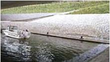
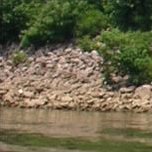

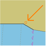
G.2.6. Revetment (Concrete Mattress) (Refer to G.2.5 Revetment) (O)
See G.2.5 Revetment
Graphics | Encoding Intructions | Object Encoding |
|---|---|---|
G.2.7. Training Wall (C)
A wall or bank, often submerged, built to direct or confine the flow of a river or tidal current, or to promote a scour action. (Adapted from IHO Dictionary, S-32, 5th Edition, 5586 and IHO Chart Specifications, M-4).
Graphics | Encoding Intructions | Object Encoding | |
|---|---|---|---|
|
IENC Symbolization
|
|
Object Encoding Object Class =slcons(L,A) (O) NATCON = [1 (masonry), 2 (concreted), 3 (loose boulders), 4 (hard surfaced), 5 (unsurfaced), 6 (wooden), 7 (metal), 8 (glass reinforced plastic (GRP))] (C) watlev = [1 (partly submerged at high water), 2 (always dry), 3 (always under water/submerged), 4 (covers and uncovers), 8 (above mean water level), 9 (below mean water level)] (C) OBJNAM = [EU: name and/or operator/owner; US: refer to letter F] (O) NOBJNM = (Refer to Section B, General Guidance) (O) CONDTN = [1 (under construction), 2 (ruined), 3 (under reclamation), 5 (planned construction)] (M) SCAMIN = [EU: 45000 for line objects or 22000 for area objects; US: 45000] (C) SORDAT = [YYYYMMDD] (C) SORIND = (Refer to Section B, General Guidance) Object Encoding Object Class =DEPARE(A) (M) DRVAL1 = [unknown] (M) DRVAL2 = [xx.x] (C) SORDAT = [YYYYMMDD] (C) SORIND = (Refer to Section B, General Guidance) |
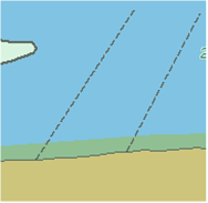
G.3. Installations
G.3.1. Boat Ramp (C)
A sloping structure that can either be used, as a landing place, at variable water levels, for small vessels, landing ships, or a ferry boats. (Adapted from IHO Dictionary, S-32, 5th Edition, 4209)
Graphics | Encoding Intructions | Object Encoding | |||
|---|---|---|---|---|---|
|
Real World
Chart Symbol
IENC Symbolization
|
|
Object Encoding Object Class =SLCONS(P,A) (M) CATSLC = [12 (ramp)] (O) NATCON = [1 (masonry), 2 (concreted), 3 (loose boulders), 4 (hard surfaced), 5 (unsurfaced), 6 (wooden), 7 (metal)] (M) WATLEV = [2 (always dry), 4 (covers and uncovers)] (O) OBJNAM = [Name + “Boat Ramp”] (O) NOBJNM = (Refer to Section B, General Guidance) (O) CONDTN = [1 (under construction), 2 (ruined), 3 (under reclamation), 5 (planned construction)] (M) SCAMIN = [EU: 8000; US: 30000] (C) SORDAT = [YYYYMMDD] (C) SORIND = (Refer to Section B, General Guidance) (C) STATUS = (Refer to letter B) |
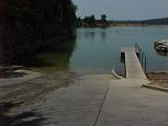
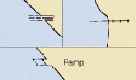
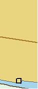
G.3.2. Bunker / Fueling Station (O)
A station, at which a vessel is able to bunker fuel, water or ballast (Inland ECDIS Standard)
Graphics | Encoding Intructions | Object Encoding | |
|---|---|---|---|
|
Real World
|
|
Object Encoding Object Class =bunsta(P,A) (O) catbun = [1 (diesel oil), 2 (water), 3 (ballast), 4 (power)] (O) OBJNAM = [name and/or operator/owner] (O) NOBJNM = (Refer to Section B, General Guidance) (M) bunves = [1 (bunker vessel available), 2 (no bunker vessel available)] (O) TXTDSC = (Refer to letter D) (C) unlocd = [ISRS code] (O) CONDTN = [1 (under construction), 2 (ruined), 3 (under reclamation), 5 (planned construction)] (M) SCAMIN = [22000] (C) SORDAT = [YYYYMMDD] (C) SORIND = (Refer to Section B, General Guidance) |
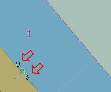
G.3.3. Conveyor (C)
A mechanical apparatus for moving bulk material or people from place to place (as by a moving belt or chain of receptacles); usually extends from a land-based facility over the shoreline to a dock, wharf, or mooring facility. (Adapted from S-57 Standard)
Graphics | Encoding Intructions | Object Encoding | |||
|---|---|---|---|---|---|
|
Real World
Chart Symbol
IENC Symbolization
|
|
Object Encoding Object Class =CONVYR(L,A) (M) CATCON = [2 (belt conveyor)] (O) PRODCT = [4 (stone), 5 (coal), 6 (ore), 7 (chemicals), 14 (sand), 15 (timber), 17 (scrap metal), 21 (cement), 22 (grain)] (O) OBJNAM = [Facility Name] (O) NOBJNM = (Refer to Section B, General Guidance) (O) VERCLR = [xx.xx] (metres), e.g., 13.27 (O) CONDTN = [1 (under construction), 2 (ruined), 3 (under reclamation), 5 (planned construction)] (M) SCAMIN = [EU: 22000; US: 30000] (C) SORDAT = [YYYYMMDD] (C) SORIND = (Refer to Section B, General Guidance) Object Encoding Object Class =convyr(L,A) (M) CATCON = [2 (belt conveyor)] (O) PRODCT = [4 (stone), 5 (coal), 6 (ore), 7 (chemicals), 14 (sand), 15 (timber), 17 (scrap metal), 21 (cement), 22 (grain)] (O) OBJNAM = [Facility Name] (O) NOBJNM = (Refer to Section B, General Guidance) (O) VERCLR = [xx.xx] (metres), e.g., 13.27 (O) verdat = [12 (Mean lower low water), 31 (Local low water reference level), 32 (Local high water reference level), 33 (Local mean water reference level), 34 (Equivalent height of water (German GlW)), 35 (Highest Shipping Height of Water (German HSW)), 36 (Reference low water level according to Danube Commission), 37 (Highest shipping height of water according to Danube Commission), 38 (Dutch river low water reference level (OLR)), 39 (Russian project water level), 40 (Russian normal backwater level), 41 (Ohio River Datum), 42 (Approximate LAT), 43 (Dutch High Water Reference Level (MHW)), 44 (Tweede Algemene Waterpassing)] (O) CONDTN = [1 (under construction), 2 (ruined), 3 (under reclamation), 5 (planned construction)] (M) SCAMIN = [EU: 22000; US: 30000] (C) SORDAT = [YYYYMMDD] (C) SORIND = (Refer to Section B, General Guidance) |
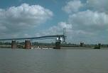
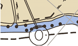
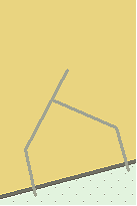
G.3.4. Crane (C)
A machine for lifting, shifting and lowering objects or materials by means of a swinging boom or with a lifting apparatus supported on an overhead track. (Digital Geographic Information Working Group, Oct.87)
Graphics | Encoding Intructions | Object Encoding | ||
|---|---|---|---|---|
|
Real World
IENC Symbolization
|
|
Object Encoding Object Class =CRANES(P,A) (M) CATCRN = [2 (container crane/gantry), 3 (sheerlegs), 4 (travelling crane), 5 (A-frame)] (O) OBJNAM = [name of owner] (O) NOBJNM = (Refer to Section B, General Guidance) (O) VERCLR = [xx.xx] (metres), e.g., 13.27 (O) CONDTN = [1 (under construction), 2 (ruined), 3 (under reclamation), 5 (planned construction)] (M) SCAMIN = [EU: 22000; US: 30000] (C) SORDAT = [YYYYMMDD] (C) SORIND = (Refer to Section B, General Guidance) Object Encoding Object Class =cranes(P,A) (M) CATCRN = [2 (container crane/gantry), 3 (sheerlegs), 4 (travelling crane), 5 (A-frame)] (O) OBJNAM = [name of owner] (O) NOBJNM = (Refer to Section B, General Guidance) (O) VERCLR = [xx.xx] (metres), e.g., 13.27 (O) verdat = [12 (Mean lower low water), 31 (Local low water reference level), 32 (Local high water reference level), 33 (Local mean water reference level), 34 (Equivalent height of water (German GlW)), 35 (Highest Shipping Height of Water (German HSW)), 36 (Reference low water level according to Danube Commission), 37 (Highest shipping height of water according to Danube Commission), 38 (Dutch river low water reference level (OLR)), 39 (Russian project water level), 40 (Russian normal backwater level), 41 (Ohio River Datum), 42 (Approximate LAT), 43 (Dutch High Water Reference Level (MHW)), 44 (Tweede Algemene Waterpassing)] (O) CONDTN = [1 (under construction), 2 (ruined), 3 (under reclamation), 5 (planned construction)] (M) SCAMIN = [EU: 22000; US: 30000] (C) SORDAT = [YYYYMMDD] (C) SORIND = (Refer to Section B, General Guidance) |
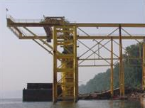
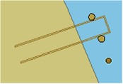
G.3.5. Dock / Wharf (C)
Platform or structure in the water where materials are loaded, unloaded and/or services are provided.
Graphics | Encoding Intructions | Object Encoding | |||||
|---|---|---|---|---|---|---|---|
|
Real World
Chart Symbol
IENC Symbolization ((Line))
IENC Symbolization ((Point))
IENC Symbolization ((Area))
|
|
Object Encoding Object Class =SLCONS(P,L,A) (M) CATSLC = [4 (pier (jetty)), 5 (promenade pier), 6 (wharf (quay)), 15 (solid face wharf), 16 (open face wharf)] (O) NATCON = [1 (masonry), 2 (concreted), 3 (loose boulders), 4 (hard surfaced), 5 (unsurfaced), 6 (wooden), 7 (metal), 8 (glass reinforced plastic (GRP)), 9 (painted)] (M) WATLEV = [1 (partly submerged at high water), 2 (always dry), 4 (covers and uncovers)] (O) OBJNAM = [name] (O) NOBJNM = (Refer to Section B, General Guidance) (O) CONDTN = [1 (under construction), 2 (ruined), 3 (under reclamation), 5 (planned construction)] (M) SCAMIN = [45000 for line, 22000 for area or 8000 for point objects] (C) SORDAT = [YYYYMMDD] (C) SORIND = (Refer to Section B, General Guidance) |

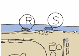
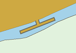
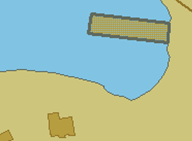
G.3.6. Dry Dock (O)
An artificial basin fitted with a gate or caisson, into which vessels can be floated and the water pumped out to expose the vessel's bottom. Also called graving dock. (IHO Dictionary, S-32, 5th Edition, 1426)
Graphics | Encoding Intructions | Object Encoding | ||
|---|---|---|---|---|
|
Real World
IENC Symbolization
|
|
Object Encoding Object Class =DRYDOC(A) (O) OBJNAM = [name and/or operator/owner] (O) NOBJNM = (Refer to Section B, General Guidance) (O) HORLEN = [xxx.x] (metres), e.g., 133.22 (O) HORWID = [xxx.x] (metres), e.g., 133.22 (O) HORCLR = [xx.x] (metres), e.g., 34.2 (O) DRVAL1 = [xx.x] (meters), e.g. 4.5 (O) TXTDSC = (Refer to letter B) (O) CONDTN = [1 (under construction), 2 (ruined), 3 (under reclamation), 5 (planned construction)] (M) SCAMIN = [EU: 12000; US: 18750] (C) SORDAT = [YYYYMMDD] (C) SORIND = (Refer to Section B, General Guidance) |

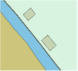
G.3.7. Floating Dock (C)
A form of dry dock consisting of a floating structure of one or more sections which can be partly submerged by controlled flooding to receive a vessel, then raised by pumping out the water so that the vessel's bottom can be exposed. (IHO Dictionary, S-32, 5th Edition, 1427)
Graphics | Encoding Intructions | Object Encoding | ||
|---|---|---|---|---|
|
Real World
IENC Symbolization
|
|
Object Encoding Object Class =flodoc(A) (O) OBJNAM = [name and/or operator/owner] (O) NOBJNM = (Refer to Section B, General Guidance) (O) HORLEN = [xxx.x] (metres), e.g., 133.22 (O) HORWID = [xxx.x] (metres), e.g., 133.22 (O) HORCLR = [xx.x] (metres), e.g., 34.2 (C) horcll = [xxx.x] (metres), e.g., 136.12 (C) horclw = [xxx.x] (metres), e.g., 25.17 (O) DRVAL1 = [xx.x] (metres), e.g. 4.5 (O) verdat = [12 (Mean lower low water), 31 (Local low water reference level), 32 (Local high water reference level), 33 (Local mean water reference level), 34 (Equivalent height of water (German GlW)), 35 (Highest Shipping Height of Water (German HSW)), 36 (Reference low water level according to Danube Commission), 37 (Highest shipping height of water according to Danube Commission), 38 (Dutch river low water reference level (OLR)), 39 (Russian project water level), 40 (Russian normal backwater level), 41 (Ohio River Datum), 42 (Approximate LAT), 43 (Dutch High Water Reference Level (MHW)), 44 (Tweede Algemene Waterpassing)] (O) TXTDSC = (Refer to letter D) (O) CONDTN = [1 (under construction), 2 (ruined), 3 (under reclamation), 5 (planned construction)] (M) SCAMIN = [22000] (M) SORDAT = [YYYYMMDD] (C) SORIND = (Refer to Section B, General Guidance) Object Encoding Object Class =FLODOC(A) (O) OBJNAM = [name and/or operato/owner] (O) NOBJNM = (Refer to Section B, General Guidance) (O) HORLEN = [xxx.x] (metres), e.g., 133.22 (O) HORWID = [xxx.x] (metres), e.g., 133.22 (O) HORCLR = [xx.x] (metres), e.g., 34.2 (O) DRVAL1 = [x.x] (metres), e.g., 2.7 or UNKNOWN (O) TXTDSC = (Refer to letter D) (O) CONDTN = [1 (under construction), 2 (ruined), 3 (under reclamation), 5 (planned construction)] (C) SORDAT = [YYYYMMDD] (C) SORIND = (Refer to Section B, General Guidance) |

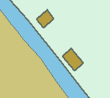
G.3.8. Fender (C)
A protective structure designed to cushion the impact of a vessel and prevent damage. (S-57 Standard)
Graphics | Encoding Intructions | Object Encoding | ||
|---|---|---|---|---|
|
Real World
IENC Symbolization
|
|
Object Encoding Object Class =SLCONS(P,L,A) (M) CATSLC = [14 (fender)] (O) NATCON = [1 (masonry), 2 (concreted), 3 (loose boulders), 4 (hard surfaced), 5 (unsurfaced), 6 (wooden), 7 (metal), 8 (glass reinforced plastic (GRP))] (M) WATLEV = [2 (always dry)] (O) CONDTN = [1 (under construction), 2 (ruined), 3 (under reclamation), 5 (planned construction)] (M) SCAMIN = [EU: 22000; US: 30000] (C) SORDAT = [YYYYMMDD] (C) SORIND = (Refer to Section B, General Guidance) |
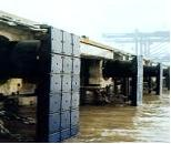

G.3.9. Harbor Area (C)
The area of water and land with the works necessary for its formation, protection and maintenance.
Graphics | Encoding Intructions | Object Encoding | ||
|---|---|---|---|---|
|
Real World
IENC Symbolization
|
|
Object Encoding Object Class =hrbare(A) (O) cathbr = [1 (custom harbour), 2 (port of refuge), 4 (fishing harbour), 5 (private harbour)] (M) OBJNAM = [Name of harbor] (O) NOBJNM = (Refer to Section B, General Guidance) (O) TXTDSC = (Refer to letter B) (C) unlocd = [ISRS code] (O) CONDTN = [1 (under construction), 2 (ruined), 3 (under reclamation), 5 (planned construction)] (M) SCAMIN = [22000] (C) SORDAT = [YYYYMMDD] (C) SORIND = (Refer to Section B, General Guidance) |
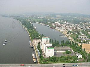
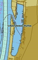
G.3.10. Harbor Basin (C)
An enclosed area of water surrounded by quay walls constructed to provide means for the transfer of cargo from and to ships.
Graphics | Encoding Intructions | Object Encoding | ||
|---|---|---|---|---|
|
Real World
IENC Symbolization (with dredged area in the harbour basin)
|
|
Object Encoding Object Class =hrbbsn(A) (O) HORLEN = [xxx.x] (metres), e.g., 133.22 (O) HORWID = [xxx.x] (metres), e.g., 133.22 (O) OBJNAM = [name and/or operator/owner] (O) NOBJNM = (Refer to Section B, General Guidance) (C) unlocd = [ISRS code] (O) CONDTN = [1 (under construction), 2 (ruined), 3 (under reclamation), 5 (planned construction)] (M) SCAMIN = [12000] (C) SORDAT = [YYYYMMDD] (C) SORIND = (Refer to Section B, General Guidance) |
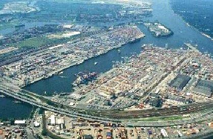
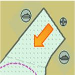
G.3.11. Landing Stage, Pontoon (C)
A floating structure, usually rectangular in shape which serves as landing, pier head or bridge support. (IHO dictionary, S-32, 5th edition, 3947)
Graphics | Encoding Intructions | Object Encoding | |||
|---|---|---|---|---|---|
|
Real World
Real World
IENC Symbolization
|
|
Object Encoding Object Class =PONTON(A) (O) OBJNAM = [name and/or name of operator/owner] (O) NOBJNM = (Refer to Section B, General Guidance) (O) TXTDSC = (Refer to letter F) (O) CONDTN = [1 (under construction), 2 (ruined), 3 (under reclamation), 5 (planned construction)] (C) SORDAT = [YYYYMMDD] (C) SORIND = (Refer to Section B, General Guidance) Object Encoding Object Class =ponton(A) (O) OBJNAM = [name and/or operator/owner] (O) NOBJNM = (Refer to Section B, General Guidance) (O) TXTDSC = (Refer to letter F) (C) unlocd = [ISRS code] (O) CONDTN = [1 (under construction), 2 (ruined), 3 (under reclamation), 5 (planned construction)] (M) SCAMIN = [EU: 12000; US: 30000] (C) SORDAT = [YYYYMMDD] (C) SORIND = (Refer to Section B, General Guidance) |
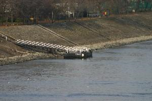
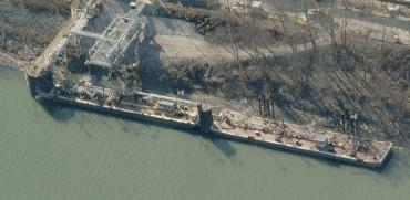
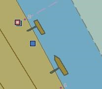
G.3.12. Mooring Facility (C)
The equipment or structure used to secure a vessel (adapted from IHO Dictionary, S-32, 5th Edition, 3322)
Graphics | Encoding Intructions | Object Encoding | |||
|---|---|---|---|---|---|
|
Real World (Mooring Cell)
Real World (US: Dolphin)
IENC Symbolization (Point cell (left); dolphin (right))
|
|
Object Encoding Object Class =MORFAC(P,L,A) (M) CATMOR = [1 (dolphin), 3 (bollard), 4 (tie-up wall), 5 (post or pile), 7 (mooring buoy)] (O) NATCON = [1 (masonry), 2 (concreted), 3 (loose boulders), 4 (hard surfaced), 5 (unsurfaced), 6 (wooden), 7 (metal), 8 (glass reinforced plastic (GRP))] (O) OBJNAM = [“Facility Name”] (O) NOBJNM = (Refer to Section B, General Guidance) (O) WATLEV = [2 (always dry)] (O) CONDTN = [1 (under construction), 2 (ruined), 3 (under reclamation), 5 (planned construction)] (M) SCAMIN = [EU: 22000; US: 30000; for individual bollards: 4000] (C) SORDAT = [YYYYMMDD] (C) SORIND = (Refer to Section B, General Guidance) |
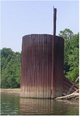
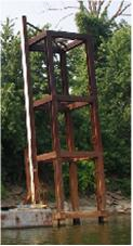
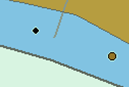
G.3.13. Federal Mooring Facility (O)
A device designated and maintained by a federal authority for tie-ups and a guaranteed depth year round.
Graphics | Encoding Intructions | Object Encoding | ||
|---|---|---|---|---|
|
Chart Symbol
IENC Symbolization
|
|
Object Encoding Object Class =SEAARE(P) (M) OBJNAM = ["Name” + (River Mile)], e.g. Federal Mooring Buoys (172.4)] (O) NOBJNM = (Refer to Section B, General Guidance) (M) SCAMIN = [EU: 22000; US: 60000] (C) SORDAT = [YYYYMMDD] (C) SORIND = (Refer to Section B, General Guidance) |
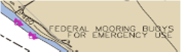

G.3.14. Permanently Moored Vessel or Facility (C)
A permanently moored ship (S-57 standard)
Graphics | Encoding Intructions | Object Encoding | |||
|---|---|---|---|---|---|
|
Real World
Chart Symbol
IENC Symbolization
|
|
Object Encoding Object Class =HULKES(A) (M) CATHLK = [1 (floating restaurant), 2 (historic ship), 3 (museum), 4 (accommodation), 5 (floating breakwater)] (O) OBJNAM = [facility name] (O) NOBJNM = (Refer to Section B, General Guidance) (O) TXTDSC = (Refer to letter E) (O) CONDTN = [1 (under construction), 2 (ruined), 3 (under reclamation), 5 (planned construction)] (C) SORDAT = [YYYYMMDD] (C) SORIND = (Refer to Section B, General Guidance) Object Encoding Object Class =hulkes(A) (O) cathlk = [1 (floating restaurant), 2 (historic ship), 3 (museum), 4 (accommodation), 5 (floating breakwater), 6 (casino boat)] (O) OBJNAM = [facility name] (O) OBJNAM = [facility name] (O) OBJNAM = [facility name] (C) unlocd = [ISRS code] (O) CONDTN = [1 (under construction), 2 (ruined), 3 (under reclamation), 5 (planned construction)] (M) SCAMIN = [EU: 22000; US: 30000] (C) SORDAT = [YYYYMMDD] (C) SORIND = (Refer to Section B, General Guidance) |
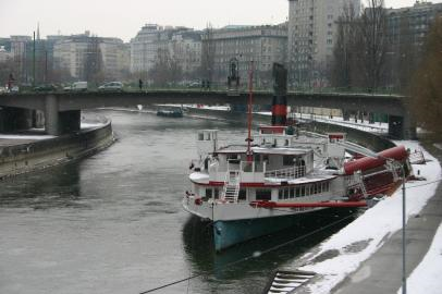
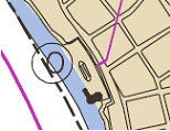
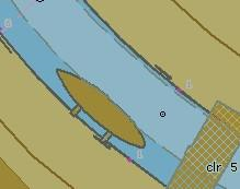
G.3.15. Port Area (C)
Apart from harbors, a port includes a city or borough with accommodations and facilities for landing passengers and goods and some amount of overseas trade. A port may possess a harbor but a harbor is not necessarily a port.
Graphics | Encoding Intructions | Object Encoding | |
|---|---|---|---|
|
Real World
|
|
Object Encoding Object Class =prtare(A) (O) OBJNAM = [name and/or operator/owner] (O) NOBJNM = (Refer to Section B, General Guidance) (C) unlocd = [ISRS code] (O) TXTDSC = (Refer to letter D) (O) CONDTN = [1 (under construction), 2 (ruined), 3 (under reclamation), 5 (planned construction)] (M) SCAMIN = [45000] (C) SORDAT = [YYYYMMDD] (C) SORIND = (Refer to Section B, General Guidance) |
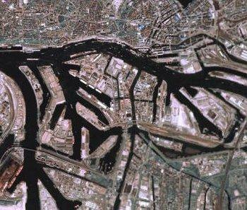
G.3.16. Free Port Area (O)
A port where certain import and export duties are waived (unless goods pass into the country) to facilitate reshipment to other countries. The area covers the water and the land area.
Graphics | Encoding Intructions | Object Encoding | |
|---|---|---|---|
|
IENC Symbolization
|
|
Object Encoding Object Class =FRPARE(A) (O) OBJNAM = [name and/or operator/owner] (O) NOBJNM = (Refer to Section B, General Guidance) (C) TXTDSC = (Refer to letter A) (O) CONDTN = [1 (under construction), 2 (ruined), 3 (under reclamation), 5 (planned construction)] (M) SCAMIN = [90000] (C) SORDAT = [YYYYMMDD] (C) SORIND = (Refer to Section B, General Guidance) |
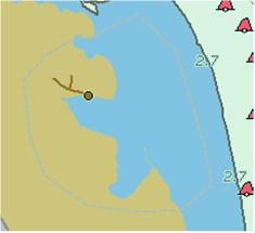
G.3.17. Refuse Dump (O)
At a refuse dump the vessels are able to unload their refuse like waste oil or black water (Inland ECDIS standard)
Graphics | Encoding Intructions | Object Encoding | |
|---|---|---|---|
|
IENC Symbolization
|
|
Object Encoding Object Class =refdmp(P) (O) catrfd = [1 (cargo residue/slop), 2 (waste oil), 3 (grey/black water), 4 (domestic refuse)] (O) OBJNAM = [name and/or operator/owner] (O) NOBJNM = (Refer to Section B, General Guidance) (C) unlocd = [ISRS code] (O) TXTDSC = (Refer to letter D) (O) CONDTN = [1 (under construction), 2 (ruined), 3 (under reclamation), 5 (planned construction)] (M) SCAMIN = [22000] (C) SORDAT = [YYYYMMDD] (C) SORIND = (Refer to Section B, General Guidance) |
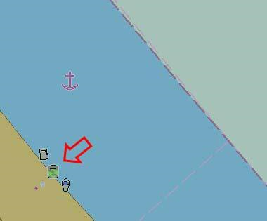
G.3.18. Slipway (C)
The prepared and usually reinforced inclined surface with installations to launch or lift vessels out of the water in relation to ship construction, repair or maintenance.
Graphics | Encoding Intructions | Object Encoding | ||
|---|---|---|---|---|
|
Real World
IENC Symbolization
|
|
Object Encoding Object Class =SLCONS(A) (M) CATSLC = [13 (slipway)] (O) OBJNAM = [name of facility or owner] (O) NOBJNM = (Refer to Section B, General Guidance) (O) CONDTN = [1 (under construction), 2 (ruined), 3 (under reclamation), 5 (planned construction)] (M) SCAMIN = [EU: 8000; US: 45000] (C) SORDAT = [YYYYMMDD] (C) SORIND = (Refer to Section B, General Guidance) |
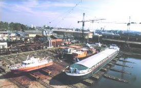
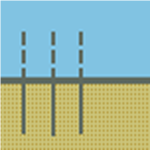
G.3.19. Terminal (C)
A terminal covers that area on shore that provides buildings and constructions for the transfer of cargo or passengers from and to ships.
Graphics | Encoding Intructions | Object Encoding | |||
|---|---|---|---|---|---|
|
Real World (container)
Real World (bulk)
IENC Symbolization
|
|
Object Encoding Object Class =termnl(P,A) (M) cathaf = [1 (RoRo-terminal), 3 (ferry terminal), 7 (tanker terminal), 8 (passenger terminal), 10 (container terminal), 11 (bulk terminal)] (O) TXTDSC = (Refer to letter C) (O) trshgd = [1 (containers), 2 (bulk goods), 3 (oil), 4 (fuel), 5 (chemicals), 6 (liquid goods), 7 (explosive goods), 8 (fish), 9 (cars), 10 (general cargo)] (O) OBJNAM = [name and/or operator/owner] (O) NOBJNM = (Refer to Section B, General Guidance) (C) unlocd = [ISRS code] (O) CONDTN = [1 (under construction), 2 (ruined), 3 (under reclamation), 5 (planned construction)] (M) SCAMIN = [EU: 12000; US: 18750] (C) SORDAT = [YYYYMMDD] (C) SORIND = (Refer to Section B, General Guidance) |
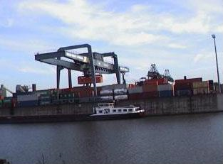
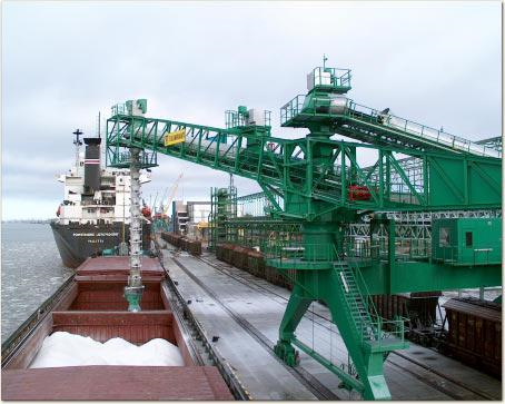
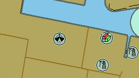
G.3.20. Vehicle Transfer Location (O)
A place where vehicles can be loaded or unloaded from the inland vessel with onboard or onshore facilities.
Graphics | Encoding Intructions | Object Encoding | ||
|---|---|---|---|---|
|
Real World
IENC Symbolization
|
|
Object Encoding Object Class =vehtrf(P,A) (M) catvtr = [1 (official), 2 (private), 3 (suitable for car cranes), 4 (suitable for car planks), 5 (permission required), 6 (locked gate)] (O) TXTDSC = (Refer to letter A) (M) HEIGHT = [xxx.x] metres, e.g., 27.4 (O) verdat = [12 (Mean lower low water), 31 (Local low water reference level), 32 (Local high water reference level), 33 (Local mean water reference level), 34 (Equivalent height of water (German GlW)), 35 (Highest Shipping Height of Water (German HSW)), 36 (Reference low water level according to Danube Commission), 37 (Highest shipping height of water according to Danube Commission), 38 (Dutch river low water reference level (OLR)), 39 (Russian project water level), 40 (Russian normal backwater level), 41 (Ohio River Datum), 42 (Approximate LAT), 43 (Dutch High Water Reference Level (MHW)), 44 (Tweede Algemene Waterpassing)] (C) unlocd = [ISRS code] (O) CONDTN = [1 (under construction), 2 (ruined), 3 (under reclamation), 5 (planned construction)] (M) SCAMIN = [45000] (C) SORDAT = [YYYYMMDD] (C) SORIND = (Refer to Section B, General Guidance) |
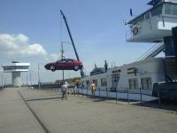
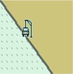
G.3.21. Landing Steps, Ladders (O)
Steps at the shoreline as the connection between land and water on different levels. Ladders in quays, jetties, dolphins, etc. to facilitate embarking and disembarking or reaching bollards.
Graphics | Encoding Intructions | Object Encoding | |||
|---|---|---|---|---|---|
|
Real World
Chart Symbol
IENC Symbolization
|
|
Object Encoding Object Class =SLCONS(P,A) (M) CATSLC = [11 (landing steps)] (O) CONDTN = [1 (under construction), 2 (ruined), 3 (under reclamation), 5 (planned construction)] (M) SCAMIN = [4000] (C) SORDAT = [YYYYMMDD] (C) SORIND = (Refer to Section B, General Guidance) |
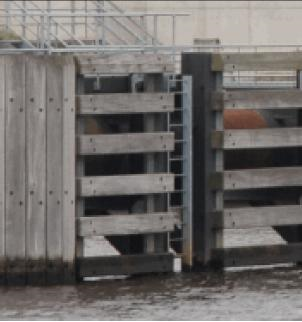

G.3.22. Production / Storage Area (O)
An area on land for the exploitation or storage of natural resources. (S-57 Standard)
Graphics | Encoding Intructions | Object Encoding | ||
|---|---|---|---|---|
|
Real World
IENC Symbolization
|
|
Object Encoding Object Class =PRDARE(A) (O) CATPRA = [1 (quarry), 2 (mine), 3 (stockpile), 4 (power station area), 5 (refinery area), 6 (timber yard), 7 (factory area), 8 (tank farm), 9 (wind farm), 10 (slag heap/spoil heap)] (O) PRODCT = [1 (oil), 2 (gas), 4 (stone), 5 (coal), 6 (ore), 7 (chemicals), 14 (sand), 15 (timber), 17 (scrap metal), 21 (cement), 22 (grain)] (O) CONVIS = [1 (visually conspicuous), 2 (not visually conspicuous)] (O) OBJNAM = [name and/or operator/owner] (O) NOBJNM = (Refer to Section B, General Guidance) (O) STATUS = [2 (occasional), 12 (illuminated), 16 (watched), 17 (un-watched)] (O) TXTDSC = (Refer to letter B) (O) CONDTN = [1 (under construction), 2 (ruined), 3 (under reclamation), 5 (planned construction)] (M) SCAMIN = [12000] (C) SORDAT = [YYYYMMDD] (C) SORIND = (Refer to Section B, General Guidance) |
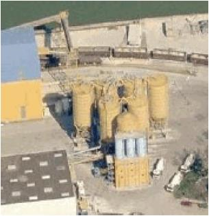
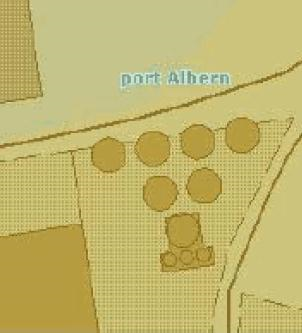
G.3.23. Ice Breaker (M)
An often wedge-like structure used for protecting a bridge pier, dock, facility, etc. from floating ice or other debris.
Graphics | Encoding Intructions | Object Encoding | ||
|---|---|---|---|---|
|
Real World
Real World (Aerial View)
|
|
Object Encoding Object Class =slcons(A) (M) catslc = [19 (ice breaker)] (O) NATCON = [1 (masonry), 2 (concreted), 3 (loose boulders), 4 (hard surfaced), 5 (unsurfaced), 6 (wooden), 7 (metal), 8 (glass reinforced plastic (GRP))] (O) OBJNAM = ["Facility Name"] (O) NOBJNM = (Refer to Section B, General Guidance) (O) watlev = [1 (partly submerged at high water), 2 (always dry), 3 (always under water/submerged), 4 (covers and uncovers), 8 (above mean water level), 9 (below mean water level)] (O) CONDTN = [1 (under construction), 2 (ruined), 3 (under reclamation), 5 (planned construction)] (M) SCAMIN = [EU: 45000; US: 60000] (C) SORDAT = [YYYYMMDD] (C) SORIND = (Refer to Section B, General Guidance) |
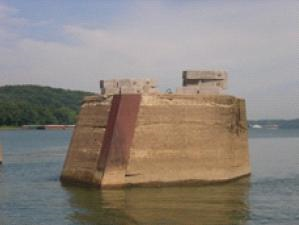
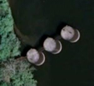
G.3.24. Pile or Post (C)
A long heavy timber or section of steel, wood, concrete, etc., forced into the earth which may serve as a support, as for a pier, or a free standing pole within a marine environment. (Adapted from IHO Dictionary, S-32, 5th Edition, 3840).
Graphics | Encoding Intructions | Object Encoding | |
|---|---|---|---|
|
Real World
|
|
Object Encoding Object Class =PILPNT(P) (O) CONDTN = [1 (under construction), 2 (ruined), 3 (under reclamation), 5 (planned construction)] (M) SCAMIN = [EU: 22000; US: 30000] (C) SORDAT = [YYYYMMDD] (C) SORIND = (Refer to Section B, General Guidance) |

G.3.25. Water Intake Structure (O)
Water intake structures divert water from a river or channel for the purposes of water supply, hydroelectric power and irrigation.
Graphics | Encoding Intructions | Object Encoding | ||
|---|---|---|---|---|
|
Real World
Real World
|
|
Object Encoding Object Class =slcons(A) (M) catslc = [20 (water intake structure)] (O) NATCON = [1 (masonry), 2 (concreted), 3 (loose boulder), 4 (hard surfaced), 5 (unsurfaced), 6 (wooden), 7 (metal)] (O) OBJNAM = [Facility Name] (O) NOBJNM = (Refer to Section B, General Guidance) (O) WATLEV = [1 (partly submerged at high water), 2 (always dry)] (M) SCAMIN = [EU: 22000, US: 45000] (C) SORDAT = [YYYYMMDD] (C) SORIND = (Refer to Section B, General Guidance) |
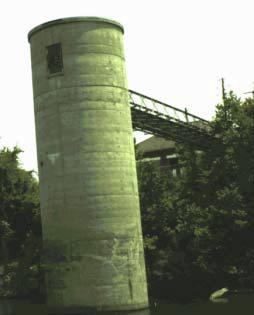
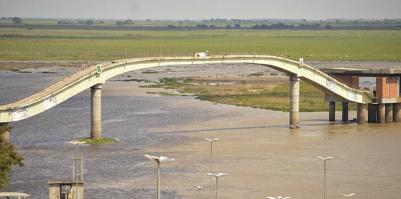
G.3.26. Power Supply Station (O)
A station, at which a vessel is able to obtain electric power supply (Inland ECDIS Standard)
Graphics | Encoding Intructions | Object Encoding | ||||
|---|---|---|---|---|---|---|
|
Real World
Real World
Real World
IENC Symbolization
|
|
Object Encoding Object Class =bunsta(P) (M) catbun = [4 (power)] (O) OBJNAM = [name and/or operator/owner] (O) NOBJNM = (Refer to Section B, General Guidance) (M) catvol = [1 (230V), 2 (400V)] (M) catfrq = [1 (50Hz), 2 (60Hz)] (M) amoamp = [xxx] (amps), e.g. 300 (O) allcon = [allowed consumption], e.g. 2 hours or 1000 kWh (O) catplg = [type of plug], e.g. CEE, Powerlock, etc. (O) shrnum = [xx] (number of connections), e.g. 4 (O) TXTDSC = (Refer to letter D) (C) unlocd = [ISRS code] (O) CONDTN = [1 (under construction), 2 (ruined), 3 (under reclamation), 5 (planned construction)] (M) SCAMIN = [22000] (C) SORDAT = [YYYYMMDD] (C) SORIND = (Refer to Section B, General Guidance) |

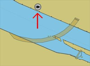
G.4. Locks, Barrages, Exceptional Navigational Structures
G.4.1. Arrival Point (O)
Arrival point location commonly associated with vessel queues at locks.
Graphics | Encoding Intructions | Object Encoding | |||
|---|---|---|---|---|---|
|
Real World
Chart Symbol
IENC Symbolization
|
|
For Arrival Points on Land Object Class =LNDRGN(P,A) (M) OBJNAM = [Facility/Lock Name + “Arrival Point”] (O) NOBJNM = (Refer to Section B, General Guidance) (O) INFORM = Check-in information, such as: Call-in Frequency, Phone Number, and Lock Name (O) NINFOM = (Refer to Section B, General Guidance) (M) TXTDSC = Check-in procedures and current lock conditions, planned closures, and operating schedules. (O) CONDTN = [1 (under construction), 2 (ruined), 3 (under reclamation), 5 (planned construction)] (M) SCAMIN = [45000] (C) SORDAT = [YYYYMMDD] (C) SORIND = (Refer to Section B, General Guidance) For Arrival Points on Water Object Class =SEAARE(P) (M) OBJNAM = [Facility/Lock Name + “Arrival Point”] (O) NOBJNM = (Refer to Section B, General Guidance) (O) INFORM = Check-in information, such as: Call-in Frequency, Phone Number, and Lock Name (O) NINFOM = (Refer to Section B, General Guidance) (M) TXTDSC = Check-in procedures and current lock conditions, planned closures, and operating schedules. (O) CONDTN = [1 (under construction), 2 (ruined), 3 (under reclamation), 5 (planned construction)] (M) SCAMIN = [45000] (C) SORDAT = [YYYYMMDD] (C) SORIND = (Refer to Section B, General Guidance) |

G.4.2. Dam / Barrier (O)
A barrier to check or confine anything in motion; particularly one constructed to hold back water and raise its level to form a reservoir, or to prevent flooding. (IHO Dictionary, S-32, 5th Edition, 1196)
Graphics | Encoding Intructions | Object Encoding | |||
|---|---|---|---|---|---|
|
Real World
Chart Symbol
IENC Symbolization
|
|
Object Encoding Object Class =DAMCON(L,A) (M) CATDAM = [1 (weir), 2 (dam)] (O) NATCON = [1 (masonry), 2 (concreted), 3 (loose boulders), 6 (wooden), 7 (metal)] (O) CONDTN = [1 (under construction), 2 (ruined), 3 (under reclamation), 5 (planned construction)] (C) SORDAT = [YYYYMMDD] (C) SORIND = (Refer to Section B, General Guidance) Object Encoding Object Class =C_AGGR() (M) OBJNAM = [name and/or operator/owner] (O) NOBJNM = (Refer to Section B, General Guidance) (C) unlocd = [ISRS code] (O) TXTDSC = (Refer to letter J) (C) SORDAT = [YYYYMMDD] (C) SORIND = (Refer to Section B, General Guidance) Please refer to letter B Object Class =RESARE(A) (M) CATREA = [12 (navigational aid safety zone)] (M) RESTRN = [7 (entry prohibited), 8 (entry restricted)] (C) INFORM = (Refer to letter E) (M) SCAMIN = [EU: 22000; US: 75000] (C) SORDAT = [YYYYMMDD] (C) SORIND = (Refer to Section B, General Guidance) |
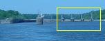

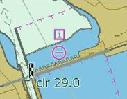
G.4.3. Lock Basin (M)
A lock basin is a wet dock in a waterway, permitting a ship to pass from one level to another. (adapted from IHO Dictionary, S-32, 5th Edition, 2881)
Graphics | Encoding Intructions | Object Encoding | ||
|---|---|---|---|---|
|
Real World
IENC Symbolization
|
|
Object Encoding Object Class =lokbsn(A) (M) horcll = [xxx.xx] (metres), e.g., 136.12 (M) horclw = [xxx.xx] (metres), e.g. 25.17 (O) HORLEN = [xxx.xx] (metres), e.g. 133.22 (O) HORWID = [xxx.xx] (metres), e.g. 133.22 (C) unlocd = [ISRS code] (O) TXTDSC = (Refer to letter G) (O) OBJNAM = [Lock chamber name] (O) NOBJNM = (Refer to Section B, General Guidance) (O) CONDTN = [1 (under construction), 2 (ruined), 3 (under reclamation), 5 (planned construction)] (M) SCAMIN = [EU: 12000; US: 30000] (C) SORDAT = [YYYYMMDD] (C) SORIND = (Refer to Section B, General Guidance) Object Encoding Object Class =C_AGGR() (M) OBJNAM = [name and/or operator/owner] (O) NOBJNM = (Refer to Section B, General Guidance) (O) TXTDSC = (Refer to letter G) (C) unlocd = [ISRS code] (C) SORDAT = [YYYYMMDD] (C) SORIND = (Refer to Section B, General Guidance) |
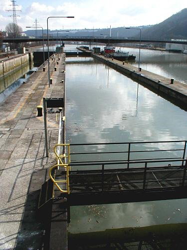
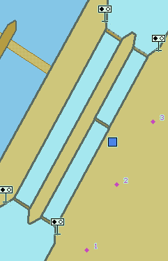
G.4.4. Lock Basin Part (O)
A lock basin is divided into several lock basin parts, if this lock basin has one ground level but several gates.
Graphics | Encoding Intructions | Object Encoding | |
|---|---|---|---|
|
IENC Symbolization
|
|
Object Encoding Object Class =lkbspt(A) (M) horcll = [xxx.xx] (metres), e.g., 136.12 (M) horclw = [xxx.xx] (metres), e.g. 25.17 (O) HORLEN = [xxx.xx] (metres), e.g. 133.22 (O) HORWID = [xxx.xx] (metres), e.g. 133.22 (C) unlocd = [ISRS code] (O) OBJNAM = [Lock Chamber Name] (O) NOBJNM = (Refer to Section B, General Guidance) (O) TXTDSC = (Refer to letter H) (O) CONDTN = [1 (under construction), 2 (ruined), 3 (under reclamation), 5 (planned construction)] (M) SCAMIN = [EU: 12000; US: 30000] (C) SORDAT = [YYYYMMDD] (C) SORIND = (Refer to Section B, General Guidance) Object Encoding Object Class =C_AGGR() (M) OBJNAM = [name and/or operator/owner] (O) NOBJNM = (Refer to Section B, General Guidance) (O) TXTDSC = (Refer to letter H) (C) unlocd = [ISRS code] (C) SORDAT = [YYYYMMDD] (C) SORIND = (Refer to Section B, General Guidance) |
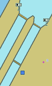
|
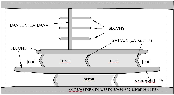
G.4.5. Lock Gate (M)
Structure swung, drawn, or raised/lowered to hold or release water in a lock.
Graphics | Encoding Intructions | Object Encoding | ||||
|---|---|---|---|---|---|---|
|
Real World
Real World (EU: lift door limiting air draught of vessel)
Chart Symbol
IENC Symbolization
|
|
Object Encoding Object Class =GATCON(L,A) (M) CATGAT = [4 (lock gate)] (M) HORCLR = [xx.x] (metres), e.g., 34.2 (C) VERCLR = [xx.xx] (metres), e.g., 13.27 (O) CONDTN = [1 (under construction), 2 (ruined), 3 (under reclamation), 5 (planned construction)] (M) SCAMIN = [22000] (C) SORDAT = [YYYYMMDD] (C) SORIND = (Refer to Section B, General Guidance) Object Encoding Object Class =gatcon(L,A) (M) CATGAT = [4 (lock gate)] (M) HORCLR = [xx.x] (metres), e.g., 34.2 (O) VERCLR = [xx.xx] (metres), e.g., 13.27 (O) verdat = [12 (Mean lower low water), 31 (Local low water reference level), 32 (Local high water reference level), 33 (Local mean water reference level), 34 (Equivalent height of water (German GlW)), 35 (Highest Shipping Height of Water (German HSW)), 36 (Reference low water level according to Danube Commission), 37 (Highest shipping height of water according to Danube Commission), 38 (Dutch river low water reference level (OLR)), 39 (Russian project water level), 40 (Russian normal backwater level), 41 (Ohio River Datum), 42 (Approximate LAT), 43 (Dutch High Water Reference Level (MHW)), 44 (Tweede Algemene Waterpassing)] (C) wtwdis = (Refer to letter F) (O) CONDTN = [1 (under construction), 2 (ruined), 3 (under reclamation), 5 (planned construction)] (M) SCAMIN = [22000] (M) SCAMIN = [22000] (C) SORIND = (Refer to Section B, General Guidance) |
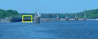
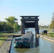
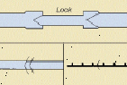
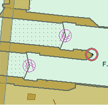
G.4.6. Lock Name (O)
The commonly known name of the lock facility.
Graphics | Encoding Intructions | Object Encoding | |
|---|---|---|---|
|
IENC Symbolization
|
|
Object Encoding Object Class =SEAARE(A) (M) OBJNAM = (Refer to letter A) (O) NOBJNM = (Refer to Section B, General Guidance) (O) CONDTN = [1 (under construction), 2 (ruined), 3 (under reclamation), 5 (planned construction)] (M) SCAMIN = [RU: 45000; US: 60000] (C) SORDAT = [YYYYMMDD] (C) SORIND = (Refer to Section B, General Guidance) |
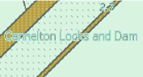
G.4.7. Lock Wall (M)
Permanent structure bounding a lock and including guide walls.
Graphics | Encoding Intructions | Object Encoding | |||
|---|---|---|---|---|---|
|
Real World
Chart Symbol
IENC Symbolization
|
|
Object Encoding Object Class =slcons(L,A) (M) catslc = [18 (lock/guide wall)] (O) NATCON = [1 (masonry), 2 (concreted), 3 (loose boulders), 6 (wooden), 7 (metal)] (O) CONDTN = [1 (under construction), 2 (ruined), 3 (under reclamation), 5 (planned construction)] (M) SCAMIN = [EU: 22000; US: 45000] (C) SORDAT = [YYYYMMDD] (C) SORIND = (Refer to Section B, General Guidance) |
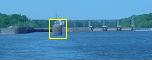
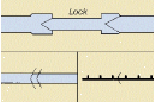
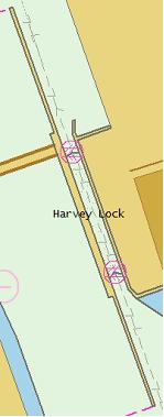
G.4.8. Exceptional Navigational Structure (M)
An exceptional navigational construction such as an aqueduct, lift-lock, etc.
Graphics | Encoding Intructions | Object Encoding | |||
|---|---|---|---|---|---|
|
Real World (Lift Lock)
Real World (Aqueduct)
IENC Symbolization
|
|
Object Encoding Object Class =excnst(P,A) (M) DRVAL1 = [x.x] (metres), e.g., 2.7 or UNKNOWN (M) catexs = [1 (Lift-Lock), 2 (Aqueduct), 3 (Sloping plane lock), 4 (Water slope lock (Pente d'Eau))] (C) verdat = [12 (Mean lower low water), 31 (Local low water reference level), 32 (Local high water reference level), 33 (Local mean water reference level), 34 (Equivalent height of water (German GlW)), 35 (Highest Shipping Height of Water (German HSW)), 36 (Reference low water level according to Danube Commission), 37 (Highest shipping height of water according to Danube Commission), 38 (Dutch river low water reference level (OLR)), 39 (Russian project water level), 40 (Russian normal backwater level), 41 (Ohio River Datum), 42 (Approximate LAT), 43 (Dutch High Water Reference Level (MHW)), 44 (Tweede Algemene Waterpassing)] (C) unlocd = (Refer to letter G) (M) wtwdis = [xxxx.xxx] (units defined in hunits), e.g., 2451.732 (M) hunits = [3 (kilometres), 4 (hectometres), 5 (statute miles), 6 (nautical miles)] (O) CONDTN = [1 (under construction), 2 (ruined), 3 (under reclamation), 5 (planned construction)] (M) SCAMIN = [EU: 90000; US: 300000] (C) SORDAT = [YYYYMMDD] (C) SORIND = (Refer to Section B, General Guidance) Object Encoding Object Class =C_AGGR() (M) OBJNAM = [name and/or operator/owner] (O) NOBJNM = (Refer to Section B, General Guidance) (C) unlocd = [ISRS code] (O) TXTDSC = (Refer to letter L) (C) SORDAT = [YYYYMMDD] (C) SORIND = (Refer to Section B, General Guidance) |
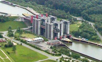
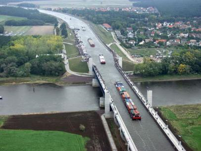
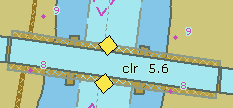
G.4.9. Opening Barrage (C)
An opening gate used to control and protect against flood water or to regulate the water level.
Graphics | Encoding Intructions | Object Encoding | |||
|---|---|---|---|---|---|
|
Real World (Aerial View)
Real World (Skipper's View)
Chart Symbol
|
|
Object Encoding Object Class =DAMCON(L,A) (M) CATDAM = [3 (flood barrage)] (O) NATCON = [1 (masonry), 2 (concreted), 3 (loose boulders), 4 (hard surfaced), 5 (unsurfaced), 6 (wooden), 7 (metal), 8 (glass reinforced plastic (GRP))] (O) CONDTN = [1 (under construction), 2 (ruined), 3 (under reclamation), 5 (planned construction)] (M) SCAMIN = [EU: 90000; US: 45000] (C) SORDAT = [YYYYMMDD] (C) SORIND = (Refer to Section B, General Guidance) Object Encoding Object Class =GATCON(L,A) (M) CATGAT = [2 (flood barrage gate)] (M) HORCLR = [xx.x] (metres), e.g., 34.2 (C) VERCLR = [xx.xx] (metres) (Refer to letter E) (C) VERCLR = [xx.xx] (metres) (Refer to letter E) (O) NOBJNM = (Refer to Section B, General Guidance) (O) CONDTN = [1 (under construction), 2 (ruined), 3 (under reclamation), 5 (planned construction)] (M) SCAMIN = [90000] (C) SORDAT = [YYYYMMDD] (C) SORIND = (Refer to Section B, General Guidance) Object Encoding Object Class =gatcon(L,A) (M) CATGAT = [2 (flood barrage gate)] (M) HORCLR = [xx.x] (metres), e.g., 34.2 (C) VERCLR = [xx.xx] (metres) (Refer to letter E) (O) verdat = [12 (Mean lower low water), 31 (Local low water reference level), 32 (Local high water reference level), 33 (Local mean water reference level), 34 (Equivalent height of water (German GlW)), 35 (Highest Shipping Height of Water (German HSW)), 36 (Reference low water level according to Danube Commission), 37 (Highest shipping height of water according to Danube Commission), 38 (Dutch river low water reference level (OLR)), 39 (Russian project water level), 40 (Russian normal backwater level), 41 (Ohio River Datum), 42 (Approximate LAT), 43 (Dutch High Water Reference Level (MHW)), 44 (Tweede Algemene Waterpassing)] (C) wtwdis = (Refer to letter G) (C) unlocd = [ISRS code] (O) CONDTN = [1 (under construction), 2 (ruined), 3 (under reclamation), 5 (planned construction)] (M) SCAMIN = [90000] (C) SORDAT = [YYYYMMDD] (C) SORIND = (Refer to Section B, General Guidance) Object Encoding Object Class =C_AGGR() (M) OBJNAM = [name and/or operator/owner] (O) NOBJNM = (Refer to Section B, General Guidance) (C) unlocd = [ISRS code] (O) TXTDSC = (Refer to letter K) (C) SORDAT = [YYYYMMDD] (C) SORIND = (Refer to Section B, General Guidance) |
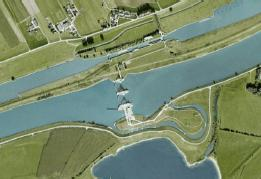
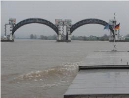

Part III. Hydrography
Table of Contents
- H. H - Currents
- I. I - Depths
- J. J - Rocks, Wrecks, Obstructions and Nature of Riverbed
- K. K - Offshore Installations
- L. L - Tracks, Routes
- M. M - Areas, Limits
Chapter H. H - Currents
Table of Contents
H.1. Currents
H.1.1. Current (O)
Current is preferably indicated at high and low water conditions to aid with planning, navigation and maneuvering.
Graphics | Encoding Intructions | Object Encoding | ||
|---|---|---|---|---|
|
Real World
IENC Symbolization
|
|
Object Encoding Object Class =curent(P,A) (C) curvhw = [xx.x] (C) curvlw = [xx.x] (C) curvmw = [xx.x] (C) curvow = [xx.x] (C) dirimp = [1 (upstream), 2 (downstream), 3 (to the left bank), 4 (to the right bank)] (C) hignam = Name of water level, which is used for the attribute higwat (value at relevant high water level) including version identification, for example year of issue or period, e.g., HSW 96 (C) lownam = Name of water level, which is used for the attribute lowwat (value at relevant low water level) including version identification, for example year of issue or period, e.g., RNW 96 (C) meanam = Name of water level, which is used for the attribute meawat (value at relevant mean water level) including version identification, for example year of issue or period, e.g., HSW 96 (C) othnam = (name of water level, which is used for the attribute othwat (value at other locally relevant water level) including version identification, for example year of issue or period) (e.g., HQ100-96) (C) ORIENT = [xxx or (UNKNOWN)] (degree (°)), e.g., 110 (M) SCAMIN = [18000] (C) SORDAT = [YYYYMMDD] (C) SORIND = (Refer to Section B, General Guidance) |
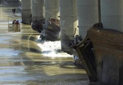
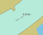
H.1.2. Water Turbulence (O)
The disturbance of water caused by the interaction of any combination of waves, currents, tidal streams, wind, shoal patches and obstructions.
Graphics | Encoding Intructions | Object Encoding | |
|---|---|---|---|
|
IENC Symbolization
|
|
Object Encoding Object Class =WATTUR(P,A) (M) CATWAT = [6 (under water turbulence)] (O) OBJNAM = [Name of object] (O) OBJNAM = [Name of object] (M) SCAMIN = [22000] (C) SORDAT = [YYYYMMDD] (C) SORIND = (Refer to Section B, General Guidance) |
Chapter I. I - Depths
I.1. Depths in Fairways and Areas
I.1.1. Detailed Depth - referenced to one water level (C)
Detailed depth information (area) – referred to one reference water level only : Water area within the waterway whose detailed depth information is within a defined range of values that refer to only one vertical datum, the reference water level.
Graphics | Encoding Intructions | Object Encoding | |
|---|---|---|---|
|
IENC Symbolization
|
|
Object Encoding Object Class =DEPARE(A) (M) DRVAL1 = [x.x] (metres), e.g., 2.7 or UNKNOWN (M) DRVAL2 = Maximum known depth of depth area: [xx.x] (metres) or UNKNOWN (C) QUASOU = [2 (depth unknown), 8 (value reported (not surveyed))] (C) SORDAT = [YYYYMMDD] (C) SORIND = (Refer to Section B, General Guidance) |
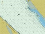
I.1.2. Detailed Depth - water level model (C)
Detailed depth information (area) – a water level model that is applied to depth areas. A water area within the waterway in which detailed depth information is known within a defined range of values referenced to a vertical datum (the reference water leve). The actual water level is provided by a water level model.
Graphics | Encoding Intructions | Object Encoding | |
|---|---|---|---|
|
IENC Symbolization
|
|
Object Encoding Object Class =depare(A) (M) DRVAL1 = [x.x] (metres), e.g., 2.7 or UNKNOWN (M) DRVAL2 = Maximum known depth of depth area: [xx.x] (metres) or UNKNOWN (C) eleva1 = Maximum elevation 1 of a depth area: [xx.x] (metres) or UNKNOWN (C) eleva2 = Minimum elevation 2 of a depth area: [xx.x] (metres) or UNKNOWN (M) wtwdis = [xxxx.x] (units defined in hunits), e.g., 2451.7 (M) hunits = [3 (kilometres), 4 (hectometres), 5 (statute miles), 6 (nautical miles)] (C) QUASOU = [2 (depth unknown), 8 (value reported (not surveyed))] (C) SORDAT = [YYYYMMDD] (C) SORIND = (Refer to Section B, General Guidance) |
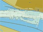
I.1.3. Dredged Area (C)
An area of the bottom of a body of water that has been deepened by dredging. (IHO Dictionary, S-32, 5th Edition, 1462)
Graphics | Encoding Intructions | Object Encoding | |
|---|---|---|---|
|
IENC Symbolization
|
|
Object Encoding Object Class =DRGARE(A) (M) DRVAL1 = [x.x] (metres), e.g., 2.7 or UNKNOWN (C) SORDAT = [YYYYMMDD] (C) SORIND = (Refer to Section B, General Guidance) |
I.1.4. Fairway (C)
Part of the navigable waterway area where a certain water depth within a certain width is available for the continuous navigation. That part of a river, harbor and so on, where the main navigable channel for vessels of larger size lies. It is also the usual course followed by vessels entering or leaving harbors, called „ship channel“. (International Maritime Dictionary, 2nd Ed.)
Graphics | Encoding Intructions | Object Encoding | ||
|---|---|---|---|---|
|
IENC Symbolization
IENC Symbolization
|
|
Object Encoding Object Class =FAIRWY(A) (M) SCAMIN = [90000] (C) SORDAT = [YYYYMMDD] (C) SORIND = (Refer to Section B, General Guidance) |
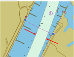
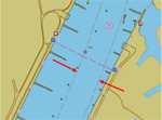
I.1.5. Fairway Depth / Project Depth (C)
Area within the waterway that is delimited by the boundaries of the navigable channel and denotes the designated area with an official water depth for the continuous navigation. It depends on the legal status of the navigable channel if this depth is maintained regularly or not.
Graphics | Encoding Intructions | Object Encoding | |
|---|---|---|---|
|
IENC Symbolization
|
|
Object Encoding Object Class =DEPARE(A) (M) DRVAL1 = [x.x] (metres), e.g., 2.7 or UNKNOWN (M) DRVAL2 = Maximum known depth of depth area: [xx.x] (metres) or UNKNOWN (C) QUASOU = (Refer to letter G) (C) SORDAT = [YYYYMMDD] (C) SORIND = (Refer to Section B, General Guidance) |
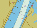
I.1.6. Low / High Water Range (Drying Height) (C)
Area denoting the range between low and high water conditions (often referred to as ‘drying height’). The feature applies only to open rivers.
Graphics | Encoding Intructions | Object Encoding | |
|---|---|---|---|
|
IENC Symbolization (shown in green)
|
|
Object Encoding Object Class =DEPARE(A) (M) DRVAL1 = UNKNOWN or -H (M) DRVAL2 = 0.0 (C) INFORM = ["Range between low and high water conditions"] (C) SORDAT = [YYYYMMDD] (C) SORIND = (Refer to Section B, General Guidance) |
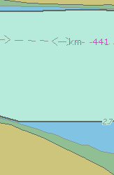
I.1.7. Shallow Depth (C)
Area within the waterway bounded by zero depth and the project depth.
Graphics | Encoding Intructions | Object Encoding | ||
|---|---|---|---|---|
|
Chart Symbol
IENC Symbolization
|
|
Object Encoding Object Class =DEPARE(A) (M) DRVAL1 = 0.0 (metres) (M) DRVAL2 = Maximum known depth of depth area: [xx.x] (metres) or UNKNOWN (C) SORDAT = [YYYYMMDD] (C) SORIND = (Refer to Section B, General Guidance) |
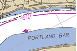

I.1.8. Soundings (O)
A measured water depth or spot that has been reduced to a vertical datum. (S-57standard)
Graphics | Encoding Intructions | Object Encoding | |
|---|---|---|---|
|
IENC Symbolization
|
|
Object Encoding Object Class =SOUNDG(P) (M) SCAMIN = [compilation scale multiplied by 2] (C) SORDAT = [YYYYMMDD] (C) SORIND = (Refer to Section B, General Guidance) |
I.1.9. Unsurveyed Area (C)
An area for which no bathymetric survey information is available. (S-57standard)
Graphics | Encoding Intructions | Object Encoding | ||
|---|---|---|---|---|
|
Chart Symbol
IENC Symbolization
|
|
Object Encoding Object Class =UNSARE(A) (C) QUASOU = (Refer to letter B) (C) SORDAT = [YYYYMMDD] (C) SORIND = (Refer to Section B, General Guidance) Object Encoding Object Class =DEPARE(A) (M) DRVAL1 = ["0"] (M) DRVAL2 = ["Unknown" or [x.x] (metres), e.g. 2.7] (C) QUASOU = (Refer to letter B) (C) SORDAT = [YYYYMMDD] (C) SORIND = (Refer to Section B, General Guidance) |
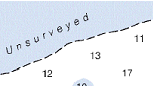
I.2. Depth Contours
I.2.1. Depth Contour
Line of constant depth denoting the depth between Shallow Depth and Fairway / Project Depth.
Graphics | Encoding Intructions | Object Encoding | ||
|---|---|---|---|---|
|
Chart Symbol
IENC Symbolization
|
|
Object Encoding Object Class =DEPCNT(L) (M) VALDCO = [xx.xx] (metres), e.g., 2.74 (M) SCAMIN = [EU: 12000; US: 18750] (C) SORDAT = [YYYYMMDD] (C) SORIND = (Refer to Section B, General Guidance) |
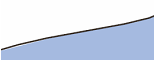
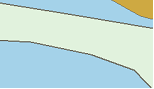
I.3. Depth References
I.3.1. Depth Indicator (C)
Device that shows the real water depth between the actual water level and the bottom of the waterway or isolated dangers under water (e.g., ground sill). The manner in which the device indicates this can either be analog (e.g., by a water level staff / pole - one can read the real water depth directly at the water level) or digital (e.g. by a display). Distinction: external indicator of a gauge, also if the indicator is not directly located at the gauge – this is not the same as a depth indicator (values at gauges are always referred to the zero point of the gauge).
Graphics | Encoding Intructions | Object Encoding | |
|---|---|---|---|
|
Real World
|
|
Object Encoding Object Class =sistaw(P) (M) catsiw = [18 (depth indication)] (O) INFORM = [additional information, e.g. "referenced to ground still"] (O) NINFOM = (Refer to Section B, General Guidance) (C) TXTDSC = (Refer to letter A) (O) CONDTN = [1 (under construction), 2 (ruined), 3 (under reclamation), 5 (planned construction)] (M) SCAMIN = [EU: 22000; US: 45000] (C) SORDAT = [YYYYMMDD] (C) SORIND = (Refer to Section B, General Guidance) |
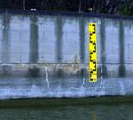
I.3.2. High Water Mark (C)
Device that shows if official high water levels are reached. This can be indicated either by analog (e.g., by signs like a staff gauge) or digital (e.g., by a display).
Graphics | Encoding Intructions | Object Encoding | ||
|---|---|---|---|---|
|
Real World
IENC Symbolization
|
|
Object Encoding Object Class =sistaw(P) (M) catsiw = [15 (high water mark)] (O) INFORM = [additional information, e.g., "I=460cm at gauge Kaub"] (O) NINFOM = (Refer to Section B, General Guidance) (C) TXTDSC = (Refer to letter A) (O) CONDTN = [1 (under construction), 2 (ruined), 3 (under reclamation), 5 (planned construction)] (M) SCAMIN = [EU: 22000; US: 45000] (C) SORDAT = [YYYYMMDD] (C) SORIND = (Refer to Section B, General Guidance) |
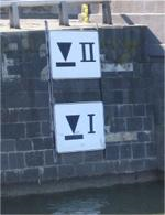
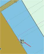
I.3.3. Vertical Clearance Indicator (C)
Device that shows the vertical clearance between the actual water level and isolated dangers above water level, such as bridges, overhead cables etc. This can be indicated either by analog (e.g., by fixed upside down scales on pylons of bridges - one can read the clearance directly at the water level) or digital (e.g., by a display).
Graphics | Encoding Intructions | Object Encoding | ||
|---|---|---|---|---|
|
Real World
IENC Symbolization
|
|
Object Encoding Object Class =sistaw(P) (M) catsiw = [16 (vertical clearance indication)] (C) TXTDSC = (Refer to letter A) (O) CONDTN = [1 (under construction), 2 (ruined), 3 (under reclamation), 5 (planned construction)] (M) SCAMIN = [EU: 22000; US: 45000] (C) SORDAT = [YYYYMMDD] (C) SORIND = (Refer to Section B, General Guidance) |
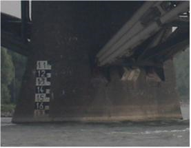
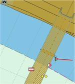
I.3.4. Waterway Gauge (C)
A waterway gauge is an instrument for measuring water levels. Waterway gauges provide the actual water level information to calculate actual depths and vertical clearances, taking into account the sloped nature of river water surfaces.
Graphics | Encoding Intructions | Object Encoding | |
|---|---|---|---|
|
Chart Symbol (USACE Gauge)
|
|
Object Encoding Object Class =wtwgag(P,A) (C) OBJNAM = [name of gauge] (O) NOBJNM = (Refer to Section B, General Guidance) (C) unlocd = [ISRS code] (O) catgag = [1 (water level staff / pole), 2 (recording water level gauge), 3 (recording water level gauge with remote access), 4 (recording water level gauge with external indicator), 5 (recording water level gauge with remote access and remote indicator)] (O) wtwdis = [xxxx.xxx] (units defined in hunits), e.g., 2451.732 (O) hunits = [3 (kilometres), 4 (hectometres), 5 (statute miles), 6 (nautical miles)] (O) ELEVAT = [xxx.x] (metres), e.g., 139.5 (O) reflev = [1 (Baltic datum), 2 (Adriatic level), 3 (Amsterdam Ordnance Datum (NAP)), 4 (Mean Sea Level), 5 (Other datum), 6 (National Geodetic Vertical Datum - NGVD29), 7 (North American Vertical Datum - NAVD88), 8 (Mean sea level 1912), 9 (Mean sea level 1929), 10 (Tweede Algemene Waterpassing (TAW))] (O) disipd = [distance of impact, downstream: unit defined in the M_UNIT meta object class, e.g., metre (m), resolution: 1m] (O) disipu = [distance of impact, upstream: unit defined in the M_UNIT meta object class, e.g., metre (m), resolution: 1m] (O) higwat = [xxx.xxx] (metres), e.g., 4.78 (O) hignam = Name of water level, which is used for the attribute higwat (value at relevant high water level) including version identification, for example year of issue or period, e.g., HSW 96 (O) lowwat = [xxx.xxx] (metres), e.g., 4.78 (O) lownam = Name of water level, which is used for the attribute lowwat (value at relevant low water level) including version identification, for example year of issue or period, e.g., RNW 96 (O) meawat = [xxx.xxx] (metres), e.g., 2.46 (O) meanam = Name of water level, which is used for the attribute meawat (value at relevant mean water level) including version identification, for example year of issue or period, e.g., HSW 96 (O) othwat = [xxx.xxx] (metres), e.g., 0.567 (O) othnam = (name of water level, which is used for the attribute othwat (value at other locally relevant water level) including version identification, for example year of issue or period) (e.g., HQ100-96) (O) sdrlev = (name of reference level to which depth are referred (from verdat list) plus version indication), e.g. GlW 2002 (O) vcrlev = Name of reference level to which vertical clearances are referred (from verdat list) plus version indication, e.g., HSW 2002 (O) CONDTN = [1 (under construction), 2 (ruined), 3 (under reclamation), 5 (planned construction)] (M) SCAMIN = [EU: 22000; US: 45000] (C) SORDAT = [YYYYMMDD] (C) SORIND = (Refer to Section B, General Guidance) |

|
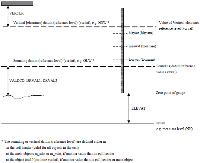
I.3.5. Waterway Profile (C)
A waterway profile is an imaginary (i.e., physically non-existent) line across the waterway.
Graphics | Encoding Intructions | Object Encoding | |
|---|---|---|---|
|
IENC Symbolization
|
|
Object Encoding Object Class =wtwprf(L) (M) wtwdis = [xxxx.xxx] (units defined in hunits), e.g., 2451.732 (M) hunits = [3 (kilometres), 5 (statute miles), 6 (nautical miles)] (C) HEIGHT = [xxx.x] metres, e.g., 27.4 (C) verdat = [12 (Mean lower low water), 31 (Local low water reference level), 32 (Local high water reference level), 33 (Local mean water reference level), 34 (Equivalent height of water (German GlW)), 35 (Highest Shipping Height of Water (German HSW)), 36 (Reference low water level according to Danube Commission), 37 (Highest shipping height of water according to Danube Commission), 38 (Dutch river low water reference level (OLR)), 39 (Russian project water level), 40 (Russian normal backwater level), 41 (Ohio River Datum), 42 (Approximate LAT), 43 (Dutch High Water Reference Level (MHW)), 44 (Tweede Algemene Waterpassing)] (C) reflev = [1 (Baltic datum), 2 (Adriatic level), 3 (Amsterdam Ordnance Datum (NAP)), 4 (Mean Sea Level), 5 (Other datum), 6 (National Geodetic Vertical Datum - NGVD29), 7 (North American Vertical Datum - NAVD88), 8 (Mean sea level 1912), 9 (Mean sea level 1929), 10 (Tweede Algemene Waterpassing (TAW))] (M) SCAMIN = [EU: 12000; US: 18750] (C) SORDAT = [YYYYMMDD] (C) SORIND = (Refer to Section B, General Guidance) |
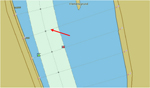
Chapter J. J - Rocks, Wrecks, Obstructions and Nature of Riverbed
Table of Contents
J.1. Rocks
J.1.1. Rocks (C)
A concreted mass of stony material or coral that dries, is awash or is below the water surface.
Graphics | Encoding Intructions | Object Encoding | |
|---|---|---|---|
|
IENC Symbolization
|
|
Object Encoding Object Class =UWTROC(P,A) (M) WATLEV = [1 (partly submerged at high water), 2 (always dry), 3 (always under water/submerged), 4 (covers and uncovers), 5 (awash)] (M) VALSOU = [+/- xx.x] (metres), e.g., -00.3 or unknown (O) NATSUR = [5 (stone), 9 (rock), 11 (lava), 14 (coral), 18 (boulder)] (C) EXPSOU = (Refer to letter F) (O) QUASOU = [2 (depth unknown), 8 (value reported (not surveyed))] (M) SCAMIN = [22000; US: 18750] (C) SORDAT = [YYYYMMDD] (C) SORIND = (Refer to Section B, General Guidance) Object Encoding Object Class =uwtroc(P,A) (M) watlev = [1 (partly submerged at high water), 2 (always dry), 3 (always under water/submerged), 4 (covers and uncovers), 8 (above mean water level), 9 (below mean water level)] (M) VALSOU = [+/- xx.x] (metres), e.g., -00.3 or unknown (C) EXPSOU = (Refer to letter F) (O) NATSUR = [5 (stone), 9 (rock), 11 (lava), 14 (coral), 18 (boulder)] (M) SCAMIN = [EU: 22000; US: 18750] (C) SORDAT = [YYYYMMDD] (C) SORIND = (Refer to Section B, General Guidance) |
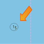
J.2. Wrecks
J.2.1. Wrecks (C)
The ruined remains of a stranded or sunken vessel that has been rendered useless. (IHO Dictionary, S-32, 5th Edition, 6027)
Graphics | Encoding Intructions | Object Encoding | |||
|---|---|---|---|---|---|
|
Real World
Chart Symbol
IENC Symbolization
|
|
Object Encoding Object Class =WRECKS(P,A) (M) CATWRK = [1 (non-dangerous wreck), 2 (dangerous wreck), 3 (distributed remains of wreck), 4 (wreck showing mast/masts), 5 (wreck showing any portion of hull or superstructure)] (O) WATLEV = [1 (partly submerged at high water), 2 (always dry), 3 (always under water/submerged), 4 (covers and uncovers), 5 (awash)] (C) VALSOU = [xx.x or (UNKNOWN)] (metres), e.g., 00.3 (O) QUASOU = [2 (depth unknown), 8 (value reported (not surveyed))] (O) TECSOU = [1 (found by echo-sounder), 2 (found by side-scan-sonar), 3 (found by multi-beam), 4 (found by diver), 5 (found by lead-line), 6 (swept by wire-drag), 7 (found by laser), 8 (swept by vertical acoustic system), 9 (found by electromagnetic sensor), 10 (photogrammetry), 11 (satellite imagery), 12 (found by levelling), 13 (swept by side-scan-sonar), 14 (computer generated)] (C) EXPSOU = (Refer to letter F) (O) STATUS = [12 (illuminated), 16 (watched), 17 (un-watched), 18 (existence doubtful)] (M) SCAMIN = [EU: 22000; US: 45000] (C) SORDAT = [YYYYMMDD] (C) SORIND = (Refer to Section B, General Guidance) |
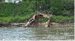
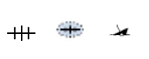
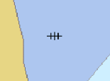
J.3. Obstructions
J.3.1. Obstruction (M)
In marine navigation, anything that hinders or prevents movement, particularly anything that endangers or prevents passage of a vessel. The term is usually used to refer to an isolated danger to navigation... (IHO Dictionary, S-32, 5th Edition, 3503) Examples of obstructions include: snags, stumps, wellheads, diffusers, cribs, fish havens, foul areas, foul grounds, booms, ice booms and ground tackle.
Graphics | Encoding Intructions | Object Encoding | |||||||||||
|---|---|---|---|---|---|---|---|---|---|---|---|---|---|
|
Chart Symbol (ad A)
Chart Symbol (ad B)
Chart Symbol (ad C)
Chart Symbol (ad D)
Chart Symbol (ad E)
Chart Symbol (ad F)
Chart Symbol (ad G)
Chart Symbol (ad H)
Chart Symbol (ad I)
Chart Symbol (ad J)
IENC Symbolization
|
|
Object Encoding Object Class =OBSTRN(P,L,A) (O) CATOBS = [1 (snag/stump), 2 (wellhead), 3 (diffuser), 4 (crib), 5 (fish haven), 6 (foul area), 7 (foul ground), 8 (ice boom), 9 (ground tackle), 10 (boom), 11 (fishing net)] (C) NATSUR = (Refer to letter C) (O) NATCON = [1 (masonry), 2 (concreted), 3 (loose boulders), 4 (hard surfaced), 6 (wooden), 7 (metal), 8 (GRP)] (C) VALSOU = [x.xx m] (metres) (C) EXPSOU = (Refer to letter P) (C) WATLEV = [1 (partly submerged at high water), 2 (always dry), 3 (always under water/submerged), 4 (covers and uncovers), 5 (awash)] (M) SCAMIN = [EU: 22000; US: 30000] (C) SORDAT = [YYYYMMDD] (C) SORIND = (Refer to Section B, General Guidance) |

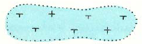

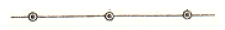
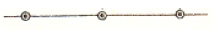
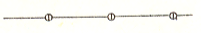
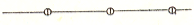
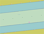
J.3.2. Oil Barrier (M)
A construction to dam oil flow on water. (S-57standard)
Graphics | Encoding Intructions | Object Encoding | |
|---|---|---|---|
|
IENC Symbolization
|
Object Encoding Object Class =OILBAR(L) (O) CATOLB = [1 (oil retention (high pressure pipe)), 2 (floating oil barrier)] (M) SCAMIN = [EU: 8000; US: 12000] (C) SORDAT = [YYYYMMDD] (C) SORIND = (Refer to Section B, General Guidance) |
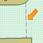
J.4. Nature of Riverbed
J.4.1. Nature of Bottom (O)
The nature of bottom includes the material of which it is composed and its physical characteristics. Also called character (or characteristics) of the bottom, or quality of the bottom. (S-57 Standard)
Graphics | Encoding Intructions | Object Encoding | |
|---|---|---|---|
|
Chart Symbol
|
|
Object Encoding Object Class =SBDARE(P,L,A) (M) NATQUA = [1 (Fine), 2 (Medium), 3 (Coarse), 4 (Broken)] (O) NATSUR = [1 (mud), 2 (clay), 3 (silt), 4 (sand), 5 (stone), 6 (gravel), 7 (pebbles), 8 (cobbles), 9 (rock), 18 (boulder)] (M) SCAMIN = [45000] (C) SORDAT = [YYYYMMDD] (C) SORIND = (Refer to Section B, General Guidance) |
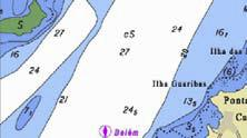
Chapter K. K - Offshore Installations
Table of Contents
K.1. Submarine Cables
K.1.1. Submarine Cable (C)
An assembly of wires or fibres, or a wire rope or chain which has been laid underwater or buried beneath the seabed (Hydrographic Service, Royal Australian Navy)
Graphics | Encoding Intructions | Object Encoding | ||
|---|---|---|---|---|
|
Chart Symbol
IENC Symbolization
|
|
Object Encoding Object Class =CBLSUB(L) (O) CATCBL = [1 (power line), 3 (transmission line), 4 (telephone), 5 (telegraph), 6 (mooring cable/chain)] (O) OBJNAM = [owner name] (O) NOBJNM = (Refer to Section B, General Guidance) (O) CONDTN = [1 (under construction), 2 (ruined), 3 (under reclamation), 5 (planned construction)] (M) SCAMIN = [EU: 22000; US: 60000] (C) SORDAT = [YYYYMMDD] (C) SORIND = (Refer to Section B, General Guidance) Object Encoding Object Class =notmrk(P) (M) catnmk = [8 (no anchoring or trailing of anchors, cables or chains)] (M) fnctnm = [1 (prohibition mark)] (O) dirimp = [1 (upstream), 2 (downstream), 3 (to the left bank), 4 (to the right bank)] (O) disipd = [xxxx] (metres), e.g., 2120 (O) disipu = [xxxx] (metres), e.g., 1730 (O) addmrk = [1 (top (board)), 2 (bottom (board)), 3 (right (triangle to the right)), 4 (left (triangle to the left)), 5 (bottom (triangle to the bottom))] (O) marsys = [1 (IALA A), 2 (IALA B), 9 (no system), 10 (other system), 11 (CEVNI), 12 (Russian inland waterway regulations), 13 (Brazilian national inland waterway regulations - two sides), 14 (Brazilian national inland waterway regulations - side independent), 15 (Paraguay-Parana waterway - Brazilian complementary aids)] (O) STATUS = [8 (private), 12 (illuminated), 14 (public)] (O) INFORM = [text of additional marks in English] (O) NINFOM = (Refer to Section B, General Guidance) (O) CONDTN = [1 (under construction), 2 (ruined), 3 (under reclamation), 5 (planned construction)] (M) SCAMIN = [22000] (C) SORDAT = [YYYYMMDD] (C) SORIND = (Refer to Section B, General Guidance) Object Encoding Object Class =CTNARE(A) (M) INFORM = ["Cable buffer zone"] (M) SCAMIN = [EU: 22000; US: 60000] (C) SORDAT = [YYYYMMDD] (C) SORIND = (Refer to Section B, General Guidance) |
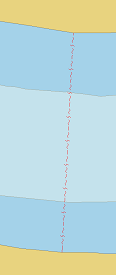
K.1.2. Submarine Cable Area (C)
An area which contains one or more submarine cables. (S-57 Standard)
Graphics | Encoding Intructions | Object Encoding | ||
|---|---|---|---|---|
|
Chart Symbol
IENC Symbolization
|
|
Object Encoding Object Class =CBLARE(A) (O) CATCBL = [1 (power line), 3 (transmission line), 4 (telephone), 5 (telegraph), 6 (mooring cable/chain)] (M) RESTRN = [1 (anchoring prohibited), 38 (use of spuds prohibited)] (O) OBJNAM = [owner name] (O) NOBJNM = (Refer to Section B, General Guidance) (C) STATUS = (Refer to letter H) (O) CONDTN = [1 (under construction), 2 (ruined), 3 (under reclamation), 5 (planned construction)] (M) SCAMIN = [EU: 22000; US: 60000] (C) SORDAT = [YYYYMMDD] (C) SORIND = (Refer to Section B, General Guidance) (C) SORDAT = [YYYYMMDD] (C) SORIND = (Refer to Section B, General Guidance) Object Encoding Object Class =notmrk(P) (M) catnmk = [8 (no anchoring or trailing of anchors, cables or chains)] (M) fnctnm = [1 (prohibition mark)] (O) dirimp = [1 (upstream), 2 (downstream), 3 (to the left bank), 4 (to the right bank)] (O) disipd = [xxxx] (metres), e.g., 2120 (O) disipu = [xxxx] (metres), e.g., 1730 (O) addmrk = [1 (top (board)), 2 (bottom (board)), 3 (right (triangle to the right)), 4 (left (triangle to the left)), 5 (bottom (triangle to the bottom))] (O) marsys = [1 (IALA A), 2 (IALA B), 9 (no system), 10 (other system), 11 (CEVNI), 12 (Russian inland waterway regulations), 13 (Brazilian national inland waterway regulations - two sides), 14 (Brazilian national inland waterway regulations - side independent), 15 (Paraguay-Parana waterway - Brazilian complementary aids)] (O) STATUS = [8 (private), 12 (illuminated), 14 (public)] (O) INFORM = [text of additional marks in English] (O) NINFOM = (Refer to Section B, General Guidance) (O) CONDTN = [1 (under construction), 2 (ruined), 3 (under reclamation), 5 (planned construction)] (M) SCAMIN = [22000] (C) SORDAT = [YYYYMMDD] (C) SORIND = (Refer to Section B, General Guidance) |
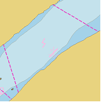
K.2. Submarine Pipelines
K.2.1. Submarine Pipeline (C)
A pipeline is a string of interconnected pipes used for the transport of matter, nowadays mainly oil or gas. (IHO Dictionary, S-32, 5th Edition, 3857) A submarine or land pipeline is a pipeline lying on or buried under the seabed or the land. (S-57 Standard)
Graphics | Encoding Intructions | Object Encoding | |||
|---|---|---|---|---|---|
|
Real World
Chart Symbol
IENC Symbolization
|
|
Object Encoding Object Class =PIPSOL(P,L) (O) CATPIP = [2 (outfall pipe), 3 (intake pipe), 4 (sewer), 6 (supply pipe)] (O) PRODCT = [1 (oil), 2 (gas), 3 (water), 7 (chemicals), 8 (drinking water)] (O) OBJNAM = [owner name] (O) NOBJNM = (Refer to Section B, General Guidance) (C) STATUS = (Refer to letter H) (O) CONDTN = [1 (under construction), 2 (ruined), 3 (under reclamation), 5 (planned construction)] (M) SCAMIN = [EU: 22000; US: 60000] (C) SORDAT = [YYYYMMDD] (C) SORIND = (Refer to Section B, General Guidance) Object Encoding Object Class =notmrk(P) (M) catnmk = [8 (no anchoring or trailing of anchors, cables or chains)] (M) fnctnm = [1 (prohibition mark)] (O) dirimp = [1 (upstream), 2 (downstream), 3 (to the left bank), 4 (to the right bank)] (O) disipd = [xxxx] (metres), e.g., 2120 (O) disipu = [xxxx] (metres), e.g., 1730 (O) addmrk = [1 (top (board)), 2 (bottom (board)), 3 (right (triangle to the right)), 4 (left (triangle to the left)), 5 (bottom (triangle to the bottom))] (O) marsys = [1 (IALA A), 2 (IALA B), 9 (no system), 10 (other system), 11 (CEVNI), 12 (Russian inland waterway regulations), 13 (Brazilian national inland waterway regulations - two sides), 14 (Brazilian national inland waterway regulations - side independent), 15 (Paraguay-Parana waterway - Brazilian complementary aids)] (O) STATUS = [8 (private), 12 (illuminated), 14 (public)] (O) INFORM = [text of additional marks in English] (O) NINFOM = (Refer to Section B, General Guidance) (O) CONDTN = [1 (under construction), 2 (ruined), 3 (under reclamation), 5 (planned construction)] (M) SCAMIN = [22000] (C) SORDAT = [YYYYMMDD] (C) SORIND = (Refer to Section B, General Guidance) Object Encoding Object Class =CTNARE(A) (M) INFORM = ["Pipeline buffer zone"] (M) SCAMIN = [EU: 22000; US: 60000] (C) SORDAT = [YYYYMMDD] (C) SORIND = (Refer to Section B, General Guidance) |
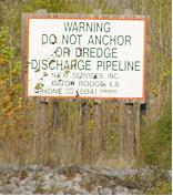
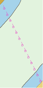
K.2.2. Submarine Pipeline Area (C)
An area containing one or more pipelines. (S-57 Standard)
Graphics | Encoding Intructions | Object Encoding | ||
|---|---|---|---|---|
|
Chart Symbol
IENC Symbolization
|
|
Object Encoding Object Class =PIPARE(A) (O) CATPIP = [2 (outfall pipe), 3 (intake pipe), 4 (sewer), 6 (supply pipe)] (O) PRODCT = [1 (oil), 2 (gas), 3 (water), 7 (chemicals), 8 (drinking water)] (M) RESTRN = [1 (anchoring prohibited), 38 (use of spuds prohibited)] (O) OBJNAM = [owner name] (O) NOBJNM = (Refer to Section B, General Guidance) (C) STATUS = (Refer to letter G) (O) CONDTN = [1 (under construction), 2 (ruined), 3 (under reclamation), 5 (planned construction)] (M) SCAMIN = [EU: 22000; US: 60000] (C) SORDAT = [YYYYMMDD] (C) SORIND = (Refer to Section B, General Guidance) Object Encoding Object Class =notmrk(P) (M) catnmk = [8 (no anchoring or trailing of anchors, cables or chains)] (M) fnctnm = [1 (prohibition mark)] (O) dirimp = [1 (upstream), 2 (downstream), 3 (to the left bank), 4 (to the right bank)] (O) disipd = [xxxx] (metres), e.g., 2120 (O) disipu = [xxxx] (metres), e.g., 1730 (O) addmrk = [1 (top (board)), 2 (bottom (board)), 3 (right (triangle to the right)), 4 (left (triangle to the left)), 5 (bottom (triangle to the bottom))] (O) marsys = [1 (IALA A), 2 (IALA B), 9 (no system), 10 (other system), 11 (CEVNI), 12 (Russian inland waterway regulations), 13 (Brazilian national inland waterway regulations - two sides), 14 (Brazilian national inland waterway regulations - side independent), 15 (Paraguay-Parana waterway - Brazilian complementary aids)] (O) STATUS = [8 (private), 12 (illuminated), 14 (public)] (O) INFORM = [text of additional marks in English] (O) NINFOM = (Refer to Section B, General Guidance) (O) CONDTN = [1 (under construction), 2 (ruined), 3 (under reclamation), 5 (planned construction)] (M) SCAMIN = [22000] (C) SORDAT = [YYYYMMDD] (C) SORIND = (Refer to Section B, General Guidance) |
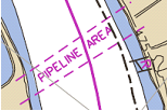
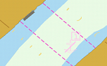
Chapter L. L - Tracks, Routes
Table of Contents
L.1. Tracks
L.1.1. Navigation Line (O)
A navigation line either defines a recommended track or marks the boundary between a safe and a dangerous area.
Graphics | Encoding Intructions | Object Encoding | |||
|---|---|---|---|---|---|
|
Chart Symbol
IENC Symbolization
IENC Symbolization
|
|
Object Encoding Object Class =NAVLNE(L) (M) CATNAV = [1 (clearing line), 2 (transit line), 3 (leading line bearing a recommended track)] (M) ORIENT = [xxx or (UNKNOWN)] (degree (°)), e.g., 110 (M) SCAMIN = [EU: 22000; US: 45000] (C) SORDAT = [YYYYMMDD] (C) SORIND = (Refer to Section B, General Guidance) |
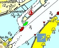
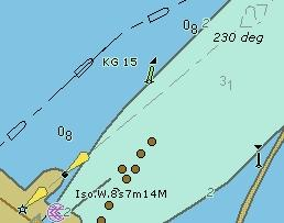
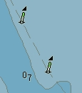
|
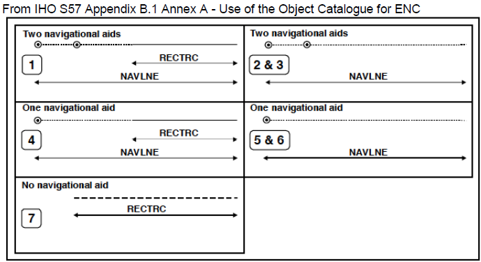
|
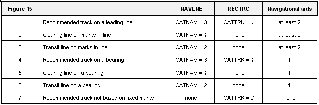
L.1.2. Sailing Line / Recommended Track (C)
Recommended sailing route for all or certain vessels.
Graphics | Encoding Intructions | Object Encoding | ||
|---|---|---|---|---|
|
Chart Symbol
IENC Symbolization
|
|
Object Encoding Object Class =RECTRC(L) (M) CATTRK = [1 (based on a system of fixed marks), 2 (not based on a system of fixed marks)] (M) ORIENT = [xxx or (UNKNOWN)] (degree (°)), e.g., 110 (M) TRAFIC = [1 (inbound), 2 (outbound), 3 (one-way), 4 (two-way)] (C) INFORM = (Refer to letter E) (C) SORDAT = [YYYYMMDD] (C) SORIND = (Refer to Section B, General Guidance) Conditional - Please refer to F Object Class =SEAARE(P) (M) OBJNAM = [“Primary Sailing Line” or “Secondary Sailing Line”] (O) NOBJNM = (Refer to Section B, General Guidance) (M) SCAMIN = [45000] (C) SORDAT = [YYYYMMDD] (C) SORIND = (Refer to Section B, General Guidance) |

L.1.3. Two-way Route Part (O)
A two-way route part is either for the entire area, or a part of an area where the traffic flow is restricted to one-way.
Graphics | Encoding Intructions | Object Encoding | |||
|---|---|---|---|---|---|
|
IENC Symbolization
IENC Symbolization
IENC Symbolization
|
|
Object Encoding Object Class =TWRTPT(A) (M) ORIENT = [xxx.xx (degrees), e.g. 246.7 for an orientation of 246.7 degrees] (M) TRAFIC = [3 (one-way), 4 (two-way)] (M) TRAFIC = [3 (one-way), 4 (two-way)] (C) SORDAT = [YYYYMMDD] (C) SORIND = (Refer to Section B, General Guidance) |
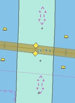
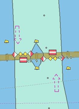
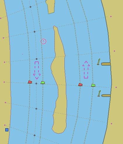
L.1.4. Waterway Axis (C)
The waterway axis can be defined by e.g.,: 1.the middle line of a fairway, 2.the middle line of a waterway (the waterway covers the entire area of a river or a canal)
Graphics | Encoding Intructions | Object Encoding | |
|---|---|---|---|
|
IENC Symbolization
|
|
Object Encoding Object Class =wtwaxs(L) (O) catccl = [1 (0 small vessels and pleasure craft), 2 (I peniche), 3 (II campine barge), 4 (III Dortmund-Ems barge), 5 (IV Rhine-Herne barge), 6 (Va Large Rhine barge; 1-barge push-tow unit), 7 (Vb 2-barge push-tow unit; long formation), 8 (VIa 2-barge push-tow unit; wide formation), 9 (VIb 4-barge push-tow unit), 10 (VIc 6-barge push-tow unit), 11 (No CEMT class), 12 (VII 9-barge push-town unit)] (M) OBJNAM = [name of public waterway / or part of a waterway] (O) NOBJNM = [content of OBJNAM in national language] (M) SCAMIN = [EU: 22000; US: 45000] (C) SORDAT = [YYYYMMDD] (C) SORIND = (Refer to Section B, General Guidance) |
L.1.5. Traffic Separation Zone (C)
A traffic separation scheme is a scheme which aims to reduce the risk of collision in congested and/or converging areas by separating traffic moving in opposite, or nearly opposite, directions. (IHO Dictionary, S-32, 5th Edition, 5585) A traffic separation zone is a zone separating the lanes in which ships are proceeding in opposite or nearly opposite directions; or separating traffic lanes designated for particular classes of ships proceeding in the same direction (IMO Ships Routeing, 6th Edition).
Graphics | Encoding Intructions | Object Encoding | ||
|---|---|---|---|---|
|
Chart Symbol
IENC Symbolization
|
|
Object Encoding Object Class =TSEZNE(A) (M) CATTSS = [1 (IMO - adopted), 2 (not IMO - adopted)] (O) DATSTA = (Refer to Section J, DATSTA, DATEND, PERSTA and PEREND) (O) DATEND = (Refer to Section J, DATSTA, DATEND, PERSTA and PEREND) (C) STATUS = [3 (recommended), 9 (mandatory)] (C) TXTDSC = (Refer to letter A) (M) SCAMIN = [EU: 260000] (C) SORDAT = [YYYYMMDD] (C) SORIND = (Refer to Section B, General Guidance) |

L.2. Ferries
L.2.1. Cable Ferry (M)
A route in a body of water where a ferry crosses from one shoreline to another. In this specific case a ferry that follows a fixed route guided by a cable (adapted from IHO Specifications , M-4). (Digital Geographic Information Working Group, Oct.87) Cable ferries (either assisted by propulsion or not) are fixed to a cable. This cable is crossing the river either above or below water surface
Graphics | Encoding Intructions | Object Encoding | ||
|---|---|---|---|---|
|
Real World
IENC Symbolization
|
|
Object Encoding Object Class =FERYRT(L) (M) CATFRY = [2 (cable ferry)] (O) OBJNAM = [name of ferry] (O) NOBJNM = (Refer to Section B, General Guidance) (O) INFORM = (Refer to letter D) (O) NINFOM = (Refer to Section B, General Guidance) (C) STATUS = [2 (occasional), 4 (not in use)] (O) TXTDSC = (Refer to letter G) (M) SCAMIN = [EU: 45000; US: 60000] (C) SORDAT = [YYYYMMDD] (C) SORIND = (Refer to Section B, General Guidance) |
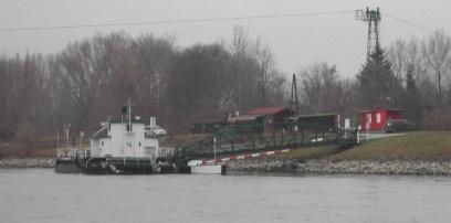
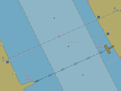
L.2.2. Free Moving Ferry (C)
A route in a body of water where a ferry crosses from one shoreline to another. In this specific case a ferry that follows a fixed route guided by a cable (adapted from IHO Specifications , M-4). (Digital Geographic Information Working Group, Oct.87) Cable ferries (either assisted by propulsion or not) are fixed to a cable. This cable is crossing the river either above or below water surface
Graphics | Encoding Intructions | Object Encoding | ||
|---|---|---|---|---|
|
Chart Symbol
IENC Symbolization
|
|
Object Encoding Object Class =FERYRT(L) (M) CATFRY = [1 ('free-moving' ferry)] (O) OBJNAM = [name of ferry] (O) NOBJNM = (Refer to Section B, General Guidance) (O) INFORM = (Refer to letter D) (O) NINFOM = (Refer to Section B, General Guidance) (C) STATUS = [2 (occasional), 4 (not in use)] (O) TXTDSC = (Refer to letter F) (M) SCAMIN = [EU: 45000; US: 60000] (C) SORDAT = [YYYYMMDD] (C) SORIND = (Refer to Section B, General Guidance) |

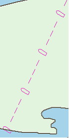
L.2.3. Swinging Wire Ferry (M)
A route in a body of water where a ferry crosses from one shoreline to another. A "Swinging Wire Ferry" is connected to a fixed point (e.g., an anchor in the middle of the waterway) and swings around this point from shore to shore via a cable to an anchor. The cable runs more or less parallel to the current. (Digital Geographic Information Working Group, Oct.87)
Graphics | Encoding Intructions | Object Encoding | |
|---|---|---|---|
|
Real World
|
|
Object Encoding Object Class =feryrt(L) (M) catfry = [4 (swinging wire ferry)] (O) OBJNAM = [name of ferry] (O) NOBJNM = (Refer to Section B, General Guidance) (O) INFORM = (Refer to letter E) (O) NINFOM = (Refer to Section B, General Guidance) (C) STATUS = [2 (occasional), 4 (not in use)] (O) TXTDSC = (Refer to letter G) (M) SCAMIN = [EU: 45000; US: 60000] (C) SORDAT = [YYYYMMDD] (C) SORIND = (Refer to Section B, General Guidance) Object Encoding Object Class =BOYSPP(P) (O) BOYSHP = [1 (conical (nun, ogival)), 2 (can (cylindrical)), 3 (spherical), 4 (pillar), 5 (spar (spindle)), 6 (barrel (tun))] (O) OBJNAM = [name of ferry] (O) NOBJNM = (Refer to Section B, General Guidance) (M) CATSPM = [37 (ferry crossing mark)] (O) COLOUR = [1 (white), 2 (black), 3 (red), 4 (green), 5 (blue), 6 (yellow), 7 (grey), 8 (brown), 9 (amber), 10 (violet), 11 (orange), 12 (magenta), 13 (pink)] (O) CONRAD = [3 (radar conspicuous (has radar reflector))] (M) SCAMIN = [EU: 22000; US: 45000] (C) SORDAT = [YYYYMMDD] (C) SORIND = (Refer to Section B, General Guidance) Object Encoding Object Class =CBLARE(A) (M) CATCBL = [6 (mooring cable / chain) or "Unknown"] (O) OBJNAM = [Ferry name] (O) NOBJNM = (Refer to Section B, General Guidance) (M) SCAMIN = [EU: 22000; US: 60000] (C) SORDAT = [YYYYMMDD] (C) SORIND = (Refer to Section B, General Guidance) |
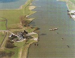
L.3. Supplemental Navigation References
L.3.1. CEMT Classification, ISRS Code (O)
Classification of the waterway according to CEMT; local International Ship Reporting System code.
Graphics | Encoding Intructions | Object Encoding |
|---|---|---|
|
|
Object Encoding Object Class =wtware(A) (M) catccl = [1 (0 small vessels and pleasure craft), 2 (I peniche), 3 (II campine barge), 4 (III Dortmund-Ems barge), 5 (IV Rhine-Herne barge), 6 (Va Large Rhine barge; 1-barge push-tow unit), 7 (Vb 2-barge push-tow unit; long formation), 8 (VIa 2-barge push-tow unit; wide formation), 9 (VIb 4-barge push-tow unit), 10 (VIc 6-barge push-tow unit), 11 (No CEMT class), 12 (VII 9-barge push-town unit)] (M) dirimp = [1 (upstream), 2 (downstream), 3 (to the left bank), 4 (to the right bank)] (C) unlocd = [ISRS code] (M) SCAMIN = [45000] (C) SORDAT = [YYYYMMDD] (C) SORIND = (Refer to Section B, General Guidance) |
L.3.2. Distance Mark Along Waterway Axis (C)
A distance mark indicates the distance measured from an origin and consists of a distinct location without special installation, used to serve as a reference along the waterway. (Adapted from S-57 Standard).
Graphics | Encoding Intructions | Object Encoding | ||
|---|---|---|---|---|
|
Real World
IENC Symbolization
|
|
Object Encoding Object Class =dismar(P) (M) CATDIS = [1 (distance mark not physically installed)] (M) wtwdis = [xxxx.x (value of unit according to hunit)] (C) unlocd = [ISRS code] (M) hunits = [3 (kilometres), 4 (hectometres), 5 (statute miles), 6 (nautical miles)] (M) SCAMIN = [EU: 8000; US: 120000] (C) SORDAT = [YYYYMMDD] (C) SORIND = (Refer to Section B, General Guidance) |
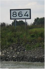
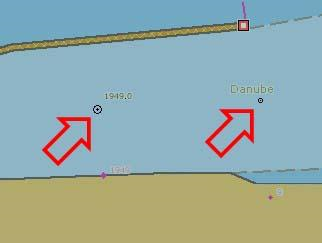
L.3.3. Distance Mark Ashore (O)
A distance mark indicates the distance measured from an origin and consists of a distinct location without special installation, used to serve as a reference along the waterway. (Adapted from S-57 Standard).
Graphics | Encoding Intructions | Object Encoding | ||||
|---|---|---|---|---|---|---|
|
Real World
Real World
Real World
IENC Symbolization
|
|
Object Encoding Object Class =dismar(P) (M) CATDIS = [1 (distance mark not physically installed), 2 (visible mark, pole), 3 (visible mark, board), 4 (visible mark, unknown shape)] (M) hunits = [3 (kilometres), 4 (hectometres), 5 (statute miles), 6 (nautical miles)] (M) wtwdis = [xxxx.x (value of unit according to hunit)] (M) SCAMIN = [22000 (except: 8000 for hunits=4)] (C) SORDAT = [YYYYMMDD] (C) SORIND = (Refer to Section B, General Guidance) |
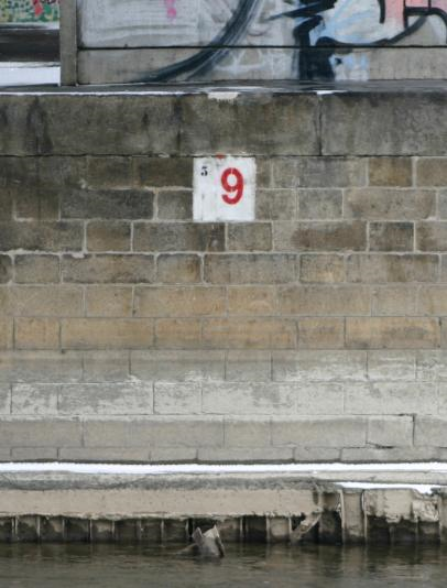
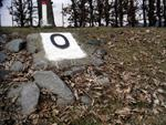
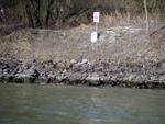
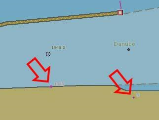
Chapter M. M - Areas, Limits
Table of Contents
M.1. Anchorage Areas and Berths
M.1.1. Anchorage Area (C)
An area in which vessels anchor or may anchor. (IHO Dictionary, S-32, 5th Edition, 130)
Graphics | Encoding Intructions | Object Encoding | |
|---|---|---|---|
|
IENC Symbolization
|
|
Object Encoding Object Class =achare(P,A) (O) catach = [1 (unrestricted anchorage), 2 (deep water anchorage), 3 (tanker anchorage), 4 (explosives anchorage), 5 (quarantine anchorage), 6 (sea-plane anchorage), 7 (small craft anchorage), 9 (anchorage for periods up to 24 hours), 10 (anchorage for pushing-navigation vessels), 11 (anchorage for other vessels than pushing-navigation vessels), 12 (anchorage for dry cargo vessels), 13 (anchorage for rafts)] (O) clsdng = [1 (one blue light / cone), 2 (two blue lights / cones), 3 (three blue lights / cones), 4 (no blue light / cone), 5 (one red light / red cone top down)] (O) TXTDSC = (Refer to letter G) (O) OBJNAM = [name or number designation to the anchorage area] (O) NOBJNM = (Refer to Section B, General Guidance) (O) restrn = [2 (anchoring restricted), 8 (entry restricted), 13 (no wake), 27 (speed restricted), 32 (berthing restricted), 38 (use of spuds prohibited)] (O) NATSUR = [1 (mud), 2 (clay), 3 (silt), 4 (sand), 5 (stone), 6 (gravel), 7 (pebbles), 8 (cobbles), 9 (rock), 11 (lava), 14 (coral), 17 (shells), 18 (boulder)] (O) STATUS = [3 (recommended), 8 (private), 12 (illuminated), 14 (public), 16 (watched), 17 (un-watched)] (C) unlocd = [ISRS code] (O) INFORM = [additional information, e.g., limited duration of use, restrictions of the number, the kind or size of vessels] (O) NINFOM = (Refer to Section B, General Guidance) (M) SCAMIN = [EU: 22000 for areas, 12000 for points; US: 45000] (C) SORDAT = [YYYYMMDD] (C) SORIND = (Refer to Section B, General Guidance) Conditional (Refer to letter F) Object Class =SEAARE(A) (M) OBJNAM = [name or number designation of the anchorage area] (O) NOBJNM = (Refer to Section B, General Guidance) (M) SCAMIN = [45000 or use SCAMIN formula to calculate value] (C) SORDAT = [YYYYMMDD] (C) SORIND = (Refer to Section B, General Guidance) |
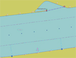
|
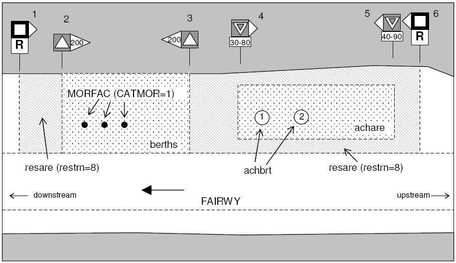
M.1.2. Anchorage Berth (C)
A designated area of water where a single vessel, convoy, sea plane, etc. may anchor.
Graphics | Encoding Intructions | Object Encoding | |
|---|---|---|---|
|
IENC Symbolization
|
|
Object Encoding Object Class =achbrt(P,A) (O) catach = [1 (unrestricted anchorage), 2 (deep water anchorage), 3 (tanker anchorage), 4 (explosives anchorage), 5 (quarantine anchorage), 6 (sea-plane anchorage), 7 (small craft anchorage), 9 (anchorage for periods up to 24 hours), 10 (anchorage for pushing-navigation vessels), 11 (anchorage for other vessels than pushing-navigation vessels), 12 (anchorage for dry cargo vessels), 13 (anchorage for rafts)] (O) clsdng = [1 (one blue light / cone), 2 (two blue lights / cones), 3 (three blue lights / cones), 4 (no blue light / cone), 5 (one red light / red cone top down)] (O) TXTDSC = (Refer to letter E) (O) OBJNAM = [name or number designation of the anchorage area] (O) NOBJNM = (Refer to Section B, General Guidance) (O) restrn = [2 (anchoring restricted), 8 (entry restricted), 13 (no wake), 27 (speed restricted), 32 (berthing restricted), 38 (use of spuds prohibited)] (O) NATSUR = [1 (mud), 2 (clay), 3 (silt), 4 (sand), 5 (stone), 6 (gravel), 7 (pebbles), 8 (cobbles), 9 (rock), 11 (lava), 14 (coral), 17 (shells), 18 (boulder)] (O) STATUS = [3 (recommended), 8 (private), 12 (illuminated), 14 (public), 16 (watched), 17 (un-watched)] (C) unlocd = [ISRS code] (O) INFORM = [additional information, e.g. limited duration of use, restrictions of the kind or the size of vessels] (O) NINFOM = (Refer to Section B, General Guidance) (M) SCAMIN = [EU: 22000 for areas, 12000 for points; US: 45000] (C) SORDAT = [YYYYMMDD] (C) SORIND = (Refer to Section B, General Guidance) |
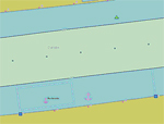
|
M.1.3. Berth without Transshipment / Fleeting Areas (M)
A designated named or numbered place at the bank of the river or in a harbour basin for the mooring of vessels without transshipment of cargo.
Graphics | Encoding Intructions | Object Encoding | |||
|---|---|---|---|---|---|
|
Real World (Fleeting Area)
Chart Symbol (Fleeting Area)
IENC Symbolization
|
|
Object Encoding Object Class =berths(P,L,A) (C) catbrt = [3 (overnight accommodation), 4 (berth for pushing-navigation vessels), 5 (berth for other vessels than pushing-navigation vessels), 6 (fleeting area), 7 (first class landing), 8 (second class landing)] (O) clsdng = [1 (one blue light / cone), 2 (two blue lights / cones), 3 (three blue lights / cones), 4 (no blue light / cone), 5 (one red light / red cone top down)] (O) TXTDSC = (Refer to letter L) (O) DRVAL1 = [The minimum (shoalest) value; unit defined by the M_UNIT meta object class e.g., metres, if this attribute is used, QUASOU, SOUACC and verdat should also be provided] (O) OBJNAM = [name or number designation of the berth] (O) NOBJNM = (Refer to Section B, General Guidance) (O) STATUS = [3 (recommended), 8 (private), 12 (illuminated), 14 (public), 16 (watched), 17 (un-watched)] (C) unlocd = (Refer to letter O) O) INFORM = [additional information, e.g., limited duration of use, restrictions of the number, the kind or the size of vessels] (O) NINFOM = (Refer to Section B, General Guidance) (M) SCAMIN = [EU: 22000 for areas, 12000 for points; US: 45000] (C) SORDAT = [YYYYMMDD] (C) SORIND = (Refer to Section B, General Guidance) Object Encoding Object Class =SLCONS(L,A) (M) CATSLC = [4 (pier (jetty)), 5 (promenade pier), 6 (wharf (quay)), 15 (solid face wharf), 16 (open face wharf)] (O) NATCON = [1 (masonry), 2 (concreted), 3 (loose boulders), 4 (hard surfaced), 5 (unsurfaced), 6 (wooden), 7 (metal), 8 (glass reinforced plastic (GRP))] (M) WATLEV = [1 (partly submerged at high water), 2 (always dry)] (M) SCAMIN = [45000 for line objects and 22000 for area objects] (C) SORDAT = [YYYYMMDD] (C) SORIND = (Refer to Section B, General Guidance) |
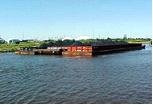
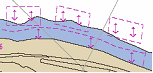
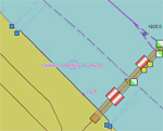
|
M.1.4. Transshipment Berth (M)
A designated named or numbered place at the bank of the river or in a harbour basin for the mooring of vessels and transshipment
Graphics | Encoding Intructions | Object Encoding | ||
|---|---|---|---|---|
|
Real World
IENC Symbolization
|
|
Object Encoding Object Class =berths(P,L,A) (O) catbrt = [1 (loading), 2 (unloading), 4 (berth for pushing-navigation vessels), 5 (berth for other vessels than pushing-navigation vessels), 9 (berth for passenger vessels)] (O) clsdng = [1 (one blue light / cone), 2 (two blue lights / cones), 3 (three blue lights / cones), 4 (no blue light / cone), 5 (one red light / red cone top down)] (O) TXTDSC = (Refer to letter K) (O) DRVAL1 = [The minimum (shoalest) value; unit defined by the M_UNIT meta object class e.g., metres, if this attribute is used, QUASOU, SOUACC and verdat should also be provided] (O) OBJNAM = [name or number designation of the berth] (O) NOBJNM = (Refer to Section B, General Guidance) (O) STATUS = [3 (recommended), 8 (private), 12 (illuminated), 14 (public), 16 (watched), 17 (un-watched)] (O) trshgd = [1 (containers), 2 (bulk goods), 3 (oil), 4 (fuel), 5 (chemicals), 6 (liquid goods), 7 (explosive goods), 8 (fish), 9 (cars), 10 (general cargo)] (C) unlocd = [ISRS code] (O) INFORM = [additional information, e.g., limited duration of use, restrictions of the number, the kind or the size of vessels] (O) NINFOM = (Refer to Section B, General Guidance) (M) SCAMIN = [EU: 22000 for areas, 12000 for points; US: 45000] (C) SORDAT = [YYYYMMDD] (C) SORIND = (Refer to Section B, General Guidance) Object Encoding Object Class =SLCONS(L,A) (M) CATSLC = [4 (pier (jetty)), 5 (promenade pier), 6 (wharf (quay)), 15 (solid face wharf), 16 (open face wharf)] (M) CATSLC = [4 (pier (jetty)), 5 (promenade pier), 6 (wharf (quay)), 15 (solid face wharf), 16 (open face wharf)] (M) WATLEV = [1 (partly submerged at high water), 2 (always dry)] (M) SCAMIN = [45000 (A), 22000 (L) or use SCAMIN formula to calculate value] (C) SORDAT = [YYYYMMDD] (C) SORIND = (Refer to Section B, General Guidance) |
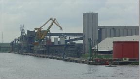
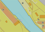
|
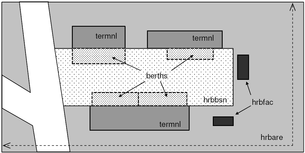
M.2. Restricted Areas
M.2.1. Restricted Area (C)
Area designated by the competent authority in which entry is prohibited or restricted to certain vessels, or certain transit rules apply. Restricted areas typically surround dams; see G.4.2 Dams.
Graphics | Encoding Intructions | Object Encoding | ||
|---|---|---|---|---|
|
Chart Symbol
IENC Symbolization
|
|
Object Encoding Object Class =resare(A) (M) restrn = [1 (anchoring prohibited), 2 (anchoring restricted), 7 (entry prohibited), 8 (entry restricted), 13 (no wake), 14 (area to be avoided), 27 (speed restricted), 28 (overtaking prohibited), 29 (overtaking of convoys by convoys prohibited), 30 (passing or overtaking prohibited), 31 (berthing prohibited), 32 (berthing restricted), 33 (making fast prohibited), 34 (making fast restricted), 35 (turning prohibited), 36 (restricted fairway depth), 37 (restricted fairway width), 38 (use of spuds prohibited)] (O) CATREA = [4 (nature reserve), 5 (bird sanctuary), 9 (military area), 12 (navigational aid safety zone), 19 (waiting area), 22 (fish sanctuary), 23 (ecological reserve), 25 (swinging area)] (O) NATSUR = [1 (mud), 2 (clay), 3 (silt), 4 (sand), 5 (stone), 6 (gravel), 7 (pebbles), 8 (cobbles), 9 (rock), 11 (lava), 14 (coral), 17 (shells), 18 (boulder)] (C) INFORM = [if restrn = 2, 8, 32, 34: brief description of restriction; if over 10 words, use TXTDSC; if restrn = 27: maximum speed limit with unit] (O) NINFOM = (Refer to Section B, General Guidance) (M) SCAMIN = [EU: 22000; US: 75000] (C) SORDAT = [YYYYMMDD] (C) SORIND = (Refer to Section B, General Guidance) |
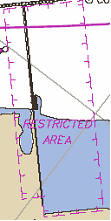
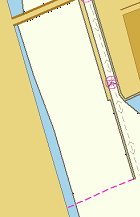
M.3. Caution Areas
M.3.1. Caution Area (C)
Generally, an area where the skipper has to be made aware of circumstances influencing the safety of navigation.
Graphics | Encoding Intructions | Object Encoding | |
|---|---|---|---|
|
IENC Symbolization
|
|
Object Encoding Object Class =CTNARE(P,A) (O) OBJNAM = [name of section or closest town] (O) OBJNAM = [name of section or closest town] (O) OBJNAM = [name of section or closest town] (O) NINFOM = (Refer to Section B, General Guidance) (M) SCAMIN = [EU: 22000; US: 60000] (C) SORDAT = [YYYYMMDD] (C) SORIND = (Refer to Section B, General Guidance) |
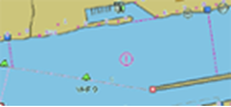
M.4. Miscellaneous Areas / Limits
M.4.1. Communication Area (C)
An area, in which a vessel has to report or may request information
Graphics | Encoding Intructions | Object Encoding | |
|---|---|---|---|
|
IENC Symbolization (No IENC symbolization (only in pick report))
|
|
Object Encoding Object Class =comare(A) (O) catcom = [1 (VTS centre), 2 (VTS sector), 3 (IVS point), 4 (MIB), 5 (lock), 6 (bridge), 7 (custom), 8 (harbour), 9 (WLAN area)] (M) COMCHA = [[XXXX];[XXXX];...] (O) OBJNAM = [name of the communication area], e.g. “lock xy” (O) NOBJNM = (Refer to Section B, General Guidance) (O) STATUS = [3 (recommended), 8 (private), 9 (mandatory), 14 (public)] (O) TXTDSC = (Refer to letter I) SCAMIN = [EU: 45000; US: 60000] (C) SORDAT = [YYYYMMDD] (C) SORIND = (Refer to Section B, General Guidance) |
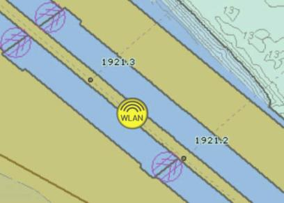
M.4.2. River Surveillance Area (O)
A defined and named administrative area of a river surveillance
Graphics | Encoding Intructions | Object Encoding | |
|---|---|---|---|
|
IENC Symbolization
|
|
Object Encoding Object Class =ADMARE(A) (M) JRSDTN = [1 (international), 2 (national), 3 (national sub-division)] (M) NATION = (Nationality is encoded by a 2 character-code following ISO 3166 (refer to Annex A to S-57 Appendix A)) (M) OBJNAM = [name of the river surveillance] (O) NOBJNM = (Refer to Section B, General Guidance) (O) INFORM = [communication information] (O) NINFOM = (Refer to Section B, General Guidance) (O) TXTDSC = (Refer to letter B) (M) SCAMIN = [90000] (C) SORDAT = [YYYYMMDD] (C) SORIND = (Refer to Section B, General Guidance) |
M.4.3. Section of Limited Depth (O)
Generally, a short section of a waterway with limited depth and well known to skippers as of high relevance for safety, also by shipping companies as the reference for the planning of the draught of vessels.
Graphics | Encoding Intructions | Object Encoding | |
|---|---|---|---|
|
IENC Symbolization
|
|
Object Encoding Object Class =resare(A) (M) restrn = [36 (restricted fairway depth)] (O) OBJNAM = ["Shallow water area" + name of section or closest town] (O) NOBJNM = (Refer to Section B, General Guidance) (O) NATSUR = [1 (mud), 2 (clay), 3 (silt), 4 (sand), 5 (stone), 6 (gravel), 7 (pebbles), 8 (cobbles), 9 (rock), 11 (lava), 14 (coral), 17 (shells), 18 (boulder)] (C) INFORM = (Refer to letter D) (O) NINFOM = (Refer to Section B, General Guidance) (M) SCAMIN = [EU: 22000; US: 75000] (C) SORDAT = [YYYYMMDD] (C) SORIND = (Refer to Section B, General Guidance) |
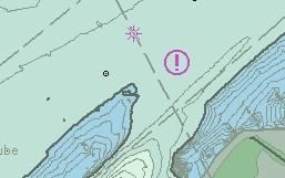
M.4.4. Section of Limited Width (O)
Generally, a short section of a waterway with limited width and well known to skippers.
Graphics | Encoding Intructions | Object Encoding |
|---|---|---|
|
|
Object Encoding Object Class =resare(A) (M) restrn = [37 (restricted fairway width)] (O) OBJNAM = ["Constricted section" + name of section or closest town)] (O) NOBJNM = (Refer to Section B, General Guidance) (O) NATSUR = [1 (mud), 2 (clay), 3 (silt), 4 (sand), 5 (stone), 6 (gravel), 7 (pebbles), 8 (cobbles), 9 (rock), 11 (lava), 14 (coral), 17 (shells), 18 (boulder)] (M) INFORM = [Section of high navigational importance due to limited width of fairway] O) NINFOM = (Refer to Section B, General Guidance) (M) SCAMIN = [EU: 22000; US: 75000] (C) SORDAT = [YYYYMMDD] (C) SORIND = (Refer to Section B, General Guidance) |
M.4.5. Turning Basin (C)
An area of water or enlargement of a channel used for turning vessels. Indicated by CEVNI sign E.8
Graphics | Encoding Intructions | Object Encoding | |
|---|---|---|---|
|
IENC Symbolization
|
|
Object Encoding Object Class =trnbsn(P,A) (O) HORCLR = [The width of the basin, which is available for safe navigation. This may, or may not, be the same as the total physical width of the basin.] (O) OBJNAM = [name of the tuning basin] (O) NOBJNM = (Refer to Section B, General Guidance) (O) NOBJNM = (Refer to Section B, General Guidance) (M) SCAMIN = [EU: 22000; US: 75000] (C) SORDAT = [YYYYMMDD] (C) SORIND = (Refer to Section B, General Guidance) |
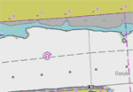
M.4.6. Dumping Ground (C)
An area where dredged material or other potentially more harmful material, e.g. explosives, chemical waste, is deliberately deposited. (Derived from IHO Chart Specifications, M-4)
Graphics | Encoding Intructions | Object Encoding | ||
|---|---|---|---|---|
|
Chart Symbol
IENC Symbolization
|
|
Object Encoding Object Class =DMPGRD(A) (M) CATDPG = [2 (chemical waste dumping ground), 4 (explosives dumping ground), 5 (spoil ground)] (O) OBJNAM = [Name] (O) NOBJNM = (Refer to Section B, General Guidance) (C) RESTRN = [1 (anchoring prohibited), 3 (fishing prohibited), 5 (trawling prohibited), 7 (entry prohibited), 8 (entry restricted), 24 (dragging prohibited)] (M) SCAMIN = [EU: 260000] (C) SORDAT = [YYYYMMDD] (C) SORIND = (Refer to Section B, General Guidance) |

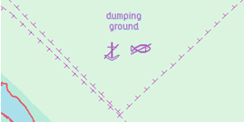
M.4.7. Marine Farm/Culture (C)
An assemblage of cages, nets, rafts and floats or posts where fish, including shellfish, are artificially cultivated. Also called fish farm. (IHO Dictionary, S-32, 5th Edition, 1811)
|
Graphics |
Encoding Intructions |
Object Encoding | |||
|---|---|---|---|---|---|
|
Real World
Chart Symbol
IENC Symbolization
|
|
Object Encoding Object Class =MARCUL(P,L,A) (M) CATMFA = [1 (crustaceans), 2 (oysters/mussels), 3 (fish), 4 (seaweed)] (O) DATSTA = (Refer to Section J, DATSTA, DATEND, PERSTA and PEREND) (O) DATEND = (Refer to Section J, DATSTA, DATEND, PERSTA and PEREND) (O) PERSTA = (Refer to Section J, DATSTA, DATEND, PERSTA and PEREND) (O) PEREND = (Refer to Section J, DATSTA, DATEND, PERSTA and PEREND) (C) EXPSOU = [1 (within the range of depth of the surrounding depth area), 2 (shoaler than the range of depth of the surrounding depth area), 3 (deeper than the range of depth of the surrounding depth area)] (C) VALSOU = [sxxxxx.xx] (s: sign, negative values only) (O) QUASOU = [1 (depth known), 2 (depth unknown), 3 (doubtful sounding), 4 (unreliable sounding), 6 (least depth known), 7 (least depth unknown, safe clearance at depth shown), 8 (value reported (not surveyed)), 9 (value reported (not confirmed))] (C) SOUACC = [xx.x] (C) STATUS = [2 (occasional), 4 (not in use)] (C) WATLEV = [1 (partly submerged at high water), 2 (always dry), 3 (always under water/submerged), 4 (covers and uncovers), 5 (awash), 7 (floating)] (O) OBJNAM = [Name] (O) NOBJNM = (Refer to Section B, General Guidance) (M) SCAMIN = [260000] (C) SORDAT = [YYYYMMDD] (C) SORIND = (Refer to Section B, General Guidance) |

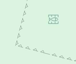
Part IV. Aids and Services
Table of Contents
- N. N - Lights
- O. O - Buoys, Beacons and Daymarks, Notice Marks
- P. P - Fog Signals
- Q. Q - Radar, Radio, Electronic Positioning
- R. R - Services
- S. S - Small Craft Facilities
- T. T - Time and Behaviour
- U. U - Legal ECDIS
Chapter N. N - Lights
Table of Contents
N.1. Light Structures
N.1.1. Bridge Light (C)
A navigation light positioned on a bridge span or support pier.
Graphics | Encoding Intructions | Object Encoding | |||
|---|---|---|---|---|---|
|
Real World
Chart Symbol
IENC Symbolization
|
|
Object Encoding Object Class =LIGHTS(P) (M) COLOUR = [1 (white), 3 (red), 4 (green), 6 (yellow)] (C) EXCLIT = [1 (light shown without change of character), 2 (daytime light), 3 (fog light), 4 (night light)] (M) LITCHR = [1 (fixed), 2 (flashing), 3 (long-flashing), 4 (quick-flashing), 5 (very quick-flashing), 6 (ultra quick flashing), 7 (isophased), 8 (occulting), 9 (interrupted quick-flashing), 10 (interrupted very quick-flashing), 11 (interrupted ultra quick-flashing), 12 (morse), 13 (fixed/flash), 14 (flash/long-flash), 15 (occulting/flash), 16 (fixed/long-flash), 17 (occulting alternating), 18 (long-flash alternating), 19 (flash alternating), 20 (group alternating), 25 (very quick-flash plus long-flash), 26 (very quick-flash plus long-flash), 27 (ultra quick-flash plus long-flash), 28 (alternating), 29 (fixed and alternating flashing)] (C) SIGPER = [xx.xx] (e.g. signal period of 12 seconds, coded as 12) (C) INFORM = (Refer to letter B) (C) MLTYLT = Integer number of lights, minimum 2. (C) SIGGRP = [(x),(x)…], e.g., (), (2), (2+1) (C) SIGSEQ = [L.LL + (E.EE)] (seconds) (M) ORIENT = [xxx or (UNKNOWN)] (degree (°)), e.g., 110 (O) CONDTN = [1 (under construction), 2 (ruined), 3 (under reclamation), 5 (planned construction)] (O) HEIGHT = [xxx.x] metres, e.g., 27.4 (O) VALNMR = [xx.x] (M) SCAMIN = [EU: 8000; US: 60000] (C) SORDAT = [YYYYMMDD] (C) SORIND = (Refer to Section B, General Guidance) |
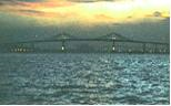

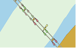
N.1.2. Minor Light (C)
A navigation light that is supported on a structure, which cannot be depicted using the encoding is Sections O.1 or O.2. As a 'minor' light, its name does not need to be displayed.
Graphics | Encoding Intructions | Object Encoding | |||
|---|---|---|---|---|---|
|
Real World
Chart Symbol
IENC Symbolization
|
|
Coding of Structure Object Object Class =PILPNT(P) (O) OBJNAM = [“Name” +(River Mile), e.g. Blackburn Island Lt.(284.4)] (O) NOBJNM = (Refer to Section B, General Guidance) (O) CONDTN = [1 (under construction), 2 (ruined), 3 (under reclamation), 5 (planned construction)] (M) SCAMIN = [EU: 22000; US: 60000] (C) SORDAT = [YYYYMMDD] (C) SORIND = (Refer to Section B, General Guidance) Coding of Equipment Object Object Class =LIGHTS(P) (M) COLOUR = [1 (white), 3 (red), 4 (green), 6 (yellow)] (C) EXCLIT = [1 (light shown without change of character), 2 (daytime light), 3 (fog light), 4 (night light)] (M) LITCHR = [1 (fixed), 2 (flashing), 3 (long-flashing), 4 (quick-flashing), 5 (very quick-flashing), 6 (ultra quick flashing), 7 (isophased), 8 (occulting), 9 (interrupted quick-flashing), 10 (interrupted very quick-flashing), 11 (interrupted ultra quick-flashing), 12 (morse), 13 (fixed/flash), 14 (flash/long-flash), 15 (occulting/flash), 16 (fixed/long-flash), 17 (occulting alternating), 18 (long-flash alternating), 19 (flash alternating), 20 (group alternating), 25 (very quick-flash plus long-flash), 26 (very quick-flash plus long-flash), 27 (ultra quick-flash plus long-flash), 28 (alternating), 29 (fixed and alternating flashing)] (C) CATLIT = (Refer to letters N or O) (C) SIGPER = [xx.xx] (e.g. signal period of 12 seconds, coded as 12) (C) SIGGRP = [(x),(x)…], e.g., (), (2), (2+1) (C) SIGSEQ = [L.LL + (E.EE)] (seconds) (O) INFORM = [descending bank, structure_up, structure_down (e.g. LDB)] (C) MLTYLT = Integer number of lights, minimum 2. (O) HEIGHT = [xxx.x] metres, e.g., 27.4 (O) VALNMR = [xx.x] (C) STATUS = (Refer to letter F) (O) CONDTN = [1 (under construction), 2 (ruined), 3 (under reclamation), 5 (planned construction)] (M) SCAMIN = [EU: 22000; US: 60000] (C) SORDAT = [YYYYMMDD] (C) SORIND = (Refer to Section B, General Guidance) |
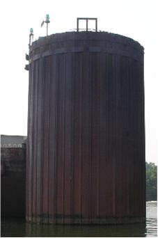
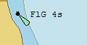
|
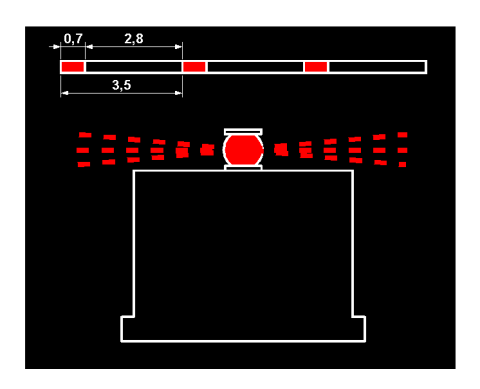
N.1.3. Leading Light (C)
A light associated with other lights so as to form a leading line to be followed. (adapted from IHO Dictionary, S-32, 5th Edition, 2794).
Graphics | Encoding Intructions | Object Encoding | |||
|---|---|---|---|---|---|
|
Real World
Chart Symbol
IENC Symbolization
|
|
Coding of Master Object Object Class =PILPNT(P) (M) OBJNAM = [“Name”+(River Mile), e.g. Blackburn Island Lt. (284.4)] (O) NOBJNM = (Refer to Section B, General Guidance) (O) CONDTN = [1 (under construction), 2 (ruined), 3 (under reclamation), 5 (planned construction)] (M) SCAMIN = [EU: 22000; US: 60000] (C) SORDAT = [YYYYMMDD] (C) SORIND = (Refer to Section B, General Guidance) Coding of Equipment Object Object Class =LIGHTS(P) (M) CATLIT = [1 (directional function), 4 (leading light), 5 (aero light), 6 (air obstruction light), 12 (front), 13 (rear), 14 (lower), 15 (upper)] (M) COLOUR = [1 (white), 3 (red), 4 (green), 6 (yellow)] (M) EXCLIT = [1 (light shown without change of character), 2 (daytime light), 3 (fog light), 4 (night light)] (M) LITCHR = [1 (fixed), 2 (flashing), 3 (long-flashing), 4 (quick-flashing), 5 (very quick-flashing), 6 (ultra quick flashing), 7 (isophased), 8 (occulting), 9 (interrupted quick-flashing), 10 (interrupted very quick-flashing), 11 (interrupted ultra quick-flashing), 12 (morse), 13 (fixed/flash), 14 (flash/long-flash), 15 (occulting/flash), 16 (fixed/long-flash), 17 (occulting alternating), 18 (long-flash alternating), 19 (flash alternating), 20 (group alternating), 25 (very quick-flash plus long-flash), 26 (very quick-flash plus long-flash), 27 (ultra quick-flash plus long-flash), 28 (alternating), 29 (fixed and alternating flashing)] (C) ORIENT = [xxx.xx] (C) SIGPER = [xx.xx] (e.g. signal period of 12 secondscoded as "12") (C) SIGGRP = [(x),(x)…], e.g., (), (2), (2+1) (C) SIGSEQ = [L.LL + (E.EE)] (seconds) (C) SIGSEQ = [L.LL + (E.EE)] (seconds) (O) VALNMR = [xx.x] (C) INFORM = US: descending bank (e.g. LDB for left descending bank) (C) MLTYLT = Integer number of lights, minimum 2. (O) STATUS = [8 (private), 14 (public)] (O) CONDTN = [1 (under construction), 2 (ruined), 3 (under reclamation), 5 (planned construction)] (M) SCAMIN = [EU: 22000; US: 60000] (C) SORDAT = [YYYYMMDD] (C) SORIND = (Refer to Section B, General Guidance) Object Encoding Object Class =NAVLNE(L) (M) CATNAV = [1 (clearing line), 2 (transit line), 3 (leading line bearing a recommended track)] (M) ORIENT = [xxx or (UNKNOWN)] (degree (°)), e.g., 110 (M) SCAMIN = [EU: 22000; US: 60000] (C) SORDAT = [YYYYMMDD] (C) SORIND = (Refer to Section B, General Guidance) Object Encoding Object Class =RECTRC(L) (M) CATTRK = [1 (based on a system of fixed marks)] (O) DRVAL1 = [sxx.x] (s: sign, negative values only) (O) DRVAL2 = [xx.x] (M) ORIENT = [xx.x] (M) TRAFIC = [1 (inbound), 2 (outbound), 3 (one-way), 4 (two-way)] (M) SCAMIN = [EU: 22000; US: 60000] (C) SORDAT = [YYYYMMDD] (C) SORIND = (Refer to Section B, General Guidance) |
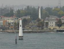
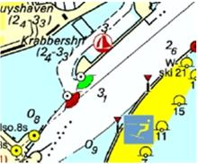
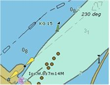
|
N.1.4. Directional Light (C)
A light illuminating a sector of very narrow angle and intended to mark a direction to follow. (IHO Dictionary, S-32, 5th Edition, 2778)
Graphics | Encoding Intructions | Object Encoding | ||
|---|---|---|---|---|
|
Chart Symbol
IENC Symbolization
|
|
Coding of Master Object Object Class =PILPNT(P) (M) OBJNAM = [“Name”+(River Mile), e.g. Blackburn Island Lt. (284.4)] (O) NOBJNM = (Refer to Section B, General Guidance) (O) CONDTN = [1 (under construction), 2 (ruined), 3 (under reclamation), 5 (planned construction)] (M) SCAMIN = [EU: 22000; US: 60000] (C) SORDAT = [YYYYMMDD] (C) SORIND = (Refer to Section B, General Guidance) Coding of Equipment Object Object Class =LIGHTS(P) (M) CATLIT = [1 (directional function)] (M) COLOUR = [1 (white), 3 (red), 4 (green), 6 (yellow)] (M) EXCLIT = [1 (light shown without change of character), 2 (daytime light), 3 (fog light), 4 (night light)] (M) LITCHR = [1 (fixed), 2 (flashing), 3 (long-flashing), 4 (quick-flashing), 5 (very quick-flashing), 6 (ultra quick flashing), 7 (isophased), 8 (occulting), 9 (interrupted quick-flashing), 10 (interrupted very quick-flashing), 11 (interrupted ultra quick-flashing), 12 (morse), 13 (fixed/flash), 14 (flash/long-flash), 15 (occulting/flash), 16 (fixed/long-flash), 17 (occulting alternating), 18 (long-flash alternating), 19 (flash alternating), 20 (group alternating), 25 (very quick-flash plus long-flash), 26 (very quick-flash plus long-flash), 27 (ultra quick-flash plus long-flash), 28 (alternating), 29 (fixed and alternating flashing)] (C) LITVIS = [4 (intensified)] (C) ORIENT = [xxx.xx] (C) SIGPER = [xx.xx] (e.g. signal period of 12 secondscoded as "12") (C) SIGGRP = [(x),(x)…], e.g., (), (2), (2+1) (C) SIGSEQ = [L.LL + (E.EE)] (seconds) (C) INFORM = US: descending bank (e.g. LDB for left descending bank) (C) MLTYLT = Integer number of lights, minimum 2. (O) HEIGHT = [xxx.x] metres, e.g., 27.4 (O) VALNMR = [xx.x] (O) STATUS = [8 (private), 14 (public)] (O) CONDTN = [1 (under construction), 2 (ruined), 3 (under reclamation), 5 (planned construction)] (M) SCAMIN = [EU: 22000; US: 60000] (C) SORDAT = [YYYYMMDD] (C) SORIND = (Refer to Section B, General Guidance) Object Encoding Object Class =NAVLNE(L) (M) CATNAV = [1 (clearing line), 2 (transit line), 3 (leading line bearing a recommended track)] (M) ORIENT = [xxx or (UNKNOWN)] (degree (°)), e.g., 110 (M) SCAMIN = [EU: 22000; US: 60000] (C) SORDAT = [YYYYMMDD] (C) SORIND = (Refer to Section B, General Guidance) Object Encoding Object Class =RECTRC(L) (M) CATTRK = [1 (based on a system of fixed marks)] (O) DRVAL1 = [sxx.x] (s: sign, negative values only) (O) DRVAL2 = [xx.x] (O) DRVAL2 = [xx.x] (M) TRAFIC = [1 (inbound), 2 (outbound), 3 (one-way), 4 (two-way)] (M) SCAMIN = [EU: 22000; US: 60000] (C) SORDAT = [YYYYMMDD] (C) SORIND = (Refer to Section B, General Guidance) |
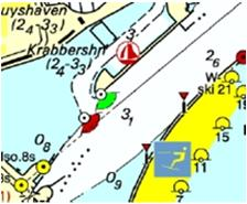
|
N.1.5. Sector Light (C)
A sector light consists of a single light whose total luminous beam is divided into sectors of different colours to provide a warning or a leading line to mariners. (IALA Aids to Navigation Manual – IALA NAVGUIDE 3 Edition 5 2006)
Graphics | Encoding Intructions | Object Encoding | |||
|---|---|---|---|---|---|
|
Real World
Chart Symbol
IENC Symbolization
|
|
Coding of Master Object Object Class =PILPNT(P) (M) OBJNAM = [“Name”+(River Mile), e.g. Blackburn Island Lt. (284.4)] (O) NOBJNM = (Refer to Section B, General Guidance) (O) CONDTN = [1 (under construction), 2 (ruined), 3 (under reclamation), 5 (planned construction)] (M) SCAMIN = [EU: 22000; US: 60000] (C) SORDAT = [YYYYMMDD] (C) SORIND = (Refer to Section B, General Guidance) Coding of Equipment Object Object Class =LIGHTS(P) (M) COLOUR = [1 (white), 3 (red), 4 (green), 6 (yellow)] (M) EXCLIT = [1 (light shown without change of character), 2 (daytime light), 3 (fog light), 4 (night light)] (M) LITCHR = [1 (fixed), 2 (flashing), 3 (long-flashing), 4 (quick-flashing), 5 (very quick-flashing), 6 (ultra quick flashing), 7 (isophased), 8 (occulting), 9 (interrupted quick-flashing), 10 (interrupted very quick-flashing), 11 (interrupted ultra quick-flashing), 12 (morse), 13 (fixed/flash), 14 (flash/long-flash), 15 (occulting/flash), 16 (fixed/long-flash), 17 (occulting alternating), 18 (long-flash alternating), 19 (flash alternating), 20 (group alternating), 25 (very quick-flash plus long-flash), 26 (very quick-flash plus long-flash), 27 (ultra quick-flash plus long-flash), 28 (alternating), 29 (fixed and alternating flashing)] (M) SECTR1 = [xxx.xx] (M) SECTR2 = [xxx.xx] (C) SIGPER = [xx.xx] (e.g. signal period of 12 secondscoded as "12") (C) SIGGRP = [(x),(x)…], e.g., (), (2), (2+1) (C) SIGSEQ = [L.LL + (E.EE)] (seconds) (O) HEIGHT = [xxx.x] metres, e.g., 27.4 (O) VALNMR = [xx.x] (C) INFORM = US: descending bank (e.g. LDB for left descending bank) (O) STATUS = [8 (private), 14 (public)] (O) CONDTN = [1 (under construction), 2 (ruined), 3 (under reclamation), 5 (planned construction)] (M) SCAMIN = [EU: 22000; US: 60000] (C) SORDAT = [YYYYMMDD] (C) SORIND = (Refer to Section B, General Guidance) |
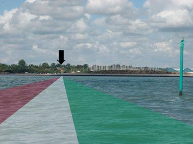
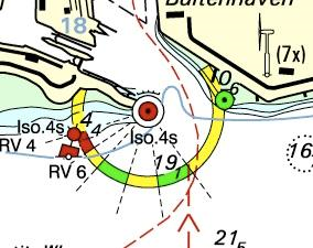
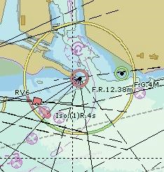
Chapter O. O - Buoys, Beacons and Daymarks, Notice Marks
Table of Contents
O.1. Buoys
O.1.1. Buoy at Bifurcation of Channel (M)
A buoy at a fairway junction may indicate by its top mark on which side it is preferable to pass (main channel).
Graphics | Encoding Intructions | Object Encoding | ||||||
|---|---|---|---|---|---|---|---|---|
|
Real World
Chart Symbol
Chart Symbol (single mark)
Chart Symbol (double marks)
Chart Symbol (double marks)
IENC Symbolization
|
|
Coding of Structure Object Object Class =BOYLAT(P) (M) CATLAM = [3 (preferred channel to starboard lateral mark), 4 (preferred channel to port lateral mark)] (M) BOYSHP = [1 (conical (nun, ogival)), 2 (can (cylindrical)), 3 (spherical), 4 (pillar), 5 (spar (spindle))] (M) COLOUR = [1 (white), 3 (red), 4 (green)] (C) OBJNAM = (Refer to letter B) (C) NOBJNM = (Refer to letter B) (C) MARSYS = [1 (IALA A), 2 (IALA B)] (C) INFORM = (Refer to letter I) (M) SCAMIN = [EU: 22000; US: 60000] (C) SORDAT = [YYYYMMDD] (C) SORIND = (Refer to Section B, General Guidance) Alternative (see coding instruction E) Object Class =BOYSPP(P) (M) BOYSHP = [1 (conical (nun, ogival)), 3 (spherical), 4 (pillar), 5 (spar (spindle))] (M) CATSPM = [54 (channel separation mark)] (M) COLOUR = [1 (white), 2 (black), 3 (red), 4 (green)] (M) COLPAT = [1 (horizontal stripes), 2 (vertical stripes)] (C) MARSYS = [1 (IALA A), 2 (IALA B)] (O) CONRAD = [3 (radar conspicuous (has radar reflector))] (C) OBJNAM = (Refer to letter B) (O) NOBJNM = (Refer to letter B) (M) SCAMIN = [EU: 22000; US: 60000] (C) SORDAT = [YYYYMMDD] (C) SORIND = (Refer to Section B, General Guidance) Alternative (see coding instruction F) Object Class =boylat(P) (M) BOYSHP = [1 (conical (nun, ogival)), 2 (can (cylindrical)), 3 (spherical), 4 (pillar), 5 (spar (spindle))] (M) catlam = [3 (preferred channel to starboard lateral mark), 4 (preferred channel to port lateral mark), 10 (bifurcation of the channel)] (M) COLOUR = [3 (red), 4 (green)] (M) COLPAT = [1 (horizontal stripes)] (C) marsys = [1 (IALA A), 2 (IALA B), 9 (no system), 10 (other system), 11 (CEVNI), 12 (Russian inland waterway regulations), 13 (Brazilian national inland waterway regulations - two sides), 14 (Brazilian national inland waterway regulations - side independent), 15 (Paraguay-Parana waterway - Brazilian complementary aids)] (O) CONRAD = [3 (radar conspicuous (has radar reflector))] (O) INFORM = (EU: Refer to letter G) (O) NINFOM = (Refer to Section B, General Guidance) (C) OBJNAM = (EU: designator as it appears on the structure; US: “Name” + (River Mile), e.g., Avoca Island Cutoff Buoy (132.7) (O) NOBJNM = (Refer to Section B, General Guidance) (M) SCAMIN = [EU: 22000; US: 60000] (C) SORDAT = [YYYYMMDD] (C) SORIND = (Refer to Section B, General Guidance) Coding of Equipment Object Object Class =TOPMAR(P) (M) COLOUR = [3 (red), 4 (green)] (M) TOPSHP = [1 (cone, point up), 3 (sphere), 5 (cylinder (can))] (C) COLPAT = [1 (horizontal stripes)] (M) SCAMIN = [EU: 22000; US: 60000] (C) SORDAT = [YYYYMMDD] (C) SORIND = (Refer to Section B, General Guidance) Object Encoding Object Class =LIGHTS(P) (M) COLOUR = [1 (white), 3 (red), 4 (green), 6 (yellow)] (M) EXCLIT = [1 (light shown without change of character), 2 (daytime light), 3 (fog light), 4 (night light)] (M) LITCHR = [1 (fixed), 2 (flashing), 3 (long-flashing), 4 (quick-flashing), 5 (very quick-flashing), 6 (ultra quick flashing), 7 (isophased), 8 (occulting), 9 (interrupted quick-flashing), 10 (interrupted very quick-flashing), 11 (interrupted ultra quick-flashing), 12 (morse), 13 (fixed/flash), 14 (flash/long-flash), 15 (occulting/flash), 16 (fixed/long-flash), 17 (occulting alternating), 18 (long-flash alternating), 19 (flash alternating), 20 (group alternating), 25 (very quick-flash plus long-flash), 26 (very quick-flash plus long-flash), 27 (ultra quick-flash plus long-flash), 28 (alternating), 29 (fixed and alternating flashing)] (C) SIGPER = [xx.xx (e.g. signal period of 12 seconds coded as 12)] (C) SIGGRP = [(x),(x)…], e.g., (), (2), (2+1) (C) SIGSEQ = [L.LL + (E.EE)] (seconds) (M) SCAMIN = [EU: 22000; US: 60000] (C) SORDAT = [YYYYMMDD] (C) SORIND = (Refer to Section B, General Guidance) |
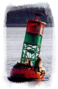
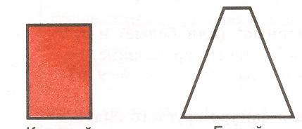
O.1.2. Buoy at Bridge Pillar (M)
A buoy at a bridge pillar may be used to improve the visibility of the pillar location on the radar.
Graphics | Encoding Intructions | Object Encoding | |||
|---|---|---|---|---|---|
|
Real World
Chart Symbol
IENC Symbolization
|
|
Object Encoding Object Class =boylat(P) (M) BOYSHP = [1 (conical (nun, ogival)), 2 (can (cylindrical)), 3 (spherical), 4 (pillar), 5 (spar (spindle)), 6 (barrel (tun)), 8 (ice buoy)] (M) catlam = [23 (bridge pier mark)] (M) COLOUR = [6 (yellow)] (C) marsys = [1 (IALA A), 2 (IALA B), 9 (no system), 10 (other system), 11 (CEVNI), 12 (Russian inland waterway regulations), 13 (Brazilian national inland waterway regulations - two sides), 14 (Brazilian national inland waterway regulations - side independent), 15 (Paraguay-Parana waterway - Brazilian complementary aids)] (O) CONRAD = [3 (radar conspicuous (has radar reflector))] (C) OBJNAM = (Refer to letter C) (O) NOBJNM = (Refer to letter C) (O) INFORM = (Refer to letter D) (O) NINFOM = (Refer to Section B, General Guidance) (M) SCAMIN = [EU: 22000; US: 60000] (C) SORDAT = [YYYYMMDD] (C) SORIND = (Refer to Section B, General Guidance) Object Encoding Object Class =LIGHTS(P) (M) COLOUR = [1 (white), 3 (red), 4 (green)] (M) EXCLIT = [1 (light shown without change of character), 2 (daytime light), 3 (fog light), 4 (night light)] (M) LITCHR = [1 (fixed), 2 (flashing), 3 (long-flashing), 4 (quick-flashing), 5 (very quick-flashing), 6 (ultra quick flashing), 7 (isophased), 8 (occulting), 9 (interrupted quick-flashing), 10 (interrupted very quick-flashing), 11 (interrupted ultra quick-flashing), 12 (morse), 13 (fixed/flash), 14 (flash/long-flash), 15 (occulting/flash), 16 (fixed/long-flash), 17 (occulting alternating), 18 (long-flash alternating), 19 (flash alternating), 20 (group alternating), 25 (very quick-flash plus long-flash), 26 (very quick-flash plus long-flash), 27 (ultra quick-flash plus long-flash), 28 (alternating), 29 (fixed and alternating flashing)] (C) SIGPER = [xx.xx] (e.g. signal period of 12 seconds coded as 12) (C) SIGGRP = [(x),(x)…], e.g., (), (2), (2+1) (C) SIGSEQ = [L.LL + (E.EE)] (seconds) (M) SCAMIN = [EU: 22000; US: 60000] (C) SORDAT = [YYYYMMDD] (C) SORIND = (Refer to Section B, General Guidance) |
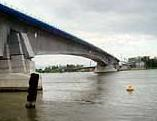
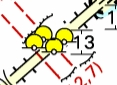

O.1.3. Buoy Marking Danger Point (M)
Buoys to indicate the presence of potentially dangerous obstructions such as groyns, banks, or wrecks.
Graphics | Encoding Intructions | Object Encoding | |||||
|---|---|---|---|---|---|---|---|
|
Real World
Chart Symbol
Chart Symbol
Chart Symbol
IENC Symbolization
|
|
Object Encoding Object Class =BOYSPP(P) (M) BOYSHP = [1 (conical (nun, ogival)), 2 (can (cylindrical)), 5 (spar (spindle))] (M) CATSPM = [41 (clearing mark), 45 (foul ground mark)] (M) COLOUR = [1 (white), 2 (black), 3 (red), 4 (green)] (M) COLPAT = [1 (horizontal stripes), 2 (vertical stripes), 3 (diagonal stripes), 4 (squared), 5 (stripes (direction unknown)), 6 (border stripe)] (C) MARSYS = [1 (IALA A), 2 (IALA B)] (O) CONRAD = [3 (radar conspicuous (has radar reflector))] (C) OBJNAM = (Refer to letter B) (O) NOBJNM = (Refer to letter B) (O) INFORM = (US: refer to letter E; EU: refer to letter F; EU and RU: refer to letter G) (O) NINFOM = (Refer to Section B, General Guidance) (M) SCAMIN = [EU: 22000; US: 60000] (C) SORDAT = [YYYYMMDD] (C) SORIND = (Refer to Section B, General Guidance) Alternative (see coding instruction D) Object Class =boylat(P) (M) catlam = [15 (danger point or obstacles at the right-hand side), 16 (danger point or obstacles at the left-hand side)] (M) BOYSHP = [5 (spar (spindle)), 8 (ice buoy)] (M) COLOUR = [1 (white), 3 (red), 4 (green)] (M) COLPAT = [1 (horizontal stripes)] (C) marsys = [1 (IALA A), 2 (IALA B), 9 (no system), 10 (other system), 11 (CEVNI), 12 (Russian inland waterway regulations), 13 (Brazilian national inland waterway regulations - two sides), 14 (Brazilian national inland waterway regulations - side independent), 15 (Paraguay-Parana waterway - Brazilian complementary aids)] (O) CONRAD = [3 (radar conspicuous (has radar reflector))] (C) OBJNAM = (Refer to letter B) (O) NOBJNM = (Refer to Section B, General Guidance) (O) INFORM = [US: refer to letter E; EU: refer to letter F] (O) NINFOM = (Refer to Section B, General Guidance) (M) SCAMIN = [EU: 22000; US: 60000] (C) SORDAT = [YYYYMMDD] (C) SORIND = (Refer to Section B, General Guidance) Object Encoding Object Class =TOPMAR(P) (M) COLOUR = [2 (black), 3 (red), 4 (green)] (M) TOPSHP = [1 (cone, point up), 2 (cone, point down), 4 (2 spheres), 5 (cylinder (can)), 10 (2 cones, point to point), 24 (triangle, point up), 25 (triangle, point down)] (M) SCAMIN = [EU: 22000; US: 60000] (C) SORDAT = [YYYYMMDD] (C) SORIND = (Refer to Section B, General Guidance) Object Encoding Object Class =LIGHTS(P) (M) COLOUR = [1 (white), 3 (red), 4 (green)] (M) EXCLIT = [1 (light shown without change of character), 2 (daytime light), 3 (fog light), 4 (night light)] (M) LITCHR = [1 (fixed), 2 (flashing), 3 (long-flashing), 4 (quick-flashing), 5 (very quick-flashing), 6 (ultra quick flashing), 7 (isophased), 8 (occulting), 9 (interrupted quick-flashing), 10 (interrupted very quick-flashing), 11 (interrupted ultra quick-flashing), 12 (morse), 13 (fixed/flash), 14 (flash/long-flash), 15 (occulting/flash), 16 (fixed/long-flash), 17 (occulting alternating), 18 (long-flash alternating), 19 (flash alternating), 20 (group alternating), 25 (very quick-flash plus long-flash), 26 (very quick-flash plus long-flash), 27 (ultra quick-flash plus long-flash), 28 (alternating), 29 (fixed and alternating flashing)] (C) SIGPER = [xx.xx (e.g. signal period of 12 seconds coded as 12)] (C) SIGGRP = [(x),(x)…], e.g., (), (2), (2+1) (C) SIGSEQ = [L.LL + (E.EE)] (seconds) (M) SCAMIN = [EU: 22000; US: 60000] (C) SORDAT = [YYYYMMDD] (C) SORIND = (Refer to Section B, General Guidance) |


O.1.4. Cardinal Buoy (M)
A cardinal buoy is used to mark the position of danger points, obstacles and special features on lakes and broad waterways.
Graphics | Encoding Intructions | Object Encoding | ||||
|---|---|---|---|---|---|---|
|
Real World
Chart Symbol
IENC Symbolization
IENC Symbolization
|
|
Object Encoding Object Class =BOYCAR(P) (M) BOYSHP = [1 (conical (nun, ogival)), 4 (pillar), 5 (spar (spindle))] (M) CATCAM = [1 (north cardinal mark), 2 (east cardinal mark), 3 (south cardinal mark), 4 (west cardinal mark)] (M) COLOUR = [2 (black), 6 (yellow)] West: COLOUR=6,2,6 East: COLOUR=2,6,2 North: COLOUR=2,6 South: COLOUR=6,2 (M) COLPAT = [1 (horizontal stripes)] (C) MARSYS = [1 (IALA A), 2 (IALA B)] (C) INFORM = (Refer to letter D) (O) NINFOM = (Refer to Section B, General Guidance) (O) CONRAD = [3 (radar conspicuous (has radar reflector))] (C) OBJNAM = (Refer to letter C) (C) OBJNAM = (Refer to letter C) (M) SCAMIN = [EU: 22000; US: 60000] (C) SORDAT = [YYYYMMDD] (C) SORIND = (Refer to Section B, General Guidance) Object Encoding Object Class =TOPMAR(P) (M) COLOUR = [2 (black)] (M) TOPSHP = [10 (2 cones, point to point), 11 (2 cones, base to base), 13 (2 cones (points upward)), 14 (2 cones (points downward))] (M) SCAMIN = [EU: 22000; US: 60000] (C) SORDAT = [YYYYMMDD] (C) SORIND = (Refer to Section B, General Guidance) Object Encoding Object Class =LIGHTS(P) (M) COLOUR = [1 (white)] (M) EXCLIT = [1 (light shown without change of character), 2 (daytime light), 3 (fog light), 4 (night light)] (M) LITCHR = [3 (long-flashing), 4 (quick-flashing)] (C) SIGPER = [xx.xx] (e.g. signal period of 12 seconds coded as 12) (C) SIGGRP = [(x),(x)…], e.g., (), (2), (2+1) (C) SIGSEQ = [L.LL + (E.EE)] (seconds) (M) SCAMIN = [EU: 22000; US: 60000] (C) SORDAT = [YYYYMMDD] (C) SORIND = (Refer to Section B, General Guidance) |


O.1.5. Lateral Buoy (M)
Lateral buoys are used to mark the direction of the fairway / navigation channel.
Graphics | Encoding Intructions | Object Encoding | |||||||||||
|---|---|---|---|---|---|---|---|---|---|---|---|---|---|
|
Real World (Can)
Real World (Nun)
Real World (EU)
Real World (EU)
Real World (RU)
Chart Symbol
Chart Symbol
Chart Symbol
IENC Symbolization
IENC Symbolization
IENC Symbolization
|
|
Object Encoding Object Class =boylat(P) (M) BOYSHP = [1 (conical (nun, ogival)), 2 (can (cylindrical)), 3 (spherical), 4 (pillar), 5 (spar (spindle)), 8 (ice buoy)] (M) catlam = [1 (port-hand lateral mark), 2 (starboard-hand lateral mark), 5 (right-hand side of the waterway), 6 (left-hand side of the waterway), 7 (right-hand side of the channel), 8 (left-hand side of the channel), 11 (channel near the right bank), 12 (channel near the left bank), 13 (channel cross-over to the right bank), 14 (channel cross-over to the left bank)] (M) COLOUR = [1 (white), 3 (red), 4 (green), 6 (yellow)] (C) marsys = [1 (IALA A), 2 (IALA B), 9 (no system), 10 (other system), 11 (CEVNI), 12 (Russian inland waterway regulations), 13 (Brazilian national inland waterway regulations - two sides), 14 (Brazilian national inland waterway regulations - side independent), 15 (Paraguay-Parana waterway - Brazilian complementary aids)] (O) CONRAD = [3 (radar conspicuous (has radar reflector))] (C) OBJNAM = (Refer to letter A) (C) NOBJNM = (Refer to letter A) (C) INFORM = (US: refer to letter F; EU: refer to letter G) (O) NINFOM = (Refer to Section B, General Guidance) (O) NINFOM = (Refer to Section B, General Guidance) (C) SORDAT = [YYYYMMDD] (C) SORIND = (Refer to Section B, General Guidance) Object Encoding Object Class =TOPMAR(P) (M) COLOUR = [3 (red), 4 (green)] (M) TOPSHP = [1 (cone, point up), 5 (cylinder (can))] (M) TOPSHP = [1 (cone, point up), 5 (cylinder (can))] (C) INFORM = (Refer to letters F and G) (O) NINFOM = (Refer to Section B, General Guidance) (O) NINFOM = (Refer to Section B, General Guidance) (C) SORDAT = [YYYYMMDD] (C) SORIND = (Refer to Section B, General Guidance) Object Encoding Object Class =LIGHTS(P) (M) COLOUR = [1 (white), 3 (red), 4 (green), 6 (yellow)] (M) EXCLIT = [1 (light shown without change of character), 2 (daytime light), 3 (fog light), 4 (night light)] (M) LITCHR = [1 (fixed), 2 (flashing), 3 (long-flashing), 4 (quick-flashing), 5 (very quick-flashing), 6 (ultra quick flashing), 7 (isophased), 8 (occulting), 9 (interrupted quick-flashing), 10 (interrupted very quick-flashing), 11 (interrupted ultra quick-flashing), 12 (morse), 13 (fixed/flash), 14 (flash/long-flash), 15 (occulting/flash), 16 (fixed/long-flash), 17 (occulting alternating), 18 (long-flash alternating), 19 (flash alternating), 20 (group alternating), 25 (very quick-flash plus long-flash), 26 (very quick-flash plus long-flash), 27 (ultra quick-flash plus long-flash), 28 (alternating), 29 (fixed and alternating flashing)] (C) SIGPER = [xx.xx (e.g. signal period of 12 seconds coded as 12)] (C) SIGPER = [xx.xx (e.g. signal period of 12 seconds coded as 12)] (C) SIGPER = [xx.xx (e.g. signal period of 12 seconds coded as 12)] (C) SIGPER = [xx.xx (e.g. signal period of 12 seconds coded as 12)] (C) SORDAT = [YYYYMMDD] (C) SORIND = (Refer to Section B, General Guidance) |
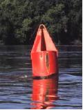
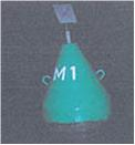
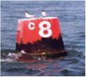
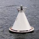
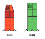

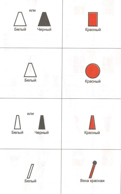
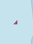

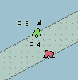
|
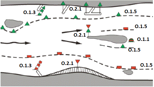
O.1.6. Safe Water Buoy (M)
A safe water buoy marking the axis or middle of a channel may be used as a centerline, mid-channel on lakes and broad waterways
Graphics | Encoding Intructions | Object Encoding | ||||
|---|---|---|---|---|---|---|
|
Real World
Chart Symbol
Chart Symbol
IENC Symbolization
|
|
Object Encoding Object Class =BOYSAW(P) (M) BOYSHP = [1 (conical (nun, ogival)), 3 (spherical), 4 (pillar), 5 (spar (spindle))] (M) COLOUR = [1 (white), 2 (black), 3 (red)] (M) COLPAT = [1 (horizontal stripes), 2 (vertical stripes)] (C) MARSYS = [1 (IALA A), 2 (IALA B)] (C) INFORM = (Refer to letter E) (O) NINFOM = (Refer to Section B, General Guidance) (O) CONRAD = [3 (radar conspicuous (has radar reflector))] (C) OBJNAM = (Refer to letter B) (C) OBJNAM = (Refer to letter B) (C) OBJNAM = (Refer to letter B) (C) SORDAT = [YYYYMMDD] (C) SORIND = (Refer to Section B, General Guidance) Object Encoding Object Class =TOPMAR(P) (M) COLOUR = [3 (red)] (M) TOPSHP = [3 (sphere)] (M) SCAMIN = [EU: 22000; US: 60000] (C) SORDAT = [YYYYMMDD] (C) SORIND = (Refer to Section B, General Guidance) Object Encoding Object Class =LIGHTS(P) (M) COLOUR = [1 (white), 6 (yellow)] (M) EXCLIT = [1 (light shown without change of character), 2 (daytime light), 3 (fog light), 4 (night light)] (M) LITCHR = [1 (fixed), 2 (flashing), 3 (long-flashing), 4 (quick-flashing), 5 (very quick-flashing), 6 (ultra quick flashing), 7 (isophased), 8 (occulting), 9 (interrupted quick-flashing), 10 (interrupted very quick-flashing), 11 (interrupted ultra quick-flashing), 12 (morse), 13 (fixed/flash), 14 (flash/long-flash), 15 (occulting/flash), 16 (fixed/long-flash), 17 (occulting alternating), 18 (long-flash alternating), 19 (flash alternating), 20 (group alternating), 25 (very quick-flash plus long-flash), 26 (very quick-flash plus long-flash), 27 (ultra quick-flash plus long-flash), 28 (alternating), 29 (fixed and alternating flashing)] (C) SIGPER = [xx.xx] (e.g. signal period of 12 seconds coded as 12) (C) SIGGRP = [(x),(x)…], e.g., (), (2), (2+1) (C) SIGSEQ = [L.LL + (E.EE)] (seconds) (M) SCAMIN = [EU: 22000; US: 60000] (C) SORDAT = [YYYYMMDD] (C) SORIND = (Refer to Section B, General Guidance) |
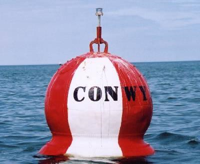

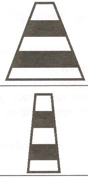

O.1.7. Stalling Buoy (M)
The buoys (floating beacons) are used to mark stalling current which does not coincide with a direction of the fairway
Graphics | Encoding Intructions | Object Encoding | |||
|---|---|---|---|---|---|
|
Chart Symbol
Chart Symbol
IENC Symbolization
|
|
Object Encoding Object Class =BOYLAT(P) (M) BOYSHP = [1 (conical (nun, ogival)), 2 (can (cylindrical))] (M) CATLAM = [1 (port-hand lateral mark), 2 (starboard-hand lateral mark)] (M) COLOUR = [3, 2 (red, black), 3, 1 (red, white), 1, 2 (white, black)] (M) COLPAT = [1 (horizontal stripes)] (C) MARSYS = [1 (IALA A), 2 (IALA B)] (C) INFORM = (Refer to letter B) (O) NINFOM = (Refer to Section B, General Guidance) (O) OBJNAM = (buoy number) (O) NOBJNM = (Refer to Section B, General Guidance) (M) SCAMIN = [EU: 22000; US: 60000] (C) SORDAT = [YYYYMMDD] (C) SORIND = (Refer to Section B, General Guidance) Object Encoding Object Class =LIGHTS(P) (M) COLOUR = [3 (red), 4 (green)] (M) LITCHR = [2 (flashing), 9 (interrupted quick-flashing)] (M) SIGGRP = [4] (M) SCAMIN = [EU: 22000; US: 60000] (C) SORDAT = [YYYYMMDD] (C) SORIND = (Refer to Section B, General Guidance) |
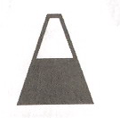
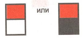
O.1.8. Swinging Axial Buoy (M)
The buoys are used to mark swinging points of the fairway axis
Graphics | Encoding Intructions | Object Encoding | ||
|---|---|---|---|---|
|
Chart Symbol
IENC Symbolization
|
|
Object Encoding Object Class =BOYSAW(P) (M) BOYSHP = [1 (conical (nun, ogival)), 5 (spar (spindle))] (M) COLOUR = [3, 2, 3, 2, 3 (red, black, red, black, red), 3, 1, 3, 1, 3 (red, white, red, white, red)] (M) COLPAT = [1 (horizontal stripes)] (C) MARSYS = [1 (IALA A), 2 (IALA B)] (C) MARSYS = [1 (IALA A), 2 (IALA B)] (O) NINFOM = (Refer to Section B, General Guidance) (O) NINFOM = (Refer to Section B, General Guidance) (O) NOBJNM = (Refer to Section B, General Guidance) (M) SCAMIN = [EU: 22000; US: 60000] (C) SORDAT = [YYYYMMDD] (C) SORIND = (Refer to Section B, General Guidance) Object Encoding Object Class =LIGHTS(P) (M) COLOUR = [1 (white)] (M) LITCHR = [9 (interrupted quick-flashing)] (M) SIGGRP = [4] (M) SCAMIN = [EU: 22000; US: 60000] (C) SORDAT = [YYYYMMDD] (C) SORIND = (Refer to Section B, General Guidance) Object Encoding Object Class =TOPMAR(P) (M) TOPSHP = [26 (circle)] (O) COLOUR = [2 (black)] (M) SCAMIN = [EU: 22000; US: 60000] (C) SORDAT = [YYYYMMDD] (C) SORIND = (Refer to Section B, General Guidance) |
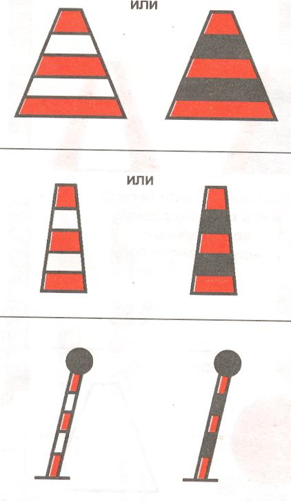
O.1.9. Swinging Lateral Buoy (M)
The buoys are used to mark swinging points at the edges of the extended rectilinear fairways, as well as at the fairway edges where the vision is limited.
Graphics | Encoding Intructions | Object Encoding | ||||
|---|---|---|---|---|---|---|
|
Chart Symbol
Chart Symbol
IENC Symbolization
IENC Symbolization
|
|
Object Encoding Object Class =BOYLAT(P) (M) BOYSHP = [1 (conical (nun, ogival)), 2 (can (cylindrical))] (M) CATLAM = [1 (port-hand lateral mark), 2 (starboard-hand lateral mark)] (M) COLOUR = [1, 2, 1 (white, black, white), 2, 1, 2 (black, white, black), 3, 1, 3, (red, white, red), 3, 2, 3, (red, black, red)] (M) COLPAT = [1 (horizontal stripes)] (C) MARSYS = [1 (IALA A), 2 (IALA B)] (O) INFORM = (Refer to letter B) (O) NINFOM = (Refer to Section B, General Guidance) (M) SCAMIN = [EU: 22000; US: 60000] (C) SORDAT = [YYYYMMDD] (C) SORIND = (Refer to Section B, General Guidance) Object Encoding Object Class =LIGHTS(P) (M) COLOUR = [1 (white), 3 (red), 4 (green), 6 (yellow)] (M) LITCHR = [2 (flashing), 4 (quick-flashing)] (M) SCAMIN = [EU: 22000; US: 60000] (C) SORDAT = [YYYYMMDD] (C) SORIND = (Refer to Section B, General Guidance) |
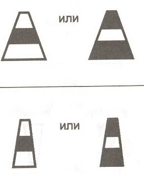
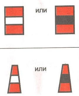


O.1.10. Isolated Danger Buoy (M)
An isolated danger buoy is used in Brazilian rivers to mark the position of a danger of limited extent, which has navigable water all around it.
Graphics | Encoding Intructions | Object Encoding | ||
|---|---|---|---|---|
|
Chart Symbol
IENC Symbolization
|
|
Object Encoding Object Class =BOYISD(P) (M) BOYSHP = [4 (pillar), 5 (spar (spindle))] (M) COLOUR = [2 (black), 3 (red)] (M) COLPAT = [1 (horizontal stripes)] (C) INFORM = (Refer to letter B) (O) NINFOM = (Refer to Section B, General Guidance) (O) CONRAD = [3 (radar conspicuous (has radar reflector))] (C) OBJNAM = (Refer to letter C) (C) NOBJNM = (Refer to letter D) (M) SCAMIN = [BR: 50000] (C) SORDAT = [YYYYMMDD] (C) SORIND = (Refer to Section B, General Guidance) Object Encoding Object Class =TOPMAR(P) (M) COLOUR = [2 (black)] (M) TOPSHP = [4 (2 spheres)] (C) INFORM = (Refer to letter B) (O) NINFOM = (Refer to Section B, General Guidance) (M) SCAMIN = [BR: 50000] (C) SORDAT = [YYYYMMDD] (C) SORIND = (Refer to Section B, General Guidance) Object Class =LIGHTS(P) (M) COLOUR = [1 (white)] (M) EXCLIT = [1 (light shown without change of character), 2 (daytime light), 3 (fog light), 4 (night light)] (M) LITCHR = [2 (flashing)] (C) SIGPER = [xx.xx] (e.g. signal period of 12 seconds, coded as 12) (C) SIGGRP = [(x),(x)…], e.g., (), (2), (2+1) (C) SIGSEQ = [L.LL + (E.EE)] (seconds) (M) SCAMIN = [BR: 50000] (C) SORDAT = [YYYYMMDD] (C) SORIND = (Refer to Section B, General Guidance) |

O.1.11. Virtual AIS Aids to Navigation (O)
An aid to navigation which is being transmitted from a remote site to appear to be coming from a physically non-existent aid to navigation.
Graphics | Encoding Intructions | Object Encoding | |
|---|---|---|---|
|
IENC Symbolization
|
|
Object Encoding Object Class =NEWOBJ(P) (M) CLSNAM = (Refer to Diagram below) (M) CLSDEF = (Refer to Diagram below) (M) SYMINS = (Refer to Diagram below) (M) INFORM = (Refer to letter A) (O) NINFOM = (Refer to Section B, General Guidance) (C) OBJNAM = (Refer to letter B) O) NOBJNM = (Refer to Section B, General Guidance) (M) SCAMIN = [US: 60000] (C) SORDAT = [YYYYMMDD] (C) SORIND = (Refer to Section B, General Guidance) |

|
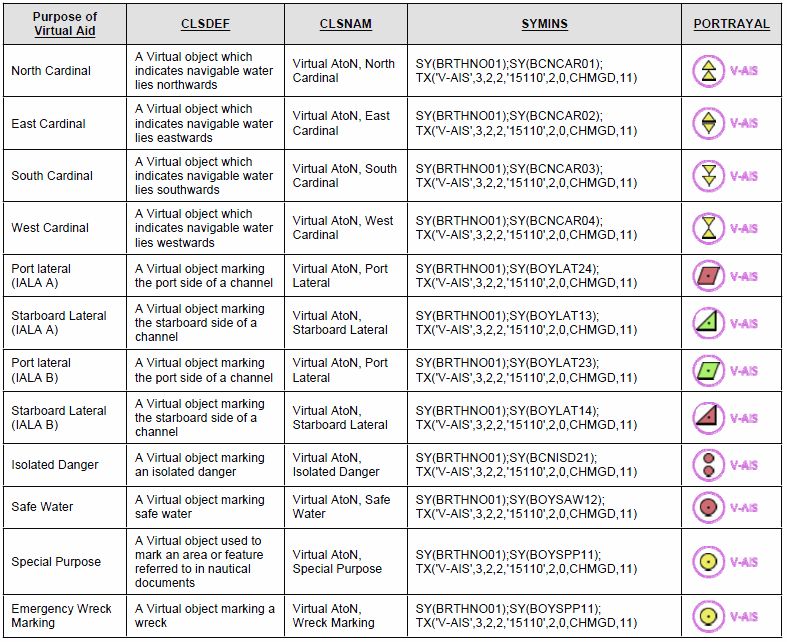
O.2. Beacons and Daymarks
O.2.1. Day Mark (M)
Day marks are used to code passing and crossing day beacons on the inland river system.
Graphics | Encoding Intructions | Object Encoding | ||||||||||||
|---|---|---|---|---|---|---|---|---|---|---|---|---|---|---|
|
Real World (US)
Real World (CEVNI)
Chart Symbol (Version 1)
Chart Symbol
Chart Symbol
Chart Symbol
Chart Symbol
Chart Symbol
Chart Symbol
IENC Symbolization
IENC Symbolization
IENC Symbolization
|
|
Coding of Structure Object Object Class =bcnlat(P) (M) BCNSHP = [1 (stake, pole, perch, post), 5 (pile beacon)] (M) catlam = [1 (port-hand lateral mark), 2 (starboard-hand lateral mark), 5 (right-hand side of the waterway), 6 (left-hand side of the waterway), 7 (right-hand side of the channel), 8 (left-hand side of the channel), 9 (bifurcation of the waterway), 11 (channel near the right bank), 12 (channel near the left bank), 13 (channel cross-over to the right bank), 14 (channel cross-over to the left bank), 15 (danger point or obstacles at the right-hand side), 16 (danger point or obstacles at the left-hand side), 24 (entry from a lake to a narrower waterway, right bank), 25 (entry from a lake to a narrower waterway, left bank)] (C) dirimp = [1 (upstream), 2 (downstream), 3 (to the left bank), 4 (to the right bank)] (M) COLOUR = ["Unknown" or 1 (white), 3 (red), 4 (green), ] (C) COLPAT = [1 (horizontal stripes), 2 (vertical stripes), 3 (diagonal stripes), 4 (squared), 5 (stripes (direction unknown)), 6 (border stripe)] (M) OBJNAM = (EU: refer to letter E; US: refer to letter H) (O) NOBJNM = (Refer to Section B, General Guidance) (O) CONDTN = [1 (under construction), 2 (ruined), 3 (under reclamation), 5 (planned construction)] (M) SCAMIN = [EU: 22000; US: 60000] (C) SORDAT = [YYYYMMDD] (C) SORIND = (Refer to Section B, General Guidance) Coding of Equipment Object Object Class =DAYMAR(P) (M) COLOUR = [1 (white), 2 (black), 3 (red), 4 (green), 6 (yellow)] (M) TOPSHP = [1 (cone, point up), 2 (cone, point down), 7 (x-shape (St. Andrew's cross)), 8 (upright cross (St George's cross)), 10 (2 cones, point to point), 12 (rhombus (diamond)), 19 (square), 24 (triangle, point up), 25 (triangle, point down), 33 (other shape (see INFORM))] (M) COLPAT = [1 (horizontal stripes), 2 (vertical stripes), 3 (diagonal stripes), 4 (squared), 5 (stripes (direction unknown)), 6 (border stripe)] (C) INFORM = (Refer to TOPSHP above) (O) NINFOM = (Refer to Section B, General Guidance) (O) CONDTN = [1 (under construction), 2 (ruined), 3 (under reclamation), 5 (planned construction)] (M) SCAMIN = [EU: 22000; US: 60000] (C) SORDAT = [YYYYMMDD] (C) SORIND = (Refer to Section B, General Guidance) Coding of Equipment Object Object Class =daymar(P) (M) COLOUR = [1 (white), 3 (red), 4 (green), 6 (yellow)] (M) TOPSHP = [1 (cone, point up), 2 (cone, point down), 7 (x-shape (St. Andrew's cross)), 8 (upright cross (St George's cross)), 10 (2 cones, point to point), 12 (rhombus (diamond)), 19 (square), 24 (triangle, point up), 25 (triangle, point down), 33 (other shape (see INFORM))] (C) COLPAT = [1 (horizontal stripes), 2 (vertical stripes), 3 (diagonal stripes), 4 (squared), 5 (stripes (direction unknown)), 6 (border stripe)] (C) INFORM = (Refer to TOPSHP above) (O) NINFOM = (Refer to Section B, General Guidance) (C) dirimp = [1 (upstream), 2 (downstream), 3 (to the left bank), 4 (to the right bank)] (C) ORIENT = [xxx or (UNKNOWN)] (degree (°)), e.g., 110 (O) CONDTN = [1 (under construction), 2 (ruined), 3 (under reclamation), 5 (planned construction)] (M) SCAMIN = [EU: 22000; US: 60000] (C) SORDAT = [YYYYMMDD] (C) SORIND = (Refer to Section B, General Guidance) Object Encoding Object Class =LIGHTS(P) (M) COLOUR = [1 (white), 3 (red), 4 (green)] (O) EXCLIT = [1 (light shown without change of character), 2 (daytime light), 3 (fog light), 4 (night light)] (M) LITCHR = [1 (fixed), 2 (flashing), 3 (long-flashing), 4 (quick-flashing), 5 (very quick-flashing), 6 (ultra quick flashing), 7 (isophased), 8 (occulting), 9 (interrupted quick-flashing), 10 (interrupted very quick-flashing), 11 (interrupted ultra quick-flashing), 12 (morse), 13 (fixed/flash), 14 (flash/long-flash), 15 (occulting/flash), 16 (fixed/long-flash), 17 (occulting alternating), 18 (long-flash alternating), 19 (flash alternating), 20 (group alternating), 25 (very quick-flash plus long-flash), 26 (very quick-flash plus long-flash), 27 (ultra quick-flash plus long-flash), 28 (alternating), 29 (fixed and alternating flashing)] (C) SIGPER = [xx.xx] (e.g., signal period of 12 seconds coded as 12) (C) SIGPER = [xx.xx] (e.g., signal period of 12 seconds coded as 12) (C) SIGSEQ = [L.LL + (E.EE)] (seconds) (C) INFORM = (US: descending bank (e.g., LDB)) (O) CONDTN = [1 (under construction), 2 (ruined), 3 (under reclamation), 5 (planned construction)] (M) SCAMIN = [EU: 22000; US: 60000] (C) SORDAT = [YYYYMMDD] (C) SORIND = (Refer to Section B, General Guidance) |
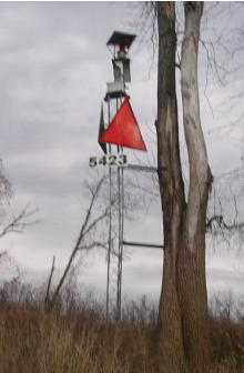
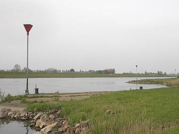
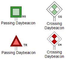
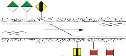
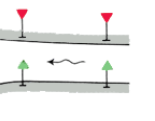
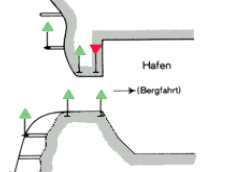
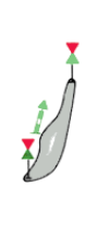
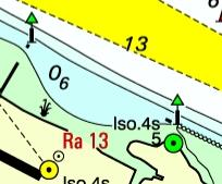
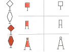
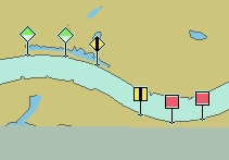
O.2.2. Landmark Beacon (M)
The beacons are used to mark specific “Landmarks”
Graphics | Encoding Intructions | Object Encoding | |||
|---|---|---|---|---|---|
|
Chart Symbol
Chart Symbol
IENC Symbolization
|
|
Object Encoding Object Class =BCNLAT() (M) BCNSHP = [1 (stake, pole, perch, post)] (M) CATLAM = [1 (port-hand lateral mark), 2 (starboard-hand lateral mark)] (M) COLOUR = [2,1, 2, 1, 2 (white, black, white, black, white), 3, 1, 3, 1, 3 (red, white, red, white, red)] (M) COLPAT = [1 (horizontal stripes)] (O) CONDTN = [1 (under construction), 2 (ruined), 3 (under reclamation), 5 (planned construction)] (M) SCAMIN = [EU: 22000; US: 60000] (C) SORDAT = [YYYYMMDD] (C) SORIND = (Refer to Section B, General Guidance) Object Encoding Object Class =TOPMAR(P) (M) TOPSHP = [21 (rectangle, vertical), 22 (trapezium, up)] (O) COLOUR = [2,1, 2, 1, 2 (white, black, white, black, white), 3, 1, 3, 1, 3 (red, white, red, white, red)] (O) COLPAT = [1 (horizontal stripes)] (O) CONDTN = [1 (under construction), 2 (ruined), 3 (under reclamation), 5 (planned construction)] (M) SCAMIN = [EU: 22000; US: 60000] (C) SORDAT = [YYYYMMDD] (C) SORIND = (Refer to Section B, General Guidance) Object Encoding Object Class =LIGHTS(P) (M) COLOUR = [1 (white), 3 (red), 4 (green), 6 (yellow)] (M) LITCHR = [2 (flashing)] (M) SIGGRP = [2] (O) CONDTN = [1 (under construction), 2 (ruined), 3 (under reclamation), 5 (planned construction)] (M) SCAMIN = [EU: 22000; US: 60000] (C) SORDAT = [YYYYMMDD] (C) SORIND = (Refer to Section B, General Guidance) |
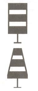
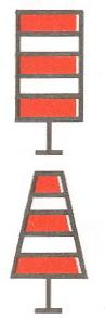

O.2.3. Radar Beacon, RACON (M)
A radar transponder beacon (racon) may be used to indicate an entrance of a canal or a bridge passage.
Graphics | Encoding Intructions | Object Encoding | |||
|---|---|---|---|---|---|
|
Real World
Chart Symbol
IENC Symbolization
|
|
Object Encoding Object Class =RTPBCN(P) (M) CATRTB = [1 (ramark, radar beacon transmitting continuously), 2 (racon, radar transponder beacon), 3 (leading racon/radar transponder beacon)] (O) RADWAL = (The wavelength (V) (metres) and the band code character (B)), e.g., V.VV-B (O) SIGGRP = [A] (O) CONDTN = [1 (under construction), 2 (ruined), 3 (under reclamation), 5 (planned construction)] (M) SCAMIN = [EU: 22000; US: 60000] (C) SORDAT = [YYYYMMDD] (C) SORIND = (Refer to Section B, General Guidance) |

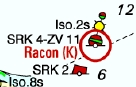
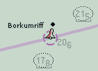
O.2.4. Spring Flood Beacon (M)
The beacons are used to mark submerged banks
Graphics | Encoding Intructions | Object Encoding | ||||
|---|---|---|---|---|---|---|
|
Chart Symbol
Chart Symbol
IENC Symbolization
IENC Symbolization
|
|
Object Encoding Object Class =BCNLAT(P) (M) BCNSHP = [1 (stake, pole, perch, post)] (M) CATLAM = [1 (port-hand lateral mark), 2 (starboard-hand lateral mark)] (M) COLOUR = [1 (white), 3 (red)] (O) INFORM = (Spring flood mark of the left (right) bank) (O) NINFOM = (Refer to Section B, General Guidance) (O) CONDTN = [1 (under construction), 2 (ruined), 3 (under reclamation), 5 (planned construction)] (O) CONDTN = [1 (under construction), 2 (ruined), 3 (under reclamation), 5 (planned construction)] (C) SORDAT = [YYYYMMDD] (C) SORIND = (Refer to Section B, General Guidance) Object Encoding Object Class =TOPMAR(P) (M) TOPSHP = [22 (trapezium, up), 26 (circle)] (O) COLOUR = [1 (white), 3 (red)] (O) CONDTN = [1 (under construction), 2 (ruined), 3 (under reclamation), 5 (planned construction)] (M) SCAMIN = [EU: 22000; US: 60000] (C) SORDAT = [YYYYMMDD] (C) SORIND = (Refer to Section B, General Guidance) Object Encoding Object Class =LIGHTS(P) (M) SCAMIN = [EU: 22000; US: 60000] (M) LITCHR = [1 (fixed)] (O) CONDTN = [1 (under construction), 2 (ruined), 3 (under reclamation), 5 (planned construction)] (M) SCAMIN = [EU: 22000; US: 60000] (C) SORDAT = [YYYYMMDD] (C) SORIND = (Refer to Section B, General Guidance) |

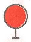


O.2.5. Isolated Danger Beacon (M)
An isolated danger beacon is used to mark the position of a danger of limited extent, which has navigable water all around it.
Graphics | Encoding Intructions | Object Encoding | ||
|---|---|---|---|---|
|
Chart Symbol
IENC Symbolization
|
|
Object Encoding Object Class =BCNISD(P) (M) BCNSHP = [1 (stake, pole, perch, post), 5 (pile beacon)] (M) COLOUR = [2 (black), 3 (red)] (M) COLPAT = [1 (horizontal stripes)] (C) INFORM = (Refer to letter B) (O) NINFOM = (Refer to Section B, General Guidance) (C) CONRAD = [3 (radar conspicuous (has radar reflector))] (C) OBJNAM = (Refer to letter C) (C) NOBJNM = (Refer to letter D) (O) CONDTN = [1 (under construction), 2 (ruined), 3 (under reclamation), 5 (planned construction)] (M) SCAMIN = [BR: 50000] (C) SORDAT = [YYYYMMDD] (C) SORIND = (Refer to Section B, General Guidance) Object Encoding Object Class =TOPMAR(P) (M) COLOUR = [2 (black)] (M) TOPSHP = [4 (2 spheres)] (C) INFORM = (Refer to letter B) (O) NINFOM = (Refer to Section B, General Guidance) (O) CONDTN = [1 (under construction), 2 (ruined), 3 (under reclamation), 5 (planned construction)] (M) SCAMIN = [BR: 50000] (C) SORDAT = [YYYYMMDD] (C) SORIND = (Refer to Section B, General Guidance) Object Encoding Object Class =LIGHTS(P) (M) COLOUR = [1 (white)] (M) EXCLIT = [1 (light shown without change of character), 2 (daytime light), 3 (fog light), 4 (night light)] (M) LITCHR = [2 (flashing)] (C) SIGPER = [xx.xx] (e.g. signal period of 12 seconds, coded as 12) (C) SIGGRP = [(x),(x)…], e.g., (), (2), (2+1) (C) SIGSEQ = [L.LL + (E.EE)] (seconds) (O) CONDTN = [1 (under construction), 2 (ruined), 3 (under reclamation), 5 (planned construction)] (M) SCAMIN = [BR: 50000] (C) SORDAT = [YYYYMMDD] (C) SORIND = (Refer to Section B, General Guidance) |

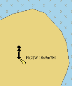
O.2.6. Change Bank (O)
Used only in the Po river (Italy). Indicates that the recommended track changes to the other side of the waterway. The white half of the mark shows the direction to be followed.
Graphics | Encoding Intructions | Object Encoding | |||
|---|---|---|---|---|---|
|
Real World
Chart Symbol
IENC Symbolization
|
|
Object Encoding Object Class =bcnlat(P) (M) BCNSHP = [1 (stake, pole, perch, post)] (M) catlam = [26 (change bank)] (M) COLOUR = [1 (white), 3 (red), 4 (green)] (M) SCAMIN = [EU: 22000] (C) SORDAT = [YYYYMMDD] (C) SORIND = (Refer to Section B, General Guidance) Object Encoding Object Class =DAYMAR(P) (M) COLOUR = [1 (white), 3 (red)] (M) TOPSHP = [12 (rhombus (diamond))] (M) COLPAT = [2 (vertical stripes)] (O) CONDTN = [1 (under construction), 2 (ruined), 3 (under reclamation), 5 (planned construction)] (M) SCAMIN = [EU: 22000] (C) SORDAT = [YYYYMMDD] (C) SORIND = (Refer to Section B, General Guidance) |
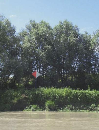
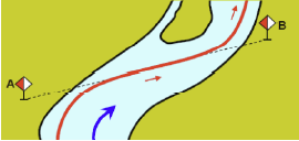

O.2.7. Continue Along Bank (O)
Used only in the Po river (Italy). Indicates that the recommended track continues along the same side of the waterway.
Graphics | Encoding Intructions | Object Encoding | |||
|---|---|---|---|---|---|
|
Real World
Chart Symbol
IENC Symbolization
|
|
Object Encoding Object Class =bcnlat(P) (M) BCNSHP = [1 (stake, pole, perch, post)] (M) catlam = [27 (continue along the bank)] (M) COLOUR = [1 (white), 3 (red), 4 (green)] (M) SCAMIN = [EU: 20000; US: 60000] (C) SORDAT = [YYYYMMDD] (C) SORIND = (Refer to Section B, General Guidance) Object Encoding Object Class =DAYMAR(P) (M) COLOUR = [1 (white), 3 (red)] (M) TOPSHP = [12 (rhombus (diamond))] (M) COLPAT = [1 (horizontal stripes)] (O) CONDTN = [1 (under construction), 2 (ruined), 3 (under reclamation), 5 (planned construction)] (M) SCAMIN = [EU: 22000] (C) SORDAT = [YYYYMMDD] (C) SORIND = (Refer to Section B, General Guidance) |
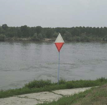
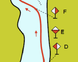

O.2.8. Touch and Go (O)
Used only in the Po river (Italy). Indicates that the ship has to reach the bank and immediately move to the other bank.
Graphics | Encoding Intructions | Object Encoding | |||
|---|---|---|---|---|---|
|
Real World
Chart Symbol
IENC Symbolization
|
|
Object Encoding Object Class =bcnlat(P) (M) BCNSHP = [1 (stake, pole, perch, post)] (M) CATLAM = [26 (change bank)] (M) COLOUR = [1 (white), 3 (red), 4 (green)] (M) SCAMIN = [EU: 22000; US: 60000] (C) SORDAT = [YYYYMMDD] (C) SORIND = (Refer to Section B, General Guidance) Object Encoding Object Class =DAYMAR(P) (M) COLOUR = [1 (white, 3 (red)] (M) TOPSHP = [12 (rhombus)] (M) COLPAT = [1 (horizontal stripes)] (O) CONDTN = [1 (under construction), 2 (ruined), 3 (under reclamation), 5 (planned construction)] (M) SCAMIN = [EU: 22000] (C) SORDAT = [YYYYMMDD] (C) SORIND = (Refer to Section B, General Guidance) |
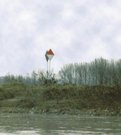
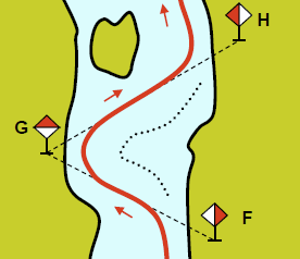

O.3. Notice Marks
O.3.1. Notice Marks (M)
Waterway signs in accordance with the European Code for Inland Waterways of UN/ECE (http://www.unece.org/trans/doc/finaldocs/sc3/TRANS-SC3-115r2e.pdf ). Used also in Brazil in accordance with Normas da Autoridade Marítima para Auxílios à Navegação (NORMAM-17) - Diretoria de Hidrografia e Navegação (DHN) and for Waterway signs in the Russian Federation in accordance with Russian Inland Waterway Regulations GOST 26600-98. For notice marks on bridges see O.3.2
Graphics | Encoding Intructions | Object Encoding | |||||||||||
|---|---|---|---|---|---|---|---|---|---|---|---|---|---|
|
Real World (Europe)
IENC Symbolization (CEVNI)
Real World (Brazil - two sides system)
Real World
Chart Symbol
IENC Symbolization
Real World (Brazil - one side system)
Real World (Paraguay-Parana (Brazilian))
Real World
Chart Symbol
IENC Symbolization
|
|
Object Encoding Object Class =notmrk(P) (M) catnmk = Refer to Annexes AA, AB, AC, AD and AE (M) fnctnm = [1 (prohibition mark), 2 (regulation mark), 3 (restriction mark), 4 (recommendation mark), 5 (information mark)] (O) dirimp = [1 (upstream), 2 (downstream), 3 (to the left bank), 4 (to the right bank), 5 (to harbor)] (O) disipd = (distance of impact, downstream: unit defined in the M_UNIT meta object class, e.g. metre (m), resolution: 1 m) (O) disipu = (distance of impact, upstream: unit defined in the M_UNIT meta object class, e.g. metre (m), resolution: 1 m) (O) disbk1 = Minimum distance of the impact from the notice mark rectangular to the bank: unit defined in the M_UNIT meta object class, e.g. metre (m), resolution: 1 m (O) disbk2 = Maximum distance of the impact from the notice mark rectangular to the bank: unit defined in the M_UNIT meta object class, e.g. metre (m), resolution: 1 m (O) addmrk = [1 (top (board)), 2 (bottom (board)), 3 (right (triangle to the right)), 4 (left (triangle to the left)), 5 (bottom (triangle to the bottom))] (O) bnkwtw = [1 (left), 2 (right)] (C) ORIENT = [xxx or (UNKNOWN)] (degree (°)), e.g., 110 (C) marsys = [1 (IALA A), 2 (IALA B), 9 (no system), 10 (other system), 11 (CEVNI), 12 (Russian inland waterway regulations), 13 (Brazilian national inland waterway regulations - two sides), 14 (Brazilian national inland waterway regulations - side independent), 15 (Paraguay-Parana waterway - Brazilian complementary aids)] (O) STATUS = [8 (private), 12 (illuminated)] (O) INFORM = (text of additional marks in English) (O) NINFOM = (Refer to Section B, General Guidance) (O) CONDTN = [1 (under construction), 2 (ruined), 3 (under reclamation), 5 (planned construction)] (M) SCAMIN = [EU: 22000; US: 60000; BR: 50000] (C) SORDAT = [YYYYMMDD] (C) SORIND = (Refer to Section B, General Guidance) |
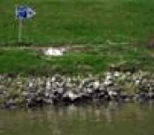
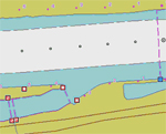
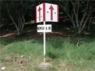
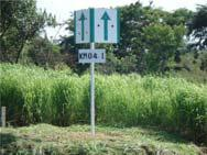
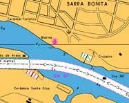
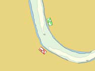

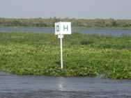
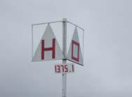
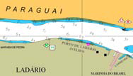
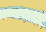
|
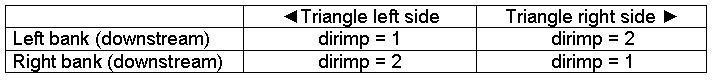
|
Diagram for Brazilian national inland waterway regulations - two sides
|
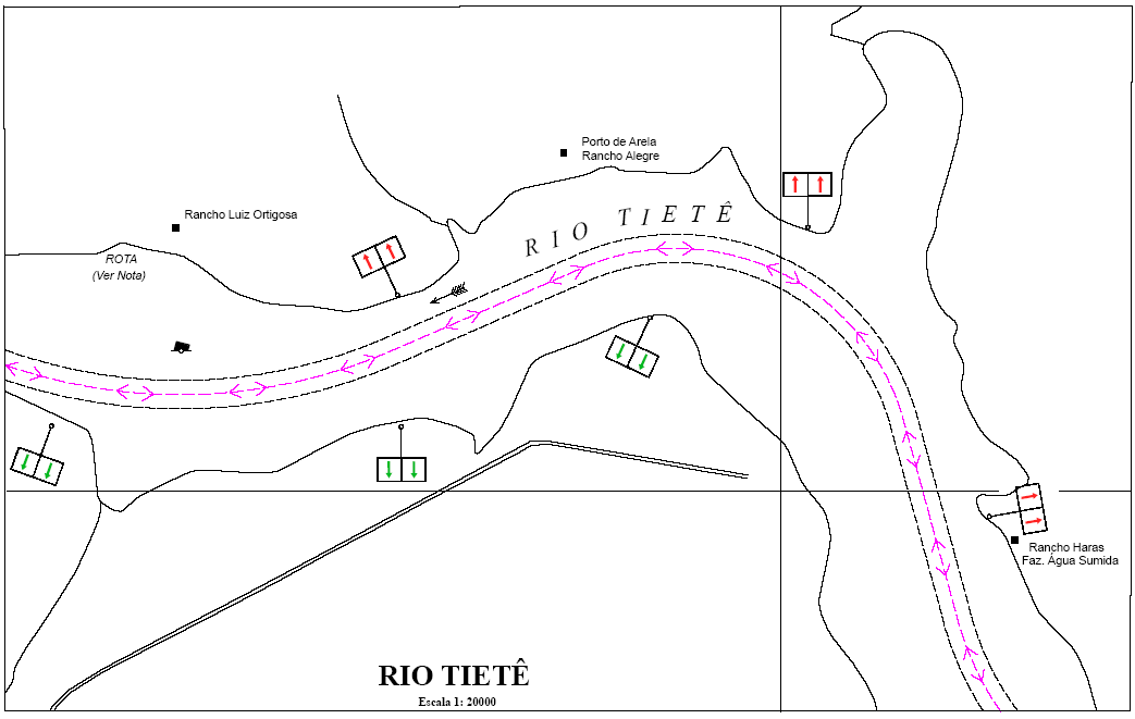
|
Diagram for Brazilian national inland waterway regulations – side independent
|
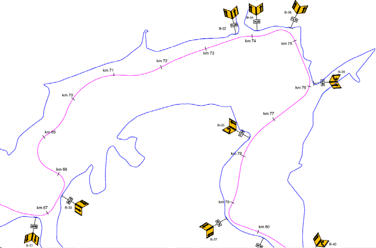
|
Diagram for Paraguay-Parana waterway - Brazilian complementary aids
|
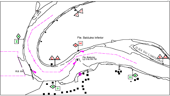
O.3.2. Notice Marks on Bridges (M)
Waterway signs in accordance with the European Code for Inland Waterways of UN/ECE (http://www.unece.org/trans/doc/finaldocs/sc3/TRANS-SC3-115r2e.pdf ) For notice marks not positioned on bridges see O.3.1
Graphics | Encoding Intructions | Object Encoding | |
|---|---|---|---|
|
IENC Symbolization
|
|
Object Encoding Object Class =notmrk(P) (M) catnmk = Refer to Annexes AA, AB, AC, AD and AE (M) fnctnm = [1 (prohibition mark, CEVNI signs A), 2 (regulation mark, CEVNI signs B), 4 (recommendation mark, CEVNI signs D), 5 (information mark, CEVNI signs E)] (O) dirimp = [1 (upstream), 2 (downstream), 3 (to the left bank), 4 (to the right bank)] (C) marsys = [1 (IALA A), 2 (IALA B), 9 (no system), 10 (other system), 11 (CEVNI), 12 (Russian inland waterway regulations), 13 (Brazilian national inland waterway regulations - two sides), 14 (Brazilian national inland waterway regulations - side independent), 15 (Paraguay-Parana waterway - Brazilian complementary aids)] (M) ORIENT = [degree (°)] (O) STATUS = [12 (illuminated)] (O) CONDTN = [1 (under construction), 2 (ruined), 3 (under reclamation), 5 (planned construction)] (M) SCAMIN = [EU: 8000; US: 12000] (C) SORDAT = [YYYYMMDD] (C) SORIND = (Refer to Section B, General Guidance) |
O.3.3. Wreck Pontoon (M)
A usually temporarily installed pontoon to draw attention to obstacles and danger points and to require vessels under way to avoid causing wash.
Graphics | Encoding Intructions | Object Encoding | ||
|---|---|---|---|---|
|
Real World
Chart Symbol
|
|
Object Encoding Object Class =notmrk(P) (M) catnmk = [110 (wreck pontoon, passage allowed on side showing red-white sign), 111 (wreck pontoon, passage allowed on both sides)] (M) ORIENT = [xxx.xx] (O) INFORM = (Information about obstruction) (O) NINFOM = (Refer to Section B, General Guidance) (O) DATSTA = (Refer to Section J, DATSTA, DATEND, PERSTA and PEREND) (O) DATEND = (Refer to Section J, DATSTA, DATEND, PERSTA and PEREND) (O) PERSTA = (Refer to Section J, DATSTA, DATEND, PERSTA and PEREND) (O) PEREND = (Refer to Section J, DATSTA, DATEND, PERSTA and PEREND) (O) CONDTN = [1 (under construction), 2 (ruined), 3 (under reclamation), 5 (planned construction)] (M) SCAMIN = [22000] (C) SORDAT = [YYYYMMDD] (C) SORIND = (Refer to Section B, General Guidance) |
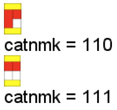
O.4. IALA Maritime Buoyage System
O.4.1. Special Purpose Buoy IALA (M)
A special purpose buoy is primarily used to indicate an area or feature, the nature of which is apparent from reference to a chart.
Graphics | Encoding Intructions | Object Encoding | |||||
|---|---|---|---|---|---|---|---|
|
Real World
Chart Symbol
Chart Symbol
IENC Symbolization
IENC Symbolization
|
|
Object Encoding Object Class =BOYSPP(P) (M) BOYSHP = [1 (conical (nun, ogival)), 3 (spherical), 4 (pillar), 5 (spar (spindle)), 6 (barrel (tun))] (M) CATSPM = [6 (cable mark), 10 (recording mark), 12 (recreation zone mark), 39 (pipeline mark), 45 (foul ground mark), 50 (entry prohibited mark), 55 (marine farm mark)] (M) COLOUR = [6 (yellow)] (O) CONRAD = [3 (radar conspicuous (has radar reflector))] (C) OBJNAM = (Refer to letter D) (O) NOBJNM = (Refer to letter D) (M) SCAMIN = [EU: 22000; US: 60000] (C) SORDAT = [YYYYMMDD] (C) SORIND = (Refer to Section B, General Guidance) Object Encoding Object Class =LIGHTS(P) (M) COLOUR = [1 (white), 3 (red), 4 (green)] (M) EXCLIT = [1 (light shown without change of character), 2 (daytime light), 3 (fog light), 4 (night light)] (M) LITCHR = [1 (fixed), 2 (flashing), 3 (long-flashing), 4 (quick-flashing), 5 (very quick-flashing), 6 (ultra quick flashing), 7 (isophased), 8 (occulting), 9 (interrupted quick-flashing), 10 (interrupted very quick-flashing), 11 (interrupted ultra quick-flashing), 12 (morse), 13 (fixed/flash), 14 (flash/long-flash), 15 (occulting/flash), 16 (fixed/long-flash), 17 (occulting alternating), 18 (long-flash alternating), 19 (flash alternating), 20 (group alternating), 25 (very quick-flash plus long-flash), 26 (very quick-flash plus long-flash), 27 (ultra quick-flash plus long-flash), 28 (alternating), 29 (fixed and alternating flashing)] (C) SIGPER = [xx.xx] (e.g. signal period of 12 seconds coded as 12) (C) SIGGRP = [(x),(x)…], e.g., (), (2), (2+1) (C) SIGSEQ = [L.LL + (E.EE)] (seconds) (C) SIGSEQ = [L.LL + (E.EE)] (seconds) (C) SORDAT = [YYYYMMDD] (C) SORIND = (Refer to Section B, General Guidance) Object Encoding Object Class =TOPMAR(P) (M) COLOUR = [1 (white), 2 (black), 3 (red), 4 (green), 6 (yellow)] (M) COLOUR = [1 (white), 2 (black), 3 (red), 4 (green), 6 (yellow)] (M) TOPSHP = [1 (cone, point up), 2 (cone, point down), 3 (sphere), 4 (2 spheres), 5 (cylinder (can)), 6 (board), 7 (x-shape (St. Andrew's cross)), 8 (upright cross (St George's cross)), 9 (cube, point up), 10 (2 cones, point to point), 11 (2 cones, base to base), 12 (rhombus (diamond)), 15 (besom, point up (broom or perch)), 16 (besom, point down (broom or perch)), 17 (flag), 18 (sphere over rhombus), 19 (square), 20 (rectangle, horizontal), 21 (rectangle, vertical), 22 (trapezium, up), 23 (trapezium, down), 24 (triangle, point up), 25 (triangle, point down), 26 (circle), 27 (two upright crosses (one over the other)), 28 (T-shape), 29 (triangle pointing up over a circle), 30 (upright cross over a circle), 31 (rhombus over a circle), 32 (circle over a triangle pointing up), 33 (other shape (see INFORM))] (C) INFORM = (Refer to TOPSHP above) (O) NINFOM = (Refer to Section B, General Guidance) (M) SCAMIN = [EU: 22000; US: 60000] (C) SORDAT = [YYYYMMDD] (C) SORIND = (Refer to Section B, General Guidance) |


Chapter P. P - Fog Signals
Table of Contents
P.1. Fog Signal
P.1.1. Fog Signal (M)
A fog signal transmits a warning signal from an aid to navigation, during periods of low visibility.
Graphics | Encoding Intructions | Object Encoding | ||
|---|---|---|---|---|
|
Chart Symbol
IENC Symbolization
|
|
Object Encoding Object Class =FOGSIG(P) (M) CATFOG = [1 (explosive), 2 (diaphone), 3 (siren), 4 (nautophone), 5 (reed), 6 (tyfon), 7 (bell), 8 (whistle), 9 (gong), 10 (horn)] (O) SIGFRQ = [xxxxxx] (Hz), e.g. 12 for 12 Hz (O) SIGGEN = [1 (automatically), 2 (by wave action)] (C) SIGPER = [xx.xx (e.g., signal period of 12 seconds coded as 12)] (C) SIGPER = [xx.xx (e.g., signal period of 12 seconds coded as 12)] (C) SIGSEQ = [L.LL + (E.EE)] (seconds) (O) VALMXR = [xx.x] (M) SCAMIN = [EU: 22000; US: 60000] (C) SORDAT = [YYYYMMDD] (C) SORIND = (Refer to Section B, General Guidance) |
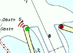
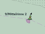
Chapter Q. Q - Radar, Radio, Electronic Positioning
Q.1. Radar
Q.1.1. Radar Station (O)
The radar station of a VTS or a lock to locate vessels and/ or monitor the traffic.
Graphics | Encoding Intructions | Object Encoding | ||
|---|---|---|---|---|
|
Chart Symbol
IENC Symbolization
|
|
Object Encoding Object Class =RADSTA(P) (M) CATRAS = [1 (radar surveillance station)] (O) OBJNAM = (name and/or operator/owner) (O) NOBJNM = (Refer to Section B, General Guidance) (M) SCAMIN = [EU: 22000; US: 60000] (C) SORDAT = [YYYYMMDD] (C) SORIND = (Refer to Section B, General Guidance) |
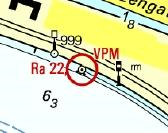
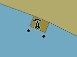
Q.2. Radio
Q.2.1. Radio Calling-in Point (M)
Also called radio reporting points, they have been established in certain busy waterways and port approaches to assist traffic control. On passing these points or crossing a defined line vessels are required to report on VHF to a Traffic Control Centre. (adapted from IHO Chart Specifications, M-4)
Graphics | Encoding Intructions | Object Encoding | ||
|---|---|---|---|---|
|
Real World
IENC Symbolization
|
|
Object Encoding Object Class =rdocal(P,L) (M) TRAFIC = [1 (inbound), 2 (outbound), 3 (one-way), 4 (two-way)] (M) ORIENT = [unit: degree (°)] (M) ORIENT = [unit: degree (°)] (M) catcom = [1 (VTS centre), 2 (VTS sector), 3 (IVS point), 4 (MIB), 5 (lock), 6 (bridge), 7 (custom), 8 (harbour)] (O) TXTDSC = (Refer to letter F) (M) OBJNAM = (name and/or operator/owner) (O) NOBJNM = (Refer to Section B, General Guidance) (C) unlocd = [ISRS code] (M) SCAMIN = [EU: 12000; US: 22000] (C) SORDAT = [YYYYMMDD] (C) SORIND = (Refer to Section B, General Guidance) |
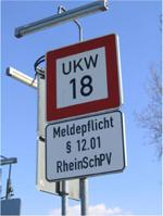
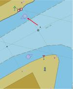
Chapter R. R - Services
R.1. Check Points
R.1.1. Check Point (C)
An official place to register, declare, or check goods and/or people.
Graphics | Encoding Intructions | Object Encoding | |
|---|---|---|---|
|
IENC Symbolization
|
|
Object Encoding Object Class =chkpnt(P,A) (M) catchp = [1 (custom), 2 (border)] (M) NATION = (Nationality is encoded by a 2 character-code following ISO 3166 (refer to Annex A to S-57 Appendix A)) (O) OBJNAM = (name of the control station) (O) NOBJNM = (Refer to Section B, General Guidance) (C) unlocd = [ISRS code] (C) unlocd = [ISRS code] (M) SCAMIN = [EU: 12000; US: 22000] (C) SORDAT = [YYYYMMDD] (C) SORIND = (Refer to Section B, General Guidance) |
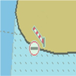
R.2. Signal Stations
R.2.1. Traffic Signal Station - Bridge Passage (O)
Place on shore from which signals are made for the control of vessels wishing to pass under a bridge.
Graphics | Encoding Intructions | Object Encoding | |||
|---|---|---|---|---|---|
|
Real World
Real World
IENC Symbolization
|
|
Object Encoding Object Class =sistat(P) (M) catsit = [8 (bridge passage)] (O) dirimp = [1 (upstream), 2 (downstream)] (C) OBJNAM = (name and/or operator/owner) (O) NOBJNM = (Refer to Section B, General Guidance) (O) INFORM = (Refer to letter D) (O) NINFOM = (Refer to Section B, General Guidance) (O) TXTDSC = (Refer to letter D) (C) unlocd = [ISRS code] (O) CONDTN = [1 (under construction), 2 (ruined), 3 (under reclamation), 5 (planned construction)] (M) SCAMIN = [EU: 22000; US: 60000] (C) SORDAT = [YYYYMMDD] (C) SORIND = (Refer to Section B, General Guidance) |
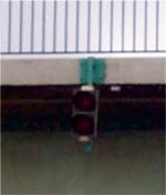
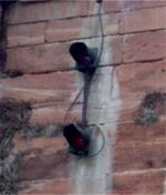
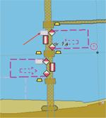
R.2.2. Traffic Signal Station - Lock (O)
Place on shore from which signals are made for the control of vessels entering or leaving a lock.
Graphics | Encoding Intructions | Object Encoding | ||||
|---|---|---|---|---|---|---|
|
Real World
Real World
Real World
IENC Symbolization
|
|
Object Encoding Object Class =sistat(P) (M) catsit = [6 (lock)] (O) dirimp = [1 (upstream), 2 (downstream)] (C) OBJNAM = (Refer to letter C) (O) NOBJNM = (Refer to Section B, General Guidance) (O) INFORM = (Refer to letter D) (O) NINFOM = (Refer to Section B, General Guidance) (O) TXTDSC = (Refer to letter D) (C) unlocd = [ISRS code] (O) CONDTN = [1 (under construction), 2 (ruined), 3 (under reclamation), 5 (planned construction)] (M) SCAMIN = [EU: 22000; US: 60000] (C) SORDAT = [YYYYMMDD] (C) SORIND = (Refer to Section B, General Guidance) |
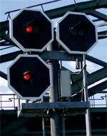


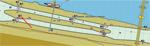
R.2.3. Traffic Signal Station - Oncoming Traffic Indicator (O)
Place on shore from which signals are made to inform about oncoming traffic.
Graphics | Encoding Intructions | Object Encoding | ||
|---|---|---|---|---|
|
Real World
IENC Symbolization
|
|
Object Encoding Object Class =sistat(P) (M) catsit = [10 (oncoming traffic indication)] (O) dirimp = [1 (upstream), 2 (downstream), 3 (to the left bank), 4 (to the right bank)] (C) OBJNAM = (Refer to letter C) (O) NOBJNM = (Refer to Section B, General Guidance) (O) INFORM = (Refer to letter D) (O) NINFOM = (Refer to Section B, General Guidance) (O) TXTDSC = (Refer to letter D) (C) unlocd = [ISRS code] (O) CONDTN = [1 (under construction), 2 (ruined), 3 (under reclamation), 5 (planned construction)] (M) SCAMIN = [EU: 22000; US: 60000] (C) SORDAT = [YYYYMMDD] (C) SORIND = (Refer to Section B, General Guidance) |
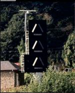
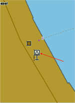
R.2.4. Traffic Signal Station - Port Entry and Departure (O)
Place on shore from which signals are made for the control of vessels entering or leaving a port.
Graphics | Encoding Intructions | Object Encoding | |||
|---|---|---|---|---|---|
|
Real World
Real World
IENC Symbolization
|
|
Object Encoding Object Class =sistat(P) (M) catsit = [2 (port entry and departure)] (O) dirimp = [1 (upstream), 2 (downstream), 3 (to the left bank), 4 (to the right bank)] (C) OBJNAM = (Refer to letter C) (O) NOBJNM = (Refer to Section B, General Guidance) (O) INFORM = (Refer to letter D) (O) NINFOM = (Refer to Section B, General Guidance) (O) TXTDSC = (Refer to letter D) (C) unlocd = [ISRS code] (O) CONDTN = [1 (under construction), 2 (ruined), 3 (under reclamation), 5 (planned construction)] (M) SCAMIN = [EU: 22000; US: 60000] (C) SORDAT = [YYYYMMDD] (C) SORIND = (Refer to Section B, General Guidance) |
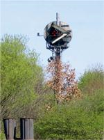
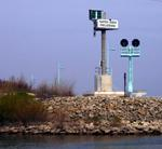
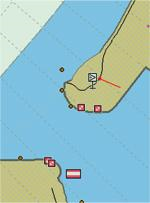
R.3. Rescue Stations
R.3.1. Rescue Station (O)
A place at which life saving equipment is held.
Graphics | Encoding Intructions | Object Encoding | |||
|---|---|---|---|---|---|
|
Real World
Real World
IENC Symbolization
|
|
Object Encoding Object Class =RSCSTA(P) (M) catrsc = [1 (rescue station with life boat), 2 (rescue station with rocket), 3 (not in use), 4 (refuge for ship-wrecked mariners), 5 (refuge for intertidal area walkers), 6 (lifeboat lying at a mooring), 7 (aid radio station), 8 (first aid equipment), 9 (lifebuoy, ring buoy, life ring, life saver)] (O) DATEND = (Refer to Section J, DATSTA, DATEND, PERSTA and PEREND) (O) DATSTA = (Refer to Section J, DATSTA, DATEND, PERSTA and PEREND) (O) PERSTA = (Refer to Section J, DATSTA, DATEND, PERSTA and PEREND) (O) PEREND = (Refer to Section J, DATSTA, DATEND, PERSTA and PEREND) (O) OBJNAM = [Name] (O) NOBJNM = (Refer to Section B, General Guidance) (O) STATUS = [2 (occasional), 4 (not in use)] (M) SCAMIN = [8000] (C) SORDAT = [YYYYMMDD] (C) SORIND = (Refer to Section B, General Guidance) |
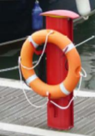
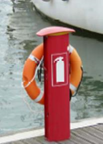

R.4. Sensors
R.4.1. Sensor (O)
A device that responds to a physical stimulus (as heat, light, sound, pressure, magnetism or a particular motion) and transmits a resulting impulse (as for measurement or operating a control).
Graphics | Encoding Intructions | Object Encoding | |
|---|---|---|---|
|
Real World
|
|
Object Encoding Object Class =sensor(P) (M) catsen = [1 (light activated), 2 (telephone activated)] (M) fnctsn = [1 (reduce bridge lighting)] (O) OBJNAM = [name and/or operator/owner] (O) OBJNAM = [name and/or operator/owner] (O) OBJNAM = [name and/or operator/owner] (C) SORDAT = [YYYYMMDD] (C) SORIND = (Refer to Section B, General Guidance) |
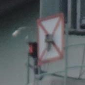
Chapter S. S - Small Craft Facilities
Table of Contents
S.1. Marinas and Other Facilities
S.1.1. Harbor Facilities (O)
A harbor installation with a service or commercial operation of public interest.
Graphics | Encoding Intructions | Object Encoding | ||
|---|---|---|---|---|
|
Real World
IENC Symbolization
|
|
Object Encoding Object Class =hrbfac(P,A) (M) cathaf = [4 (fishing harbour), 6 (naval base), 9 (shipyard), 12 (syncrolift), 13 (straddle carrier), 16 (service and repair), 17 (quarantine station)] (O) TXTDSC = (Refer to letter E) (O) CONDTN = [1 (under construction), 2 (ruined), 3 (under reclamation), 5 (planned construction)] (M) SCAMIN = [EU: 12000; US: 22000] (C) SORDAT = [YYYYMMDD] (C) SORIND = (Refer to Section B, General Guidance) |
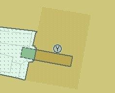
|
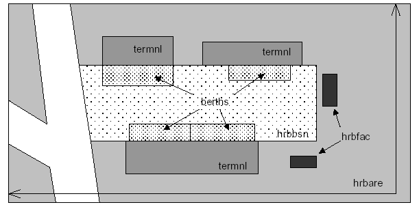
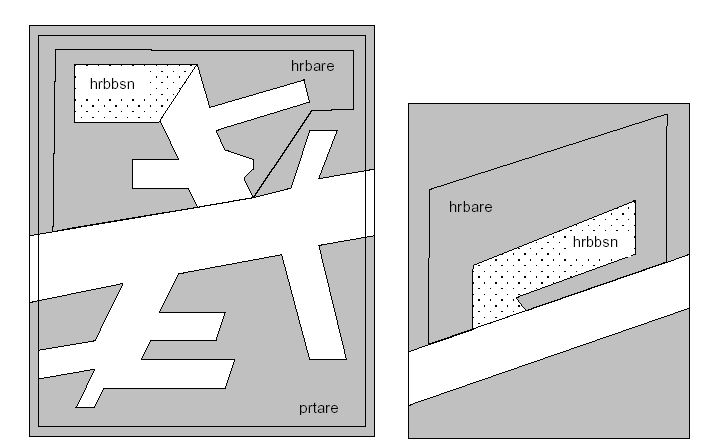
S.1.2. Marina (O)
A harbour installation with a service or commercial operation of public interest. (S-57 Standard)
Graphics | Encoding Intructions | Object Encoding | |||
|---|---|---|---|---|---|
|
Real World
Chart Symbol
IENC Symbolization
|
|
Object Encoding Object Class =HRBFAC(P,A) (M) CATHAF = [5 (yacht harbour/marina)] (M) OBJNAM = [(Marina Name) + ”Marina”] (O) NOBJNM = (Refer to Section B, General Guidance) (O) CONDTN = [1 (under construction), 2 (ruined), 3 (under reclamation), 5 (planned construction)] (M) SCAMIN = [EU: 12000; US: 60000] (C) SORDAT = [YYYYMMDD] (C) SORIND = (Refer to Section B, General Guidance) |
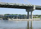

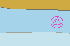
S.1.3. Small Craft Facility (O)
A place at which a service generally of interest to small craft or pleasure boats is available.
Graphics | Encoding Intructions | Object Encoding | |
|---|---|---|---|
|
IENC Symbolization
|
|
Object Encoding Object Class =SMCFAC(P,A) (M) CATSCF = [1 (visitor's berth), 2 (nautical club), 3 (boat hoist), 4 (sailmaker), 5 (boatyard), 6 (public inn), 7 (restaurant), 8 (chandler), 9 (provisions), 10 (doctor), 11 (pharmacy), 12 (water tap), 13 (fuel station), 14 (electricity), 15 (bottle gas), 16 (showers), 17 (launderette), 18 (public toilets), 19 (post box), 20 (public telephone), 21 (refuse bin), 22 (car park), 23 (parking for boats and trailers), 24 (caravan site), 25 (camping site), 26 (sewerage pump-out station), 27 (emergency telephone), 28 (landing/launching place for boats), 29 (visitors mooring), 30 (scrubbing berth), 31 (picnic area), 32 (mechanics workshop), 33 (guard and/or security service)] (O) OBJNAM = (name and/or operator/owner) (O) NOBJNM = (Refer to Section B, General Guidance) (O) TXTDSC = (Refer to letter E) (O) CONDTN = [1 (under construction), 2 (ruined), 3 (under reclamation), 5 (planned construction)] (M) SCAMIN = [EU: 8000; US: 12000] (C) SORDAT = [YYYYMMDD] (C) SORIND = (Refer to Section B, General Guidance) |
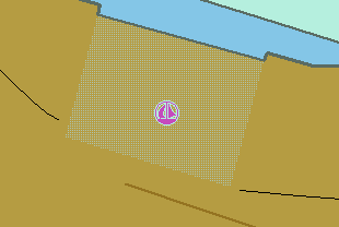
Chapter T. T - Time and Behaviour
Table of Contents
T.1. Schedules
T.1.1. Time Schedule (general) (C)
Time schedules are used to encode operating hours of locks, bridges etc.
Graphics | Encoding Intructions | Object Encoding | ||
|---|---|---|---|---|
|
Real World
IENC Symbolization
|
|
Object Encoding Object Class =tisdge() (M) cattab = [1 (operational period), 2 (non-operational period)] (M) schref = (Time schedule reference: if a structured external XML-file is available, the reference to the file has to be entered here.) (M) shptyp = [1 (general cargo vessel), 2 (container vessel), 3 (tanker), 4 (sailing vessel), 5 (fishing vessel)] (M) useshp = [1 (liner trade), 2 (occasional professional shipping), 3 (leisure)] (O) aptref = Average passing time reference; if a structured external XLM-file is available, the reference to the files has to be entered here] (O) dirimp = [1 (upstream), 2 (downstream), 3 (to the left bank), 4 (to the right bank)] (C) SORDAT = [YYYYMMDD] (C) SORIND = (Refer to Section B, General Guidance) |
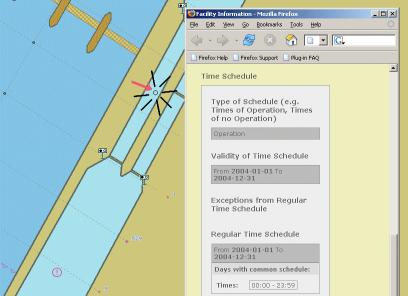
Chapter U. U - Legal ECDIS
Table of Contents
U.1. Maximum Dimensions, Speed
U.1.1. Maximum Permitted Ship Dimensions (C)
Waterway or waterway section for which a juridical regulation with respect to the maximum permitted vessel dimensions exists.
Graphics | Encoding Intructions | Object Encoding |
|---|---|---|
|
|
Object Encoding Object Class =lg_sdm(A) (M) lg_rel = [1 (other), 2 (usage of waterway), 3 (carriage of equipment), 4 (task,operation)] (M) lg_bme = [xx.xx] (metres), e.g., 10.45 (M) lg_lgs = [xxx.xx] (metres), e.g., 110.00 (M) lg_drt = [xx.xx] (metres), e.g., 3.10 (M) lg_wdp = [xxxx.x] (m³ or tonnes), e.g., 310.0 (M) lg_wdu = [1 (other), 2 (cubic meters), 3 (tonnes)] (C) lg_des = [legal description; please refer to F] (M) lc_csi = [1 (all types), 2 (other), 3 (non-motorized vessel), 5 (craft), 6 (vessel), 7 (inland waterway vessel), 8 (sea going ship), 9 (motor vessel), 10 (motor tanker), 11 (motor cargo vessel), 12 (canal barge), 13 (tug), 14 (pusher), 15 (barge), 16 (tank barge), 17 (dumb barge), 18 (lighter), 19 (tank lighter), 20 (cargo lighter), 21 (ship borne lighter), 22 (passenger vessel), 23 (passenger sailing vessel), 24 (day trip vessel), 25 (cabin vessel), 26 (High-speed vessel), 27 (floating equipment), 28 (worksite craft), 29 (recreational craft), 30 (Dinghy), 31 (floating establishment), 32 (floating object)] (M) lc_cse = [1 (all types), 2 (other), 3 (non-motorized vessel), 5 (craft), 6 (vessel), 7 (inland waterway vessel), 8 (sea going ship), 9 (motor vessel), 10 (motor tanker), 11 (motor cargo vessel), 12 (canal barge), 13 (tug), 14 (pusher), 15 (barge), 16 (tank barge), 17 (dumb barge), 18 (lighter), 19 (tank lighter), 20 (cargo lighter), 21 (ship borne lighter), 22 (passenger vessel), 23 (passenger sailing vessel), 24 (day trip vessel), 25 (cabin vessel), 26 (High-speed vessel), 27 (floating equipment), 28 (worksite craft), 29 (recreational craft), 30 (Dinghy), 31 (floating establishment), 32 (floating object)] (M) lc_asi = [1 (all types), 2 (other), 3 (single vessel), 5 (convoy), 6 (formation), 7 (rigid convoy), 8 (pushed convoy), 9 (breasted up formation), 10 (towed convoy)] (M) lc_ase = [1 (all types), 2 (other), 3 (single vessel), 5 (convoy), 6 (formation), 7 (rigid convoy), 8 (pushed convoy), 9 (breasted up formation), 10 (towed convoy)] (M) lc_cci = [1 (all types), 2 (other), 4 (bulk), 5 (dry cargo), 6 (liquid cargo), 7 (liquid cargo (type N)), 8 (liquid cargo (type C)), 9 (gas)] (M) lc_cce = [1 (all types), 2 (other), 4 (bulk), 5 (dry cargo), 6 (liquid cargo), 7 (liquid cargo (type N)), 8 (liquid cargo (type C)), 9 (gas)] (O) lg_pbr = (publication reference) (C) SORDAT = [YYYYMMDD] (C) SORIND = (Refer to Section B, General Guidance) |
U.1.2. Maximum Permitted Vessel Speed (C)
Waterway or waterway section for which a juridical regulation with respect to the maximum permitted vessel speed exists.
Graphics | Encoding Intructions | Object Encoding |
|---|---|---|
|
|
Object Encoding Object Class =g_vsp(A) (M) lg_rel = [1 (other), 2 (usage of waterway), 3 (carriage of equipment), 4 (task,operation)] (M) lg_spd = [xx.x] (km/h), e.g., 10.0 for a maximum permitted speed of 10.0 km/h (M) lg_spr = [1 (other), 2 (speed over ground), 3 (speed through water)] (C) lg_des = (legal description: please refer to F) (M) lc_csi = [1 (all types), 2 (other), 3 (non-motorized vessel), 5 (craft), 6 (vessel), 7 (inland waterway vessel), 8 (sea going ship), 9 (motor vessel), 10 (motor tanker), 11 (motor cargo vessel), 12 (canal barge), 13 (tug), 14 (pusher), 15 (barge), 16 (tank barge), 17 (dumb barge), 18 (lighter), 19 (tank lighter), 20 (cargo lighter), 21 (ship borne lighter), 22 (passenger vessel), 23 (passenger sailing vessel), 24 (day trip vessel), 25 (cabin vessel), 26 (High-speed vessel), 27 (floating equipment), 28 (worksite craft), 29 (recreational craft), 30 (Dinghy), 31 (floating establishment), 32 (floating object)] (M) lc_cse = [1 (all types), 2 (other), 3 (non-motorized vessel), 5 (craft), 6 (vessel), 7 (inland waterway vessel), 8 (sea going ship), 9 (motor vessel), 10 (motor tanker), 11 (motor cargo vessel), 12 (canal barge), 13 (tug), 14 (pusher), 15 (barge), 16 (tank barge), 17 (dumb barge), 18 (lighter), 19 (tank lighter), 20 (cargo lighter), 21 (ship borne lighter), 22 (passenger vessel), 23 (passenger sailing vessel), 24 (day trip vessel), 25 (cabin vessel), 26 (High-speed vessel), 27 (floating equipment), 28 (worksite craft), 29 (recreational craft), 30 (Dinghy), 31 (floating establishment), 32 (floating object)] (M) lc_asi = [1 (all types), 2 (other), 3 (single vessel), 5 (convoy), 6 (formation), 7 (rigid convoy), 8 (pushed convoy), 9 (breasted up formation), 10 (towed convoy)] (M) lc_ase = [1 (all types), 2 (other), 3 (single vessel), 5 (convoy), 6 (formation), 7 (rigid convoy), 8 (pushed convoy), 9 (breasted up formation), 10 (towed convoy)] (M) lc_cci = [1 (all types), 2 (other), 4 (bulk), 5 (dry cargo), 6 (liquid cargo), 7 (liquid cargo (type N)), 8 (liquid cargo (type C)), 9 (gas)] (M) lc_cce = [1 (all types), 2 (other), 4 (bulk), 5 (dry cargo), 6 (liquid cargo), 7 (liquid cargo (type N)), 8 (liquid cargo (type C)), 9 (gas)] (O) lg_pbr = (publication reference) (C) SORDAT = [YYYYMMDD] (C) SORIND = (Refer to Section B, General Guidance) |
Part V. Alphabetical Indices
Table of Contents
Chapter V. V - Abbreviations
|
ADN |
Agreement on the Transport of Dangerous Goods on Inland Waterways |
|
CEMT |
Conference of European Maritime Transportation |
|
CEVNI |
European Code for Inland Waterways of the Economic Commission for Europe of the United Nations |
|
CO |
Company |
|
Corp |
Corporation |
|
Dbn |
Daybeacon |
|
DSPM |
Data set parameter |
|
DSPM |
Data Set Field Parameter |
|
ECDIS |
Electronic Chart Display and Information Systems |
|
Hwy |
Highway |
|
IALA |
International Association of Lighthouse Authorities |
|
IEHG |
Inland ENC Harmonization Group |
|
IENC |
Inland Electronic Navigational Chart |
|
IHO |
International Hydrographic Organisation |
|
INTU |
Intended usage subfield |
|
ISO |
International Standard Organisation |
|
ISRS |
International standard for electronic ship reporting in inland navigation |
|
IVS |
Reporting and Information system for inland navigation in the Netherlands |
|
I-xx |
Interstate, where xx equals interstate number |
|
JPEG |
stanndardized image file formate of the Joint Photographic Expert Group |
|
LDB |
Left Descending Bank |
|
Ldg |
Landing |
|
LL |
Light List number |
|
Lt |
Light |
|
MIB |
Reporting and Information system for inland navigation in Germany |
|
No |
Number |
|
RACON |
Radar Transformer Beacon |
|
RDB |
Right Descending Bank |
|
RIS |
River Information Services |
|
RR |
Railway, railroad |
|
SOTE |
Skin of the Earth, (Group I features) |
|
TIFF |
Tagged Image File Format |
|
UN |
United Nations |
|
UNECE |
European Commission for Europe of the United Nations |
|
UNLOCODE |
Location Codes of the United Nations |
|
USACE |
US Army Corps of Engineers |
|
VHF |
Very High Frequency Radio |
|
VTS |
Vessel Traffic Services |
|
XML |
Extended Markup Language |
Chapter W. W - Naming Conventions
|
Bridges |
Hwy,RR/Bridge Name Bridge (e.g.,Kansas City Southern RR Swing Bridge) |
|
Cities and Towns |
St. Louis, MO Vicksburg, MS |
|
Interstates/Highways |
I-90 Hwy 20 |
|
Railways |
Kansas City Southern RR Union Pacific RR |
Chapter X. X - References
|
IHO S-57 Standard |
IHO TRANSFER STANDARD for DIGITAL HYDROGRAPHIC DATA Edition 3.1 - November 2000 |
|
S-57 Appendix A |
IHO Object Catalogue Edition 3.1 - November 2000 |
|
S-57 Appendix B.1 |
ENC Product Specification Edition 2.0 - November 2000 |
|
S-57 Appendix B.1, Annex A |
Use of the Object Catalogue Editon 2.1 - April 2002 |
Chapter Y. Y - Regions
|
BR |
Brazil |
|
EU |
Europe |
|
RU |
Russian Federation |
|
US |
United States |
Chapter Z. Z - Record of Changes
|
*Feature Catalogue | Aligned BCNLAT with EG |
Deleted: attributed values from BCNSHP, CATLAM, COLOUR and COLPAT that are not referenced in the Encoding Guide for BCNLAT. |
|
*Feature Catalogue | Attribute for Geo-objects |
Modified: Geo-objects modified to ensure that SORIND, SORDAT, OBJNAM, NOBJNM, INFORM, NINFOM, TXTDSC, NTXTDS and PICREP are associated with all Geo-Object Classes. |
|
*Feature Catalogue | CATGAT |
Modified: Definition of CATGAT value 2 (flood barrage gate) to align with S-57. |
|
*Feature Catalogue | clsdng | B. Birklhuber |
Added: definition for clsdng_4 (no blue light / cone). |
|
*Feature Catalogue | rdocal | P. Kluytenaar |
Modified: catcom changed from Optional (O) to Mandatory (M) |
|
*Feature Catalogue | termnl | D. LaDue |
Modified: definition of terml to include the word "passengers". |
|
*Feature Catalogue | TUNNEL | P. Kluytenaar |
Added: 'unlocd' as an attribute for TUNNEL |
|
*Feature Catalogue | verdat | G. Morlion |
Added: New verdat values 42 (Approximate LAT), 43 (Dutch High Water Reference Level (MHW)), 44 (Tweede Algemene Waterpassing (TAW)) |
|
*Feature Catalogue | Waterway Profile |
Modified: Definition for Waterway Profile (wtwprf) changed. |
|
Annex AA | CEVNI Notice Marks | B. Birklhuber |
Modified: Definitions of several CEVNI Notice Marks Added: 6 additional CEVNI Notice Marks |
|
B | Attribute Classes | B. Birklhuber |
Modified: NTXTDS added to "Attribute Classes Associated With All Geo Classes". Deleted: NTXTDS from object encoding for R.3.1 |
|
C.1.5 | Vertical Datum | B. Birklhuber |
Modifed: Encoding Instruction D: deleted VERCSA |
|
D.1.3 | Named Water Area | multiple |
Added: CATSEA values 5 (bay), 12, (narrows), 52 (lake), 54 (reach), 57 (chute), 58 (backwater/slough), 59 (bend) |
|
D.2.2 | Land Region | B. Birklhuber |
Added: CATLND values 2 (marsh), 9 (agricultural land), 11 (parkland), 12 (swamp) |
|
D.3.1 | Vegetation | J. Lubczonek |
Added: CATVEG value 11 (reed) |
|
E.3.2 | Embankment | D. LaDue |
Added: Full Object Encoding for Embankment |
|
G.1.12 | Retractable (Draw) Bridge | R. Visser |
Added: Full Object Encoding for Retractable (Draw) Bridge. |
|
G.1.2 | Bridge with Bridge Arches | B. Birklhuber |
Added: new CATBRG value 13 (bridge arch), encoding instructions for the use of CATBRG_13 and Object Encoding for new aggregate feature c_brga. |
|
G.1.9 | Overhead Pipe | B. Birklhuber |
Modified: Encoding Instruction D: deleted "Lights on towers should be captured. |
|
G.2.5 | Revetment | B. Birklhuber |
Added: to Object Encoding for RESARE the attribute value = 38 (use of spuds prohibited) to RESTRN Modified: Encoding Instruction letter E |
|
G.3.12 | Mooring Facility | D. LaDue |
Added: CATMOR value 4 (tie-up wall) to the attribute values for MORFAC. |
|
G.3.25 | Water Intake Structure | D. LaDue |
Added: Full Object Encoding for Water Intake Structure |
|
G.3.26 | Power Supply Station | G. Morlion |
Added: Full Object Encoding for Power Supply Station (bunsta) |
|
H.1.2 | Water Turbulence | G. Morlion |
Added: Full Object Encoding for Water Turbulence |
|
I.3.4 | Waterway Gauge | G. Morlion |
Added: new attribute value = 10 (Tweede Algemene Waterpassing (TAW) |
|
I.3.5 | Waterway Profile | G. Morlion |
Added: new attribute value = 10 (Tweede Algemene Waterpassing (TAW) |
|
J.1.1 | Underwater Rocks | P. Kluytenaar |
Added: EXPSOU as an acceptable attribute for UWTROC and uwtroc. Added: Encoding Instructions Letters E and F Modified: NATSUR values; unapplicable values removed from list |
|
J.2.1 | Wrecks | P. Kluytenaar |
Added: EXPSOU as an acceptable attribute for WRECKS. Added: Encoding Instruction Letter F Modified: Encoding Instruction Letter A |
|
J.3.1 | Obstruction | D. LaDue |
Added: NATCON as allowable attribute for OBSTRN. |
|
J.3.1 | Obstruction | J. Lubczonek |
Added: new OBSTRN value 11 (fishing net) and encoding instructions for the use of OBSTRN_11. |
|
J.3.1 | Obstruction | P. Kluytenaar |
Added: Encoding Instruction letter P and EXPSOU to the encoding of OBSTRN |
|
J.4.1 | Nature of Bottom | F. Mandarino |
J.4.1 | Nature of Bottom | F. Mandarino |
|
K.1.2 | Cable Area | B. Birklhuber |
Added: to Object Encoding for CBLARE the attribute value = 38 (use of spuds prohibited) to RESTRN Added: Encoding Instruction letter I |
|
K.2.2 | Pipeline Area | B. Birklhuber |
Added: to Object Encoding for PIPARE the attribute value = 38 (use of spuds prohibited) to RESTRN Added: Encoding Instruction letter H |
|
L.1.4 | Waterway Axis | B. Birklhuber |
Added: new catccl value 12 (VII 9-barge push-town unit) to the encoding of wtwaxs. |
|
M.1.1 | Anchorage Area | B. Birklhuber |
Added: to Object Encoding for achare the attribute value = 38 (use of spuds prohibited) to restrn Added: Encoding Instruction letter K |
|
M.1.2 | Anchorage Berth | B. Birklhuber |
Added: to Object Encoding for achbrt the attribute value = 38 (use of spuds prohibited) to restrn Added: Encoding Instruction letter J |
|
M.1.4 | Transhipment Berth | B. Birklhuber |
Added: new catbrt value 9 (berth for passenger vessels) to the encoding of berths. |
|
M.2.1 | Restricted Area | B. Birklhuber |
Added: to Object Encoding for resare the attribute value = 38 (use of spuds prohibited) to restrn Added: Encoding Instruction letter H |
|
M.4.1 | Communication Area | B. Birklhuber |
Modified: Encoding Instruction C: changed 'rdcpnt' to 'rdocal' |
|
M.4.1 | Communication Area | J. Nemeth |
Added: new catcom value 9 (WLAN area) to the encoding of catcomm |
|
M.4.6 | Dumping Ground | B. Birklhuber |
Modified: Changed DMPGRD from (P,A) to (A), as S-57 only allows DMPGRD to be encoded as an area feature |
|
N.1.* | LIGHTS | J. Dumollin |
Added: all LITCHR values according to S-57 Added: HEIGHT attribute for LIGHTS Added: VALNMR attribute for LIGHTS |
|
N.1.2 | Minor Light | D. LaDue |
Added: CATLIT value 5 (aero light) and value 6 (air obstruction light) |
|
N.1.3 | Leading Light | B. Birklhuber |
Modified: Encoding Instruction K: changed M_AGGR to C_AGGR |
|
O.1.11 | Virtual AIS AtoNs | D. Ladue |
Added: Full Object Encoding for Virtual AIS Aids to Navigation using Object Class NEWOBJ |
|
O.2.1 | Day Mark | W. Haupt |
Added: catlam value = 24 (entry from a lake to a narrower waterway, right bank) and catlam value = 25 (entry from a lake to a narrower waterway, left bank) |
|
O.2.6 | Change Bank | L. Crose |
Added: Full encoding for new feature Change Bank mark. |
|
O.2.7 | Continue Along Bank | L. Crose |
Added: Full encoding for new feature Continue Along Bank mark. |
|
O.2.8 | Touch and Go | L. Crose |
Added: Full encoding for new feature Touch and Go mark. |
|
R.2.4 | Runway | F. Mandarino |
Added: Full Object Encoding for Runway |
|
R.3.1 | Rescue Station | P. Kluytenaar |
Modified: catrsc changed from (O) to M, SCAMIN changed from (O) to (M), SORDAT changed from (O) to (C), SORIND changed from (O) to (C). |
|
R.4.1 | Sensor | D. LaDue |
Added: Full Object Encoding for Sensor |
Part VI. Annexes
Table of Contents
- AA. AA - Notice Marks (CEVNI)
- AB. Annex AB - Notice Marks (Russian Inland Waterway Regulations)
- AC. Annex AC - Notice Marks (Brazilian Two Sides System)
- AD. Annex AD - Notice Marks (Brazilian Side Independent System)
- AE. Annex AE - Notice Marks (Brazilian Paraguay-Parana Waterway)
- AF. Annex AD - Notice Marks (Brazilian Side Independent System)
- AG. Annex AE - Notice Marks (Brazilian Paraguay-Parana Waterway)
- AH. Annex AF - XML Definition
Chapter AA. AA - Notice Marks (CEVNI)
|
catnm ID |
Meaning |
CEVNI |
Picture |
Area of Impact |
Objects / (Attributes) | |
|---|---|---|---|---|---|---|
|
1 |
no entry (general sign) |
A.1 |
|
no area, when at a bridge, otherwise bank to bank |
resare (restrn = 7) | |
|
2 |
sections closed to use, no entry except for nonmotorized small craft |
|
resare (restrn = 8) | |||
|
3 |
no overtaking |
A.2 |
|
bank to bank |
resare (restrn = 28) | |
|
4 |
no overtaking of convoys by convoys |
A.3 |
|
bank to bank |
resare (restrn = 29) | |
|
5 |
no passing or overtaking |
A.4 |
|
bank to bank |
resare (restrn = 30) | |
|
6 |
no berthing (i.e. no anchoring or making fast to the bank) on the side of the waterway on which the sign is placed |
A.5 |
|
bank to fairway |
resare (restrn = 1,31) | |
|
7 |
no berthing on the stretch of water whose breadth, measured from the sign, is shown in metres on the sign |
A.5.1 |
|
bank to indicated distance |
resare (restrn = 1,31) | |
|
8 |
no anchoring or trailing of anchors, cables or chains on the side of the waterway on which the sign is placed |
A.6 |
|
bank to fairway or bank to bank if the sign is placed on both banks |
resare (restrn = 1) | |
|
9 |
no making fast to the bank on the side of the waterway on which the sign is placed |
A.7 |
|
bank to fairway |
resare (restrn = 31) (restrn = 38 if applicable) | |
|
10 |
no turning |
A.8 |
|
bank to bank |
resare (restrn = 35) | |
|
11 |
do not create wash likely to cause damage |
A.9 |
|
bank to bank or bank to middle of fairway depending on the size of the waterway |
resare (restrn = 13) | |
|
12 |
no passing on left side (in openings of bridges or weirs) |
A.10 |
| |||
|
13 |
no passing on right side (in openings of bridges or weirs) |
A.10 |
| |||
|
14 |
motorized craft prohibited |
A.12 |
|
bank to bank |
resare (restrn = 8, INFORM = motorized craft prohibited) | |
|
15 |
sports or pleasure craft prohibited |
A.13 |
| |||
|
16 |
water skiing prohibited |
A.14 |
| |||
|
17 |
sailing vessels prohibited |
A.15 |
| |||
|
18 |
all craft other than motorized vessels or sailing craft prohibited |
A.16 |
| |||
|
19 |
use of sailboards prohibited |
A.17 |
| |||
|
20 |
water bikes prohibited |
A.20 |
| |||
|
21 |
end of zone authorized for high speed navigation of small sport and pleasure craft |
A.18 |
| |||
|
22 |
no launching or beaching of vessels |
A.19 |
| |||
|
23 |
proceed in left direction |
B.1 |
| |||
|
24 |
proceed in right direction |
B.1 |
| |||
|
25 |
move to the side of the fairway on your port side |
B.2a |
| |||
|
26 |
move to the side of the fairway on your starboard side |
B.2b |
| |||
|
27 |
keep the side of the fairway on your port side |
B.3a |
| |||
|
28 |
keep the side of the fairway on your starboard side |
B.3b |
| |||
|
29 |
cross fairway to port |
B.4a |
| |||
|
30 |
cross fairway to starboard |
B.4b |
| |||
|
31 |
stop as prescribed in the Regulations |
B.5 |
| |||
|
32 |
do not exceed the speed indicated (in km/h) |
B.6 |
|
bank to bank |
resare (restrn = 27, INFORM = 12 km/h) | |
|
33 |
give a sound signal |
B.7 |
| |||
|
34 |
keep a particularly sharp lookout |
B.8 |
| |||
|
35 |
do not enter the main waterway until certain that this will not oblige vessels proceeding on it to change their course or speed |
B.9a |
| |||
|
36 |
do not cross the main waterway until certain that this will not oblige vessels proceeding on it to change their course or speed |
B.9b |
| |||
|
37 |
obligation to enter into a radiotelephone link on the channel as indicated on the board |
B.11 |
|
bank to bank |
comare (catcom, COMCHA = 11, STATUS = 9) | |
|
38 |
depth of water limited |
C.1 |
|
bank to bank |
resare (restrn = 36, INFORM = 2.20 m) | |
|
39 |
headroom limited |
C.2 |
| |||
|
40 |
width of passage or channel limited |
C.3 |
|
resare (restrn = 37, INFORM = 45 m) | ||
|
41 |
there are restrictions on navigation: see the information plate below the sign |
C.4 |
| |||
|
42 |
the channel lies at a distance from the left bank; the figure shown on the sign indicates the distance in metres, measured from the sign, to which vessels should keep |
C.5 |
|
bank to distance |
resare (restrn = 7) | |
|
43 |
the channel lies at a distance from the right bank; the figure shown on the sign indicates the distance in metres, measured from the sign, to which vessels should keep |
C.5 |
|
bank to distance |
resare (restrn = 7) | |
|
44 |
recommended channel in both directions (at bridges) |
D.1a |
| |||
|
45 |
recommended channel only in the direction indicated (passage in the opposite direction prohibited) (at bridges) |
D.1b |
| |||
|
46 |
you are recommended to keep on right side (in openings of bridges and weirs) |
D.2 |
| |||
|
47 |
you are recommended to keep on left side (in openings of bridges and weirs) |
D.2 |
| |||
|
48 |
you are recommended to proceed in the left direction |
D.3 |
| |||
|
49 |
you are recommended to proceed in the right direction |
D.3 |
| |||
|
50 |
50 entry permitted (general sign) |
E.1 |
| |||
|
51 |
overhead cable crossing |
E.2 |
| |||
|
52 |
weir |
E.3 |
| |||
|
53 |
ferry-boat not moving independently |
E.4a |
| |||
|
54 |
ferry-boat moving independently |
E.4b |
| |||
|
55 |
berthing (i.e. anchoring or making fast to the bank) permitted on the side of the waterway on which the sign is placed |
E.5 |
|
achare, achbrt, berths | ||
|
56 |
berthing permitted on the stretch of water of the breadth measured from, and shown on the board in metres |
E.5.1 |
|
achare, achbrt, berths | ||
|
57 |
berthing permitted on the stretch of water bounded by the two distances measured from, and shown on the board in metres |
E.5.2 |
|
achare, achbrt, berths | ||
|
58 |
maximum number of vessels permitted to berth abreast on the side of the waterway on which the sign is placed |
E.5.3 |
|
achare, achbrt, berths | ||
|
59 |
berthing area reserved for pushing-navigation vessels that are not required to carry blue lights or blue cones on the side of the waterway on which the sign is placed |
E.5.4 |
|
achare, achbrt, berths (catach = 10/catbrt = 4, clsdng = 4) | ||
|
60 |
berthing area reserved for pushing-navigation vessels that are required to carry one blue light or one blue cone on the side of the waterway on which the sign is placed |
E.5.5 |
|
achare, achbrt, berths (catach =10/catbrt = 4, clsdng = 1) | ||
|
61 |
berthing area reserved for pushing-navigation vessels that are required to carry two blue lights or two blue cones on the side of the waterway on which the sign is placed |
E.5.6 |
|
achare, achbrt, berths (catach = 10/catbrt = 4, clsdng = 2) | ||
|
62 |
berthing area reserved for pushing-navigation vessels that are required to carry three blue lights or three blue cones on the side of the waterway on which the sign is placed |
E.5.7 |
|
achare, achbrt, berths (catach = 10/catbrt = 4, clsdng = 3) | ||
|
63 |
berthing area reserved for vessels other than pushing-navigation vessels that are not required to carry blue lights or blue cones on the side of the waterway on which the sign is placed |
E.5.8 |
|
achare, achbrt, berths (catach = 11/catbrt = 5, clsdng = 4) | ||
|
64 |
berthing area reserved for vessels other than pushing-navigation vessels that are required to carry one blue light or one blue cone on the side of the waterway on which the sign is placed |
E.5.9 |
|
achare, achbrt, berths (catach = 11/catbrt = 5, clsdng = 1) | ||
|
65 |
berthing area reserved for vessels other than pushing-navigation vessels that are required to carry two blue lights or two blue cones on the side of the waterway on which the sign is placed |
E.5.10 |
|
achare, achbrt, berths (catach = 11/catbrt = 5, clsdng = 2) | ||
|
66 |
berthing area reserved for vessels other than pushing-navigation vessels that are required to carry three blue lights or three blue cones on the side of the waterway on which the sign is placed |
E.5.11 |
|
achare, achbrt, berths (catach = 11/catbrt = 5, clsdng = 3) | ||
|
67 |
berthing area reserved for all vessels that are not required to carry blue lights or blue cones on the side of the waterway on which the sign is placed |
E.5.12 |
|
achare, achbrt, berths (clsdng = 4) | ||
|
68 |
berthing area reserved for all vessels that are required to carry one blue light or one blue cone on the side of the waterway on which the sign is placed |
E.5.13 |
|
achare, achbrt, berths (clsdng = 1) | ||
|
69 |
berthing area reserved for all vessels that are required to carry two blue lights or two blue cones on the side of the waterway on which the sign is placed |
E.5.14 |
|
achare, achbrt, berths (clsdng = 2) | ||
|
70 |
berthing area reserved for all vessels that are required to carry three blue lights or three blue cones on the side of the waterway on which the sign is placed |
E.5.15 |
|
achare, achbrt, berths (clsdng = 3) | ||
|
71 |
anchoring or trailing of anchors, cables or chains permitted on the side of the waterway on which the sign is placed |
E.6 |
|
achare, achbrt | ||
|
72 |
making fast to the bank permitted on the side of the waterway on which the sign is placed |
E.7 |
|
berths | ||
|
73 |
berthing area reserved for loading and unloading vehicles |
E.7.1 |
|
berths | ||
|
74 |
turning area |
E.8 |
|
trnbsn | ||
|
75 |
crossing with secondary waterway ahead |
E.9a |
| |||
|
76 |
secondary waterway ahead on the right |
E.9b |
| |||
|
77 |
secondary waterway ahead on the left |
E.9c |
| |||
|
78 |
78 secondary waterway ahead (main waterway right) |
E.9d |
| |||
|
79 |
secondary waterway ahead (main waterway left) |
E.9e |
| |||
|
80 |
secondary waterway left (main waterway right) |
E.9f |
| |||
|
81 |
secondary waterway right (main waterway left) |
E.9g |
| |||
|
82 |
secondary waterway ahead and left (main waterway right) |
E.9h |
| |||
|
83 |
secondary waterway ahead and right (main waterway left) |
E.9i |
| |||
|
84 |
crossing with main waterway ahead |
E.10a |
| |||
|
85 |
junction with main waterway ahead |
E.10b |
| |||
|
86 |
junction with main waterway ahead and right |
E.10c |
| |||
|
87 |
junction with main waterway ahead and left |
E.10d |
| |||
|
88 |
junction with main waterway ahead and right (secondary waterway left) |
E.10e |
| |||
|
89 |
junction with main waterway ahead and left (secondary waterway right) |
E.10f |
| |||
|
90 |
end of prohibition or obligation applying to traffic in one direction only, or end of a restriction |
E.11 |
| |||
|
91 |
drinking-water supply |
E.13 |
| |||
|
92 |
telephone |
E.14 |
| |||
|
93 |
motorized vessels permitted |
E.15 |
|
bank to fairway or bank to bank depending on local situation |
CTNARE (INFORM = motorized vessels permitted) | |
|
94 |
sport and pleasure craft permitted |
E.16 |
|
bank to fairway or bank to bank depending on local situation |
CTNARE (INFORM = sport and pleasure craft permitted) | |
|
95 |
water skiing permitted |
E.17 |
|
bank to fairway or bank to bank depending on local situation |
CTNARE (INFORM = water skiing permitted) | |
|
96 |
sailing vessels permitted |
E.18 |
|
bank to fairway or bank to bank depending on local situation |
CTNARE (INFORM = sailing vessels permitted) | |
|
97 |
craft other than motorized vessels or sailing craft permitted |
E.19 |
|
bank to fairway or bank to bank depending on local situation |
CTNARE (INFORM = craft other than motorized vessels or sailing craft permitted) | |
|
98 |
use of sailboards permitted |
E.20 |
|
bank to fairway or bank to bank depending on local situation |
CTNARE (INFORM = use of sailboards permitted) | |
|
99 |
possibility of obtaining nautical information by radio-telephone on the channel indicated |
E.23 |
|
bank to bank |
come (catcom, COMCHA = 11, STATUS = 3) | |
|
100 |
water bikes permitted |
E.24 |
|
bank to fairway |
CTNARE (INFORM = water bikes permitted) | |
|
101 |
zone authorized for high speed navigation of small sport and pleasure craft |
E.21 |
|
bank to fairway or bank to bank depending on local situation |
CTNARE (INFORM = zone authorized for high speed navigation of small sport and pleasure craft) | |
|
102 |
launching or beaching of vessels permitted |
E.22 |
|
bank to fairway |
CTNARE (INFORM = launching or beaching of vessels permitted) | |
|
110 |
wreck pontoon, passage allowed on side showing red-white sign |
| ||||
|
111 |
wreck pontoon, passage allowed on both signs |
| ||||
|
117 |
electrical power supply point |
E.25 |
| |||
|
118 |
winter harbor |
E.26 |
| |||
|
119 |
maximum number of vessels permitted to berth in winter harbor |
E.26.1 |
| |||
|
120 |
winter shelter |
E.27 |
| |||
|
121 |
maximum number of vessels permitted to berth in winter shelter maximum number of vessels permitted to berth abreast maximum number of rows of vessels which are berthed abreast |
E.27.1 |
| |||
|
122 |
use of spuds permitted |
E.6.1 |
|

Chapter AB. Annex AB - Notice Marks (Russian Inland Waterway Regulations)
|
catnm ID |
Meaning |
Russian IW Regulations GOST 26600-98 |
Picture |
Area of Impact |
Objects / (Attributes) | |
|---|---|---|---|---|---|---|
|
5 |
no passing or overtaking |
1.3 |
|
bank to bank |
resare (restrn = 30) | |
|
8 |
no anchoring or trailing of anchors, cables or chains |
1.1 |
|
bank to fairway |
resare (restrn = 1) | |
|
11 |
do not create wash |
1.4 |
|
bank to bank |
resare (restrn = 13) | |
|
39 |
headroom limited |
2.4 |
| |||
|
74 |
turning area |
3.2 |
| |||
|
112 |
no passing or overtaking of convoys |
1.2 |
|
bank to bank |
resare (restrn = 30, INFORM = no passing or overtaking of convoys) | |
|
113 |
small crafts prohibited |
1.5 |
|
bank to bank |
resare (INFORM = small crafts prohibited) | |
|
114 |
Attention! (Keep caution) |
2.1 |
| |||
|
115 |
fairway crossing |
2.2 |
| |||
|
116 |
shipping inspection point |
3.3 |
|
Chapter AC. Annex AC - Notice Marks (Brazilian Two Sides System)
|
catnm ID |
Meaning |
Picture |
Bank |
Area of Impact |
Function |
Objects / (Attributes) | |
|---|---|---|---|---|---|---|---|
|
8 |
no anchoring or trailing of anchors, cables or chains |
|
left (bnkwtw_1) |
upstream (dirimp_1) or downstream (dirimp_2) |
Prohibition mark (fnctnm_1) |
resare (restrn = 1) | |
|
8 |
no anchoring or trailing of anchors, cables or chains |
|
right (bnkwtw_2) |
upstream (dirimp_1) or downstream (dirimp_2) |
Prohibition mark (fnctnm_1) |
resare (restrn = 1) | |
|
39 |
headroom limited |
|
left (bnkwtw_1) |
upstream (dirimp_1) or downstream (dirimp_2) |
Restriction mark (fnctnm_3) | ||
|
39 |
headroom limited |
|
right (bnkwtw_2) |
upstream (dirimp_1) or downstream (dirimp_2) |
Restriction mark (fnctnm_3) | ||
|
103 |
proceed close to the margin on your portside |
|
left (bnkwtw_1) |
downstream (dirimp_2) |
Regulation mark (fnctnm_2) | ||
|
103 |
proceed close to the margin on your portside |
|
right (bnkwtw_2) |
upstream (dirimp_1) |
Regulation mark (fnctnm_2) | ||
|
104 |
proceed close to the margin on your starboard side |
|
left (bnkwtw_1) |
upstream (dirimp_1) |
Regulation mark (fnctnm_2) | ||
|
104 |
proceed close to the margin on your starboard side |
|
right (bnkwtw_2) |
downstream (dirimp_2) |
Regulation mark (fnctnm_2) | ||
|
105 |
proceed in the middle of the river |
|
left (bnkwtw_1) |
upstream (dirimp_1) or downstream (dirimp_2) |
Regulation mark (fnctnm_2) | ||
|
105 |
proceed in the middle of the river |
|
right (bnkwtw_2) |
upstream (dirimp_1) or downstream (dirimp_2) |
Regulation mark (fnctnm_2) | ||
|
106 |
cross river to port |
|
left (bnkwtw_1) |
upstream (dirimp_1) |
Regulation mark (fnctnm_2) | ||
|
106 |
cross river to port |
|
right (bnkwtw_2) |
downstream (dirimp_2) |
Regulation mark (fnctnm_2) | ||
|
107 |
cross river to starboard |
|
left (bnkwtw_1) |
downstream (dirimp_2) |
Regulation mark (fnctnm_2) | ||
|
107 |
cross river to starboard |
|
right (bnkwtw_2) |
upstream (dirimp_1) |
Regulation mark (fnctnm_2) | ||
|
108 |
traffic between margins |
|
left (bnkwtw_1) |
upstream (dirimp_1) or downstream (dirimp_2) |
Information mark (fnctnm_5) |
CTNARE | |
|
108 |
traffic between margins |
|
right (bnkwtw_2) |
upstream (dirimp_1) or downstream (dirimp_2) |
Information mark (fnctnm_5) |
CTNARE | |
|
109 |
reduce speed |
|
left (bnkwtw_1) |
upstream (dirimp_1) or downstream (dirimp_2) |
Regulation mark (fnctnm_2) |
resare (restrn = 27) | |
|
109 |
reduce speed |
|
right (bnkwtw_2) |
upstream (dirimp_1) or downstream (dirimp_2) |
Regulation mark (fnctnm_2) |
resare (restrn = 27) |
Chapter AD. Annex AD - Notice Marks (Brazilian Side Independent System)
|
catnm ID |
Meaning |
Picture |
Area of Impact |
Function |
Objects / (Attributes) | |
|---|---|---|---|---|---|---|
|
8 |
no anchoring or trailing of anchors, cables or chains |
|
upstream (dirimp_1) or downstream (dirimp_2) |
Prohibition mark (fnctnm_1) |
resare (restrn = 1) | |
|
39 |
headroom limited |
|
upstream (dirimp_1) or downstream (dirimp_2) |
Restriction mark (fnctnm_3) | ||
|
82 |
secondary waterway ahead on the left, main waterway on the right |
|
upstream (dirimp_1) or downstream (dirimp_2) |
Information mark (fnctnm_5) | ||
|
83 |
secondary waterway ahead on the right, main waterway on the left |
|
upstream (dirimp_1) or downstream (dirimp_2) |
Information mark (fnctnm_5) | ||
|
103 |
proceed close to the margin on your portside |
|
upstream (dirimp_1) or downstream (dirimp_2) |
Regulation mark (fnctnm_2) | ||
|
104 |
proceed close to the margin on your starboard side |
|
upstream (dirimp_1) or downstream (dirimp_2) |
Regulation mark (fnctnm_2) | ||
|
105 |
proceed in the middle of the river |
|
upstream (dirimp_1) or downstream (dirimp_2) |
Regulation mark (fnctnm_2) | ||
|
106 |
cross river to port |
|
upstream (dirimp_1) or downstream (dirimp_2) |
Regulation mark (fnctnm_2) | ||
|
107 |
cross river to starboard |
|
upstream (dirimp_1) or downstream (dirimp_2) |
Regulation mark (fnctnm_2) | ||
|
108 |
traffic between margins |
|
upstream (dirimp_1) or downstream (dirimp_2) |
Information mark (fnctnm_5) |
CTNARE | |
|
109 |
reduce speed |
|
upstream (dirimp_1) or downstream (dirimp_2) |
Regulation mark (fnctnm_2) |
resare (restrn = 13) |
Chapter AE. Annex AE - Notice Marks (Brazilian Paraguay-Parana Waterway)
|
catnm ID |
Meaning |
Picture |
Bank |
Area of Impact |
Function |
Objects / (Attributes) | |
|---|---|---|---|---|---|---|---|
|
82 |
secondary waterway ahead on the left, main waterway on the right |
|
left (bnkwtw_1) |
upstream (dirimp_1) or downstream (dirimp_2) |
Information mark (fnctnm_5) | ||
|
82 |
secondary waterway ahead on the left, main waterway on the right |
|
right (bnkwtw_2) |
upstream (dirimp_1) or downstream (dirimp_2) |
Information mark (fnctnm_5) | ||
|
83 |
secondary waterway ahead on the right, main waterway on the left |
|
left (bnkwtw_1) |
upstream (dirimp_1) or downstream (dirimp_2) |
Information mark (fnctnm_5) | ||
|
83 |
secondary waterway ahead on the right, main waterway on the left |
|
right (bnkwtw_2) |
upstream (dirimp_1) or downstream (dirimp_2) |
Information mark (fnctnm_5) | ||
|
103 |
proceed close to the margin on your portside |
|
left (bnkwtw_1) |
downstream (dirimp_2) |
Regulation mark (fnctnm_2) | ||
|
103 |
proceed close to the margin on your portside |
|
right (bnkwtw_2) |
upstream (dirimp_1) |
Regulation mark (fnctnm_2) | ||
|
104 |
proceed close to the margin on your starboard side |
|
left (bnkwtw_1) |
upstream (dirimp_1) |
Regulation mark (fnctnm_2) | ||
|
104 |
proceed close to the margin on your starboard side |
|
right (bnkwtw_2) |
downstream (dirimp_2) |
Regulation mark (fnctnm_2) | ||
|
105 |
proceed in the middle of the river |
|
left (bnkwtw_1) |
upstream (dirimp_1) or downstream (dirimp_2) |
Regulation mark (fnctnm_2) | ||
|
105 |
proceed in the middle of the river |
|
right (bnkwtw_2) |
upstream (dirimp_1) or downstream (dirimp_2) |
Regulation mark (fnctnm_2) | ||
|
106 |
cross river to port |
|
left (bnkwtw_1) |
upstream (dirimp_1) |
Regulation mark (fnctnm_2) | ||
|
106 |
cross river to port |
|
right (bnkwtw_2) |
downstream (dirimp_2) |
Regulation mark (fnctnm_2) | ||
|
107 |
cross river to starboard |
|
left (bnkwtw_1) |
downstream (dirimp_2) |
Regulation mark (fnctnm_2) | ||
|
107 |
cross river to starboard |
|
right (bnkwtw_2) |
upstream (dirimp_1) |
Regulation mark (fnctnm_2) |
Chapter AF. Annex AD - Notice Marks (Brazilian Side Independent System)
|
catnm ID |
Meaning |
Picture |
Area of Impact |
Function |
Objects / (Attributes) | |
|---|---|---|---|---|---|---|
|
8 |
no anchoring or trailing of anchors, cables or chains |
|
upstream (dirimp_1) or downstream (dirimp_2) |
Prohibition mark (fnctnm_1) |
resare (restrn = 1) | |
|
39 |
headroom limited |
|
upstream (dirimp_1) or downstream (dirimp_2) |
Restriction mark (fnctnm_3) | ||
|
82 |
secondary waterway ahead on the left, main waterway on the right |
|
upstream (dirimp_1) or downstream (dirimp_2) |
Information mark (fnctnm_5) | ||
|
83 |
secondary waterway ahead on the right, main waterway on the left |
|
upstream (dirimp_1) or downstream (dirimp_2) |
Information mark (fnctnm_5) | ||
|
103 |
proceed close to the margin on your portside |
|
upstream (dirimp_1) or downstream (dirimp_2) |
Regulation mark (fnctnm_2) | ||
|
104 |
proceed close to the margin on your starboard side |
|
upstream (dirimp_1) or downstream (dirimp_2) |
Regulation mark (fnctnm_2) | ||
|
105 |
proceed in the middle of the river |
|
upstream (dirimp_1) or downstream (dirimp_2) |
Regulation mark (fnctnm_2) | ||
|
106 |
cross river to port |
|
upstream (dirimp_1) or downstream (dirimp_2) |
Regulation mark (fnctnm_2) | ||
|
107 |
cross river to starboard |
|
upstream (dirimp_1) or downstream (dirimp_2) |
Regulation mark (fnctnm_2) | ||
|
108 |
traffic between margins |
|
upstream (dirimp_1) or downstream (dirimp_2) |
Information mark (fnctnm_5) |
CTNARE | |
|
109 |
reduce speed |
|
upstream (dirimp_1) or downstream (dirimp_2) |
Regulation mark (fnctnm_2) |
resare (restrn = 13) |
Chapter AG. Annex AE - Notice Marks (Brazilian Paraguay-Parana Waterway)
|
catnm ID |
Meaning |
Picture |
Bank |
Area of Impact |
Function |
Objects / (Attributes) | |
|---|---|---|---|---|---|---|---|
|
82 |
secondary waterway ahead on the left, main waterway on the right |
|
left (bnkwtw_1) |
upstream (dirimp_1) or downstream (dirimp_2) |
Information mark (fnctnm_5) | ||
|
82 |
secondary waterway ahead on the left, main waterway on the right |
|
right (bnkwtw_2) |
upstream (dirimp_1) or downstream (dirimp_2) |
Information mark (fnctnm_5) | ||
|
83 |
secondary waterway ahead on the right, main waterway on the left |
|
left (bnkwtw_1) |
upstream (dirimp_1) or downstream (dirimp_2) |
Information mark (fnctnm_5) | ||
|
83 |
secondary waterway ahead on the right, main waterway on the left |
|
right (bnkwtw_2) |
upstream (dirimp_1) or downstream (dirimp_2) |
Information mark (fnctnm_5) | ||
|
103 |
proceed close to the margin on your portside |
|
left (bnkwtw_1) |
downstream (dirimp_2) |
Regulation mark (fnctnm_2) | ||
|
103 |
proceed close to the margin on your portside |
|
right (bnkwtw_2) |
upstream (dirimp_1) |
Regulation mark (fnctnm_2) | ||
|
104 |
proceed close to the margin on your starboard side |
|
left (bnkwtw_1) |
upstream (dirimp_1) |
Regulation mark (fnctnm_2) | ||
|
104 |
proceed close to the margin on your starboard side |
|
right (bnkwtw_2) |
downstream (dirimp_2) |
Regulation mark (fnctnm_2) | ||
|
105 |
proceed in the middle of the river |
|
left (bnkwtw_1) |
upstream (dirimp_1) or downstream (dirimp_2) |
Regulation mark (fnctnm_2) | ||
|
105 |
proceed in the middle of the river |
|
right (bnkwtw_2) |
upstream (dirimp_1) or downstream (dirimp_2) |
Regulation mark (fnctnm_2) | ||
|
106 |
cross river to port |
|
left (bnkwtw_1) |
upstream (dirimp_1) |
Regulation mark (fnctnm_2) | ||
|
106 |
cross river to port |
|
right (bnkwtw_2) |
downstream (dirimp_2) |
Regulation mark (fnctnm_2) | ||
|
107 |
cross river to starboard |
|
left (bnkwtw_1) |
downstream (dirimp_2) |
Regulation mark (fnctnm_2) | ||
|
107 |
cross river to starboard |
|
right (bnkwtw_2) |
upstream (dirimp_1) |
Regulation mark (fnctnm_2) |
Chapter AH. Annex AF - XML Definition
|